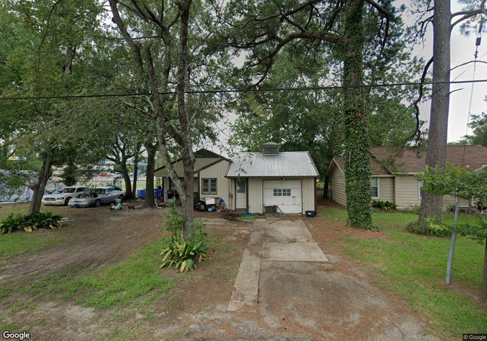
210 Melvin Ave Lufkin, TX 75904
Estimated Value: $80,000 - $114,000
Studio
5
Baths
924
Sq Ft
$109/Sq Ft
Est. Value
About This Home
This home is located at 210 Melvin Ave, Lufkin, TX 75904 and is currently estimated at $100,899, approximately $109 per square foot. 210 Melvin Ave is a home located in Angelina County with nearby schools including Garrett Primary School, Dunbar Primary School, and Brandon Elementary School.
Ownership History
Date
Name
Owned For
Owner Type
Purchase Details
Closed on
Feb 1, 2012
Sold by
Scott Naomi and Scott Joseph M
Bought by
Garcia Ernesto and Barrios Isaura
Current Estimated Value
Home Financials for this Owner
Home Financials are based on the most recent Mortgage that was taken out on this home.
Original Mortgage
$33,600
Interest Rate
3.95%
Mortgage Type
FHA
Create a Home Valuation Report for This Property
The Home Valuation Report is an in-depth analysis detailing your home's value as well as a comparison with similar homes in the area
Purchase History
| Date | Buyer | Sale Price | Title Company |
|---|---|---|---|
| Garcia Ernesto | -- | Community Title |
Source: Public Records
Mortgage History
| Date | Status | Borrower | Loan Amount |
|---|---|---|---|
| Closed | Garcia Ernesto | $33,600 |
Source: Public Records
Tax History
| Year | Tax Paid | Tax Assessment Tax Assessment Total Assessment is a certain percentage of the fair market value that is determined by local assessors to be the total taxable value of land and additions on the property. | Land | Improvement |
|---|---|---|---|---|
| 2025 | $1,647 | $78,810 | $9,620 | $69,190 |
| 2024 | $1,609 | $76,980 | $9,620 | $67,360 |
| 2023 | $1,506 | $75,770 | $9,620 | $66,150 |
| 2022 | $1,416 | $62,190 | $4,760 | $57,430 |
| 2021 | $1,411 | $57,280 | $4,760 | $52,520 |
| 2020 | $1,233 | $50,190 | $3,720 | $46,470 |
| 2019 | $1,305 | $50,190 | $3,720 | $46,470 |
| 2018 | $817 | $35,660 | $3,720 | $31,940 |
| 2017 | $817 | $34,260 | $3,720 | $30,540 |
| 2016 | $804 | $33,710 | $3,720 | $29,990 |
| 2015 | $30 | $36,760 | $3,720 | $33,040 |
| 2014 | $30 | $34,470 | $3,720 | $30,750 |
Source: Public Records
Map
Nearby Homes
- 0 N Timberland Dr Unit 26175096
- TBD N Timberland Dr
- 1303 Voyle St
- 1114 Maberry St
- 1518 Phelps St
- 233 N Banks St
- 201 Silver Spur Dr
- 333 Humason Ave
- 223 Stoney Ridge
- 1706 approx. Norwood Dr
- 4795 LEWIS & PO Norwood Dr
- 1207 Glade St
- 2502 Davisville Rd
- 2504 Davisville Rd
- 2509 Martin Luther King Junior Blvd
- 515 Martin Luther King Junior Blvd
- 2604 Moffett Rd
- 16018 Lot 3 Davisville Rd
- 16018 Lot 1 Davisville Rd
- 16018 Lot 5 Davisville Rd
- 206 Melvin Ave
- 2001 N Timberland Dr
- 117 Butler St
- 202 Melvin Ave
- 204 Melvin Ave
- 2003 N Timberland Dr
- 115 Butler St
- 2005 N Timberland Dr
- 106 Melvin Ave
- 2006 N Timberland Dr
- 1908 Mccall St
- 2007 N Timberland Dr
- 104 Melvin Ave
- 116 Butler St
- 111 Butler St
- 2009 N Timberland Dr
- 2005 Lowery St
- 102 Melvin Ave
- 109 Butler St
- 112 Butler St
Your Personal Tour Guide
Ask me questions while you tour the home.