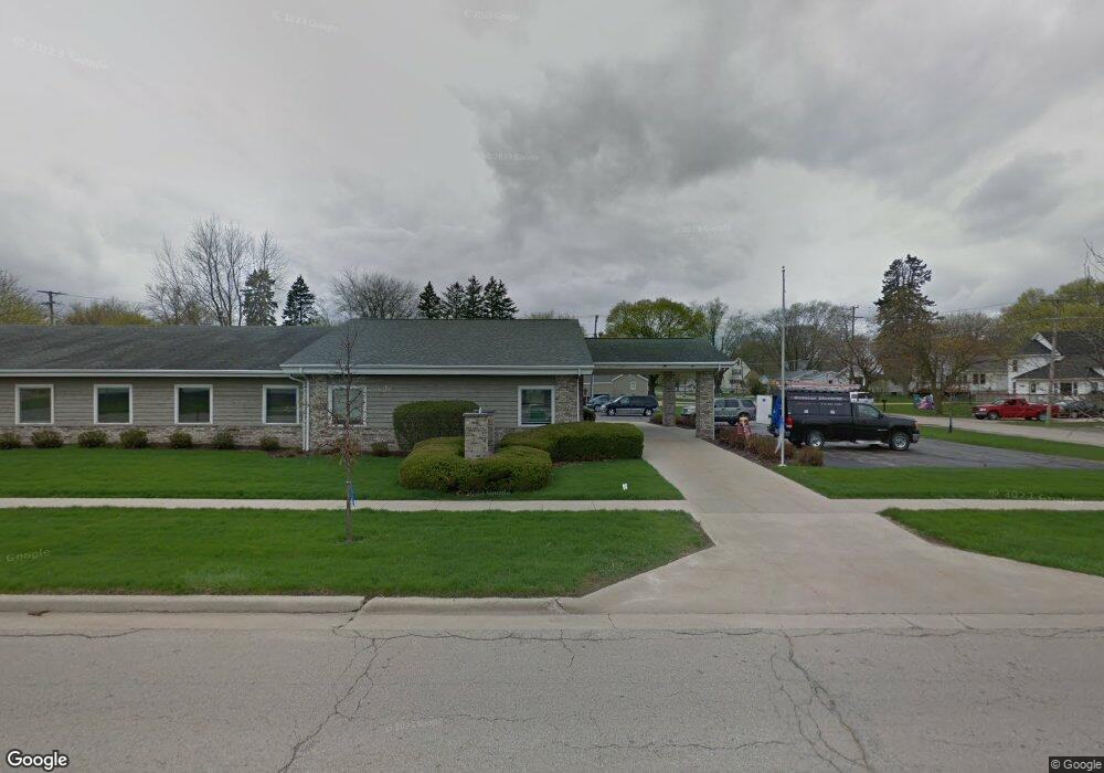
210 N Walnut Ave Forreston, IL 61030
Studio
--
Bath
--
Sq Ft
13,199
Sq Ft Lot
About This Home
This home is located at 210 N Walnut Ave, Forreston, IL 61030. 210 N Walnut Ave is a home located in Ogle County with nearby schools including Forreston High School.
Ownership History
Date
Name
Owned For
Owner Type
Purchase Details
Closed on
Mar 19, 2014
Sold by
Ruter Keith R and Ruter Keith R
Bought by
Shady Oak Dental Llc
Home Financials for this Owner
Home Financials are based on the most recent Mortgage that was taken out on this home.
Original Mortgage
$2,050,000
Interest Rate
4.24%
Mortgage Type
FHA
Create a Home Valuation Report for This Property
The Home Valuation Report is an in-depth analysis detailing your home's value as well as a comparison with similar homes in the area
Home Values in the Area
Average Home Value in this Area
Purchase History
| Date | Buyer | Sale Price | Title Company |
|---|---|---|---|
| Shady Oak Dental Llc | $425,000 | Security First Title Co |
Source: Public Records
Mortgage History
| Date | Status | Borrower | Loan Amount |
|---|---|---|---|
| Closed | Shady Oak Dental Llc | $2,050,000 |
Source: Public Records
Tax History
| Year | Tax Paid | Tax Assessment Tax Assessment Total Assessment is a certain percentage of the fair market value that is determined by local assessors to be the total taxable value of land and additions on the property. | Land | Improvement |
|---|---|---|---|---|
| 2024 | $3,485 | $39,564 | $12,187 | $27,377 |
| 2023 | $3,256 | $36,903 | $11,367 | $25,536 |
| 2022 | $3,088 | $33,766 | $10,401 | $23,365 |
| 2021 | $3,026 | $32,923 | $10,141 | $22,782 |
| 2020 | $2,958 | $32,341 | $9,962 | $22,379 |
| 2019 | $2,898 | $31,023 | $9,556 | $21,467 |
| 2018 | $2,938 | $31,023 | $9,556 | $21,467 |
| 2017 | $2,983 | $31,023 | $9,556 | $21,467 |
| 2016 | $3,107 | $30,287 | $9,329 | $20,958 |
| 2015 | $2,853 | $29,577 | $9,110 | $20,467 |
| 2014 | $2,872 | $29,577 | $9,110 | $20,467 |
| 2013 | $2,930 | $30,314 | $9,337 | $20,977 |
Source: Public Records
Map
Nearby Homes
- 304 Maple Ave
- 502 N Walnut Ave
- 406 W Balsam St
- 601 Hewitt St
- 603 Hewitt St
- 609 Hewitt St
- 613 Hewitt St
- 605 & 607 Hewitt St
- 613 & 615 Hewitt St
- 609 & 611 Hewitt St
- 617 & 619 Hewitt St
- 617 Hewitt St
- 701 Hewitt St
- 702 Hewitt St
- 703 Hewitt St
- 605 Hewitt St
- 404 E Willow St
- 8701 N Main St
- 10182 N Adeline Rd
- 10225 N Brookville Rd
- 204 N Walnut Ave
- 202 W Avon St
- 204 W Avon St
- 202 N Walnut Ave
- 205 W Avon St
- 202 W White Oak Rd
- 304 N Walnut Ave
- 301 N Walnut Ave
- 206 W Avon St
- 207 W Avon St
- 204 W White Oak Rd
- 101 S 2nd Ave
- 303 N Walnut Ave
- 101 W White Oak Rd
- 208 W Avon St
- 306 N Walnut Ave
- 303 Maple Ave
- 103 S 2nd Ave
- 102 S 1st Ave
- 305 Maple Ave
Your Personal Tour Guide
Ask me questions while you tour the home.