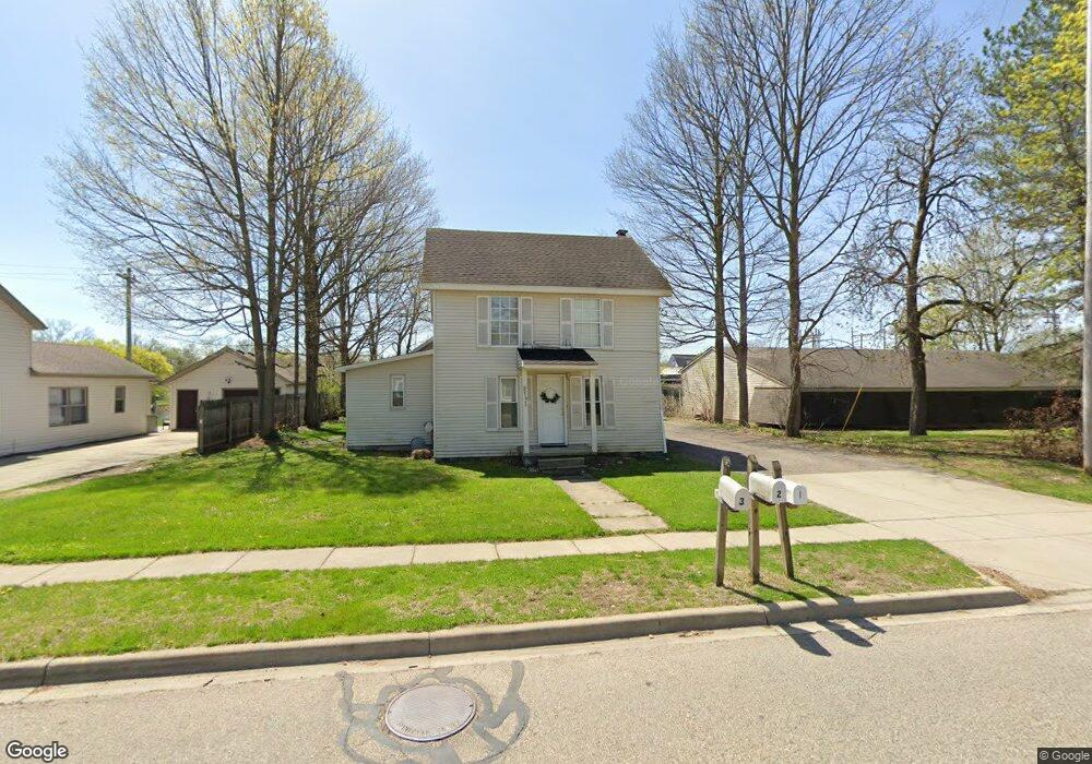
210 Oak St Linden, MI 48451
Estimated Value: $233,000 - $382,000
4
Beds
3
Baths
1,828
Sq Ft
$157/Sq Ft
Est. Value
About This Home
This home is located at 210 Oak St, Linden, MI 48451 and is currently estimated at $287,423, approximately $157 per square foot. 210 Oak St is a home located in Genesee County with nearby schools including Linden Elementary School, Linden Middle School, and Linden High School.
Ownership History
Date
Name
Owned For
Owner Type
Purchase Details
Closed on
Jan 17, 2025
Sold by
Hughes Debra R and Cameron Debra R
Bought by
Cameron Debra R and Hughes Debra R
Current Estimated Value
Purchase Details
Closed on
Jan 14, 2025
Sold by
Struthers-Wilson Cindy M
Bought by
Cameron Debra R and Hughes Debra R
Purchase Details
Closed on
Oct 19, 2020
Sold by
Struthers James A and Struthers Patricia A
Bought by
Patricia A Struthers Trust
Create a Home Valuation Report for This Property
The Home Valuation Report is an in-depth analysis detailing your home's value as well as a comparison with similar homes in the area
Home Values in the Area
Average Home Value in this Area
Purchase History
| Date | Buyer | Sale Price | Title Company |
|---|---|---|---|
| Cameron Debra R | -- | None Listed On Document | |
| Cameron Debra R | -- | None Listed On Document | |
| Cameron Debra R | $50,000 | None Listed On Document | |
| Struthers-Wilson Cindy M | -- | None Listed On Document | |
| Patricia A Struthers Trust | -- | None Available |
Source: Public Records
Tax History
| Year | Tax Paid | Tax Assessment Tax Assessment Total Assessment is a certain percentage of the fair market value that is determined by local assessors to be the total taxable value of land and additions on the property. | Land | Improvement |
|---|---|---|---|---|
| 2025 | $2,986 | $110,900 | $0 | $0 |
| 2024 | $1,689 | $103,000 | $0 | $0 |
| 2023 | $1,696 | $93,300 | $0 | $0 |
| 2022 | $2,723 | $81,300 | $0 | $0 |
| 2021 | $2,961 | $75,000 | $0 | $0 |
| 2020 | $2,084 | $69,700 | $0 | $0 |
| 2019 | $2,103 | $67,200 | $0 | $0 |
| 2018 | $2,886 | $67,200 | $0 | $0 |
| 2017 | $2,830 | $64,300 | $0 | $0 |
| 2016 | $2,857 | $58,600 | $0 | $0 |
| 2015 | $2,862 | $51,900 | $0 | $0 |
| 2012 | -- | $34,878 | $34,878 | $0 |
Source: Public Records
Map
Nearby Homes
- 532 E Broad St
- 331 Andrea Ave Unit 63
- 5220 Amelia Earhart Dr
- 513 W Broad St
- 5194 Amelia Earhart Dr
- 15051 Poberezny Ct
- 216 Canterbury Ct Unit 84
- 185 Laura Ln Unit 26
- 330 Stan Eaton Dr
- 231 Kathy Cir Unit 43
- 16257 Rogan Dr
- 16245 Rogan Dr
- 14238 Durant St
- 4468 Edison Blvd Unit 50
- 4447 Edison Blvd
- 4437 Edison Blvd
- 4448 Ford Ave
- 1565 W Rolston Rd
- 395 Haystack Dr Unit 97
- 14247 Webster Dr
Your Personal Tour Guide
Ask me questions while you tour the home.