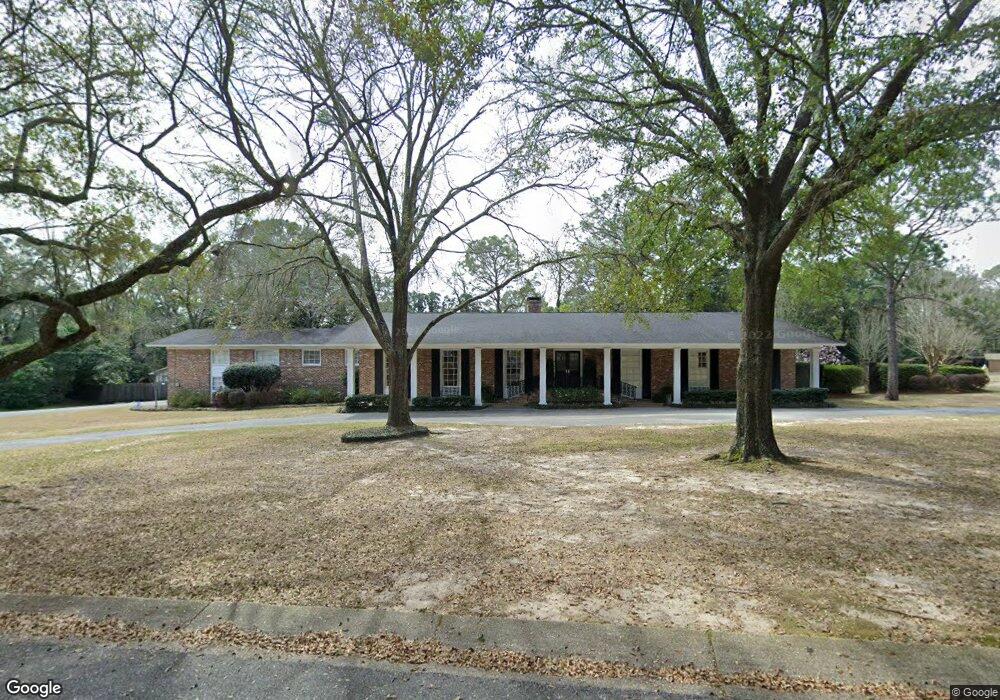
210 Rochester Rd Mobile, AL 36608
Country Club NeighborhoodEstimated Value: $790,633 - $1,014,000
About This Home
This home is located at 210 Rochester Rd, Mobile, AL 36608 and is currently estimated at $931,544, approximately $200 per square foot. 210 Rochester Rd is a home located in Mobile County with nearby schools including ER Dickson Elementary School, CL Scarborough Middle School, and Murphy High School.
Ownership History
We collect this data history from publicly available records. To have your information removed, we recommend requesting removal directly through your county’s website.
Purchase Details
Home Financials for this Owner
Home Financials are based on the most recent Mortgage that was taken out on this home.Home Values in the Area
Average Home Value in this Area
Purchase History
We collect this data history from publicly available records. To have your information removed, we recommend requesting removal directly through your county’s website.
| Date | Buyer | Sale Price | Title Company |
|---|---|---|---|
| $355,000 | -- |
Mortgage History
We collect this data history from publicly available records. To have your information removed, we recommend requesting removal directly through your county’s website.
| Date | Status | Borrower | Loan Amount |
|---|---|---|---|
| Open | $284,000 |
Tax History
We collect this data history from publicly available records. To have your information removed, we recommend requesting removal directly through your county’s website.
| Year | Tax Paid | Tax Assessment Tax Assessment Total Assessment is a certain percentage of the fair market value that is determined by local assessors to be the total taxable value of land and additions on the property. | Land | Improvement |
|---|---|---|---|---|
| 2025 | $4,043 | $64,550 | $12,500 | $52,050 |
| 2024 | $4,043 | $64,550 | $12,500 | $52,050 |
| 2023 | $3,771 | $60,270 | $12,500 | $47,770 |
| 2022 | $3,713 | $59,500 | $12,500 | $47,000 |
| 2021 | $3,372 | $54,150 | $12,500 | $41,650 |
| 2020 | $3,408 | $54,720 | $12,500 | $42,220 |
| 2019 | $3,428 | $55,040 | $0 | $0 |
| 2018 | $3,459 | $55,520 | $0 | $0 |
| 2017 | $3,387 | $54,400 | $0 | $0 |
| 2016 | $3,480 | $55,860 | $0 | $0 |
| 2013 | $3,264 | $63,980 | $0 | $0 |
Map
- 4601 Bit & Spur Rd
- 69 Jordan Ln
- 229 Lakewood Dr W
- 0 Winnie Way
- 65 Byrnes Blvd
- 4596 Hawthorne Place
- 251 Larkspur St
- 20 Westminster Way
- 254 Jackson Blvd
- 4543 Kingsway Dr
- 9 Cosgrove Dr
- 712 Westmoreland Dr W
- 0 S Hilltop Dr Unit 7710076
- 0 S Hilltop Dr Unit 3
- 167 Bit And Spur Terrace
- 312 Gaines Ave
- 4059 Airport Blvd
- 5488 S Hilltop Dr
- 4242 Bit & Spur Rd
- 5801 Fairfax Rd S
- 209 Childree Dr
- 212 Rochester Rd
- 207 Rochester Rd
- 0 Childree Dr Unit 2
- 213 Childree Dr
- 0 Childree Dr Unit 2 0607782
- 209 Rochester Rd
- 210 Childree Dr
- 211 Childree Dr
- 208 Childree Dr
- 205 Rochester Rd
- 214 Rochester Rd
- 211 Rochester Rd
- 212 Childree Dr Unit 58
- 222 Rochester Rd
- 204 Rochester Rd
- 204 Rochester Rd Unit 1
- 204 Rochester Rd Unit 2
- 4506 Sunset Dr N
- 213 Rochester Rd
Ask me questions while you tour the home.