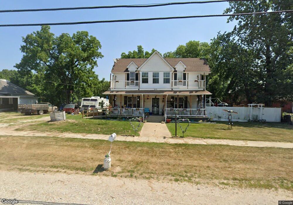
210 W Washington Ave Richland, MO 65556
Estimated Value: $91,000 - $199,000
3
Beds
2
Baths
1,782
Sq Ft
$83/Sq Ft
Est. Value
About This Home
This home is located at 210 W Washington Ave, Richland, MO 65556 and is currently estimated at $148,425, approximately $83 per square foot. 210 W Washington Ave is a home located in Pulaski County with nearby schools including Richland Elementary School, Richland Jr. High School, and Richland High School.
Ownership History
Date
Name
Owned For
Owner Type
Purchase Details
Closed on
Aug 11, 2006
Sold by
Andrews Carol Jean
Bought by
Smith Donald and Smith Karen
Current Estimated Value
Home Financials for this Owner
Home Financials are based on the most recent Mortgage that was taken out on this home.
Original Mortgage
$98,300
Interest Rate
10%
Mortgage Type
Construction
Create a Home Valuation Report for This Property
The Home Valuation Report is an in-depth analysis detailing your home's value as well as a comparison with similar homes in the area
Purchase History
We collect this data history from publicly available records. To have your information removed, we recommend requesting removal directly through your county’s website.
| Date | Buyer | Sale Price | Title Company |
|---|---|---|---|
| Smith Donald | -- | None Available |
Source: Public Records
Mortgage History
We collect this data history from publicly available records. To have your information removed, we recommend requesting removal directly through your county’s website.
| Date | Status | Borrower | Loan Amount |
|---|---|---|---|
| Closed | Smith Donald | $98,300 |
Source: Public Records
Tax History
| Year | Tax Paid | Tax Assessment Tax Assessment Total Assessment is a certain percentage of the fair market value that is determined by local assessors to be the total taxable value of land and additions on the property. | Land | Improvement |
|---|---|---|---|---|
| 2025 | $447 | $10,722 | $2,098 | $8,624 |
| 2024 | $4 | $9,588 | $1,748 | $7,840 |
| 2023 | $412 | $9,588 | $1,748 | $7,840 |
| 2022 | $403 | $9,588 | $1,748 | $7,840 |
| 2021 | $407 | $9,588 | $1,748 | $7,840 |
| 2020 | $393 | $9,285 | $0 | $0 |
| 2019 | $393 | $9,215 | $0 | $0 |
| 2018 | $392 | $9,215 | $0 | $0 |
| 2017 | $392 | $10,444 | $0 | $0 |
| 2016 | $392 | $9,220 | $0 | $0 |
| 2015 | -- | $9,220 | $0 | $0 |
| 2014 | $302 | $9,220 | $0 | $0 |
Source: Public Records
Map
Nearby Homes
- 23013 Rock Bluff Dr
- 402 N Chestnut St
- 220 Warren St
- 204 E Mcclurg St
- TBD SW State Route 7
- TBD Route 7
- 810 Mildred St
- 8 Flora Dr
- 112 Frisco St
- 11 Flora Dr
- 514 O Dell Ave
- 337 Cottonwood Branch
- 24939 Storm Break Dr
- 34555 Highway Ff
- 22798 River View Dr
- 26287 Radcliff Dr
- 271 Pleasant Knoll Rd
- 27 Pleasant Knoll Rd
- 23400 Range Ln
- 30131 Ranch Ln
- 304 W Washington Ave
- 202 W Washington Ave
- 105 N Chestnut St
- 109 N Chestnut St
- 207 W Washington Ave
- 207 W Washington Ave
- 112 N Chestnut St
- 301 W Washington Ave
- 107 S Walnut St
- 3 Different Houses
- 23589 Rock Bluff Dr
- 112 Chesnut
- 214 W Camden Ave
- 0 N Chestnut St
- 205 W Jefferson Ave
- 107 W Washington Ave
- 100 Warren St
- 211 W Camden Ave
- 0 Route 7
- Tbd Missouri 7
Your Personal Tour Guide
Ask me questions while you tour the home.