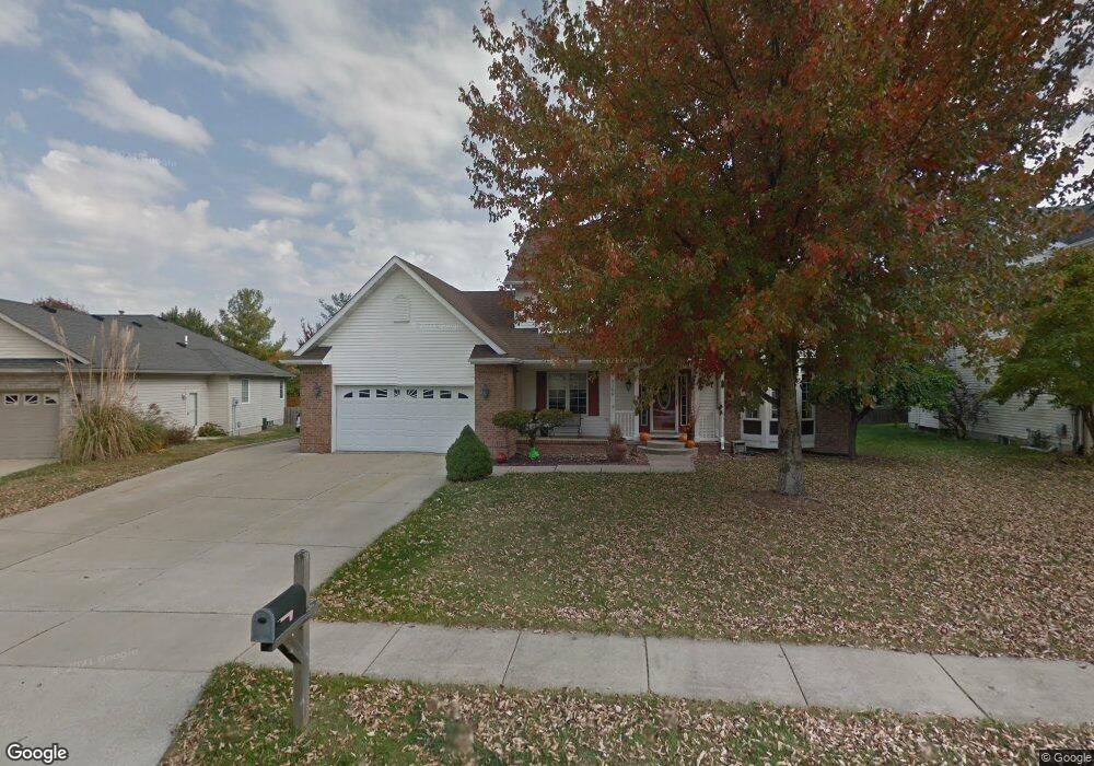
2100 Burgess Dr Springfield, IL 62711
Estimated Value: $294,000 - $344,000
Studio
--
Bath
--
Sq Ft
11,543
Sq Ft Lot
About This Home
This home is located at 2100 Burgess Dr, Springfield, IL 62711 and is currently estimated at $327,883. 2100 Burgess Dr is a home located in Sangamon County with nearby schools including Lindsay School, U.S. Grant Middle School, and Springfield High School.
Ownership History
Date
Name
Owned For
Owner Type
Purchase Details
Closed on
Apr 2, 2024
Sold by
Neposchlan Jay A and Neposchlan Julie L
Bought by
Schonauer Louis J and Pryor Natalie B
Current Estimated Value
Home Financials for this Owner
Home Financials are based on the most recent Mortgage that was taken out on this home.
Original Mortgage
$228,000
Outstanding Balance
$224,522
Interest Rate
6.77%
Mortgage Type
New Conventional
Estimated Equity
$103,361
Purchase Details
Closed on
Aug 26, 1994
Create a Home Valuation Report for This Property
The Home Valuation Report is an in-depth analysis detailing your home's value as well as a comparison with similar homes in the area
Purchase History
| Date | Buyer | Sale Price | Title Company |
|---|---|---|---|
| Schonauer Louis J | $285,000 | None Listed On Document | |
| -- | $27,800 | -- |
Source: Public Records
Mortgage History
| Date | Status | Borrower | Loan Amount |
|---|---|---|---|
| Open | Schonauer Louis J | $228,000 |
Source: Public Records
Tax History
| Year | Tax Paid | Tax Assessment Tax Assessment Total Assessment is a certain percentage of the fair market value that is determined by local assessors to be the total taxable value of land and additions on the property. | Land | Improvement |
|---|---|---|---|---|
| 2024 | $8,182 | $104,872 | $15,880 | $88,992 |
| 2023 | $8,320 | $101,537 | $14,505 | $87,032 |
| 2022 | $7,919 | $95,714 | $13,758 | $81,956 |
| 2021 | $7,637 | $92,130 | $13,243 | $78,887 |
| 2020 | $7,486 | $92,269 | $13,263 | $79,006 |
| 2019 | $7,347 | $91,947 | $13,217 | $78,730 |
| 2018 | $7,119 | $91,499 | $13,153 | $78,346 |
| 2017 | $6,965 | $90,316 | $12,983 | $77,333 |
| 2016 | $6,822 | $88,999 | $12,794 | $76,205 |
| 2015 | $6,750 | $87,935 | $12,641 | $75,294 |
| 2014 | $6,354 | $87,367 | $12,559 | $74,808 |
| 2013 | $6,213 | $83,806 | $12,560 | $71,246 |
Source: Public Records
Map
Nearby Homes
- 1606 Tern Place
- 4521 Barrington Dr
- LOT 54 Chestnut Dr
- 1412 Winston Dr
- 5404 Jaeger Dr
- 3924 Surry Place Ln
- 2700 Dryden Dr
- 6013 Hedley Rd
- 5904 Hedley Rd
- 2612 Dickens Dr
- 3908 Waterstone Way
- 3924 Old Mill Ln
- 2104 Dubsdread Dr
- 4568 Old Jacksonville Rd
- 2862 Reseda Rd Unit LOT16
- 5225 Jade Ln Unit LOT19
- 3050 W Iles Ave
- 5301 Jade Ln Unit LOT20
- 2806 Haggard Dr
- 5220 Jade Ln Unit LOT39
- 2012 Burgess Dr
- 2104 Burgess Dr
- 2101 Redlands Dr
- 2008 Burgess Dr
- 2105 Redlands Dr
- 2009 Burgess Dr
- 2101 Burgess Dr
- 2017 Redlands Dr
- 2108 Burgess Dr
- 2105 Burgess Dr
- 2013 Redlands Dr
- 2109 Redlands Dr
- 2005 Burgess Dr
- 2112 Burgess Dr
- 2004 Burgess Dr
- 2109 Burgess Dr
- 2009 Redlands Dr
- 2113 Redlands Dr
- 2005 Redlands Dr
- 2100 Redlands Dr
Your Personal Tour Guide
Ask me questions while you tour the home.