2100 Quentin Ave Lansing, MI 48910
Colonial Village NeighborhoodEstimated Value: $188,000 - $237,000
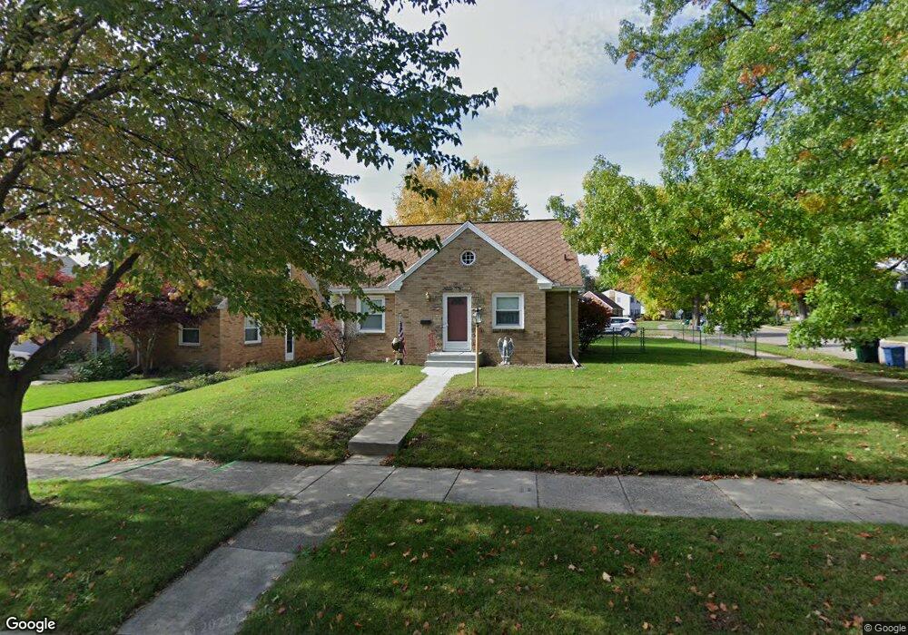
About This Home
This home is located at 2100 Quentin Ave, Lansing, MI 48910 and is currently estimated at $202,279, approximately $200 per square foot. 2100 Quentin Ave is a home located in Ingham County with nearby schools including Averill Elementary School, Attwood School, and J.W. Sexton High School.
Ownership History
We collect this data history from publicly available records. To have your information removed, we recommend requesting removal directly through your county’s website.
Purchase Details
Home Financials for this Owner
Home Financials are based on the most recent Mortgage that was taken out on this home.Purchase Details
Home Financials for this Owner
Home Financials are based on the most recent Mortgage that was taken out on this home.Purchase Details
Home Values in the Area
Average Home Value in this Area
Purchase History
We collect this data history from publicly available records. To have your information removed, we recommend requesting removal directly through your county’s website.
| Date | Buyer | Sale Price | Title Company |
|---|---|---|---|
| $102,500 | Tri County Title Agency Llc | ||
| $117,900 | Midstate Title Company | ||
| $82,900 | -- |
Mortgage History
We collect this data history from publicly available records. To have your information removed, we recommend requesting removal directly through your county’s website.
| Date | Status | Borrower | Loan Amount |
|---|---|---|---|
| Open | $104,703 | ||
| Previous Owner | $120,258 |
Tax History
We collect this data history from publicly available records. To have your information removed, we recommend requesting removal directly through your county’s website.
| Year | Tax Paid | Tax Assessment Tax Assessment Total Assessment is a certain percentage of the fair market value that is determined by local assessors to be the total taxable value of land and additions on the property. | Land | Improvement |
|---|---|---|---|---|
| 2025 | $3,150 | $86,500 | $11,800 | $74,700 |
| 2024 | $31 | $79,800 | $11,800 | $68,000 |
| 2023 | $3,582 | $74,000 | $11,800 | $62,200 |
| 2022 | $3,227 | $71,200 | $11,200 | $60,000 |
| 2021 | $3,160 | $66,300 | $7,700 | $58,600 |
| 2020 | $3,141 | $61,300 | $7,700 | $53,600 |
| 2019 | $3,012 | $59,000 | $7,700 | $51,300 |
| 2018 | $2,821 | $55,500 | $7,700 | $47,800 |
| 2017 | $2,701 | $55,500 | $7,700 | $47,800 |
| 2016 | $2,583 | $49,700 | $7,700 | $42,000 |
| 2015 | $2,583 | $48,100 | $15,326 | $32,774 |
| 2014 | $2,583 | $46,800 | $11,494 | $35,306 |
Map
- 1716 Gordon Ave
- 1810 Cooper Ave
- 1312 W Mount Hope Ave
- 1915 Cooper Ave
- 1910 Gordon Ave
- 1727 Wellington Rd
- 1740 Wellington Rd Unit 207
- 1740 Wellington Rd Unit 103
- 1927 Cooper Ave
- 1729 Loraine Ave
- 1116 George St
- 2222 Fairfax Rd
- 1027 Cooper Ave
- 1830 Fletcher St
- 1207 Edward St
- 1309 Hammond St
- 1033 Kelsey Ave
- 2801 Chatham Rd
- 917 W Barnes Ave
- 1823 Delevan Ave
- 2106 Quentin Ave
- 2112 Quentin Ave
- 1615 Lenore Ave
- 2116 Quentin Ave
- 1619 Lenore Ave
- 1600 Lenore Ave
- 1606 Lenore Ave
- 2103 Quentin Ave
- 1612 Lenore Ave
- 2122 Quentin Ave
- 1623 Lenore Ave
- 1618 Lenore Ave
- 1612 Cooper Ave
- 1521 Lenore Ave
- 1618 Cooper Ave
- 2113 Quentin Ave
- 1622 Cooper Ave
- 1622 Lenore Ave
- 2117 Quentin Ave
- 1701 Lenore Ave
Ask me questions while you tour the home.