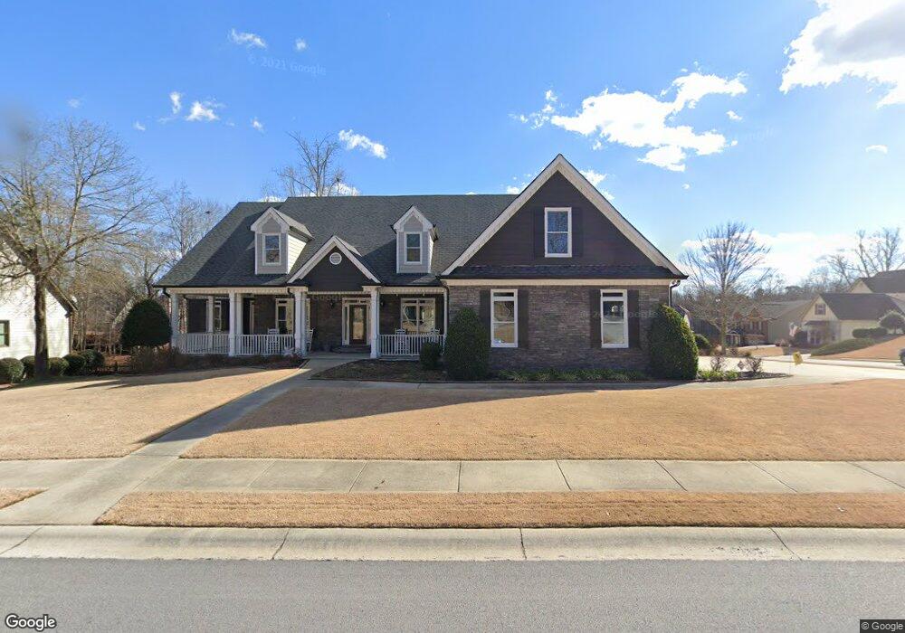
2105 Independence Ln Buford, GA 30519
Estimated Value: $567,000 - $604,000
4
Beds
4
Baths
3,100
Sq Ft
$189/Sq Ft
Est. Value
About This Home
This home is located at 2105 Independence Ln, Buford, GA 30519 and is currently estimated at $585,283, approximately $188 per square foot. 2105 Independence Ln is a home located in Hall County with nearby schools including Friendship Elementary School, Cherokee Bluff Middle School, and Cherokee Bluff High School.
Ownership History
Date
Name
Owned For
Owner Type
Purchase Details
Closed on
Jan 31, 2005
Sold by
Embry Custom Homes Llc
Bought by
Howard Eugene S and Howard Sharon
Current Estimated Value
Home Financials for this Owner
Home Financials are based on the most recent Mortgage that was taken out on this home.
Original Mortgage
$179,250
Interest Rate
5.12%
Mortgage Type
New Conventional
Purchase Details
Closed on
Aug 26, 2004
Sold by
Chateau Corners Development Corp
Bought by
Embry Custom Homes Llc
Create a Home Valuation Report for This Property
The Home Valuation Report is an in-depth analysis detailing your home's value as well as a comparison with similar homes in the area
Home Values in the Area
Average Home Value in this Area
Purchase History
| Date | Buyer | Sale Price | Title Company |
|---|---|---|---|
| Howard Eugene S | $358,500 | -- | |
| Embry Custom Homes Llc | $272,000 | -- |
Source: Public Records
Mortgage History
| Date | Status | Borrower | Loan Amount |
|---|---|---|---|
| Closed | Howard Eugene S | $179,250 |
Source: Public Records
Tax History
| Year | Tax Paid | Tax Assessment Tax Assessment Total Assessment is a certain percentage of the fair market value that is determined by local assessors to be the total taxable value of land and additions on the property. | Land | Improvement |
|---|---|---|---|---|
| 2025 | $4,293 | $216,520 | $44,200 | $172,320 |
| 2024 | $5,450 | $219,080 | $43,680 | $175,400 |
| 2023 | $4,011 | $178,360 | $29,960 | $148,400 |
| 2022 | $4,108 | $159,040 | $28,320 | $130,720 |
| 2021 | $3,578 | $136,280 | $17,000 | $119,280 |
| 2020 | $3,568 | $132,120 | $17,000 | $115,120 |
| 2019 | $3,450 | $126,720 | $16,000 | $110,720 |
| 2018 | $3,606 | $128,200 | $16,000 | $112,200 |
| 2017 | $3,557 | $123,480 | $12,000 | $111,480 |
| 2016 | $3,025 | $107,800 | $12,000 | $95,800 |
| 2015 | $2,998 | $107,800 | $12,000 | $95,800 |
| 2014 | $2,998 | $106,029 | $12,000 | $94,029 |
Source: Public Records
Map
Nearby Homes
- 2244 Mayors Way
- 2209 Independence Ln
- 2978 Legislative Ln
- 2638 Democracy Dr Unit 1
- 7343 Peacebrook Dr
- 7259 Williams Rd
- 7307 Williams Rd
- 7464 Williams Rd
- 7389 Williams Rd
- 2824 Pleasant Oak Dr
- 2747 Pearl Ridge Trace
- 2342 Sparta Way
- 2869 Wild Rose St
- 3088 Lantana Way
- 3138 Lantana Way
- 7078 Reserve Ct
- 7115 Spout Springs Rd
- 7207 Spout Springs Rd
- 7277 Maple Brook Ln
- 7512 Clover Unit 208
- 2109 Independence Ln Unit 175
- 2109 Independence Ln
- 2085 Democracy Dr
- 2117 Independence Ln
- 2103 Democracy Dr Unit 3
- 2092 Democracy Dr Unit 140
- 2092 Democracy Dr
- 2096 Democracy Dr Unit 139
- 2088 Democracy Dr Unit 141
- 2088 Democracy Dr
- 2081 Democracy Dr
- 2125 Independence Ln
- 2107 Democracy Dr Unit 3
- 2108 Independence Ln
- 2124 Independence Ln
- 2112 Independence Ln
- 2077 Democracy Dr
- 2131 Independence Ln
- 2120 Independence Ln
- 2106 Democracy Dr
Your Personal Tour Guide
Ask me questions while you tour the home.