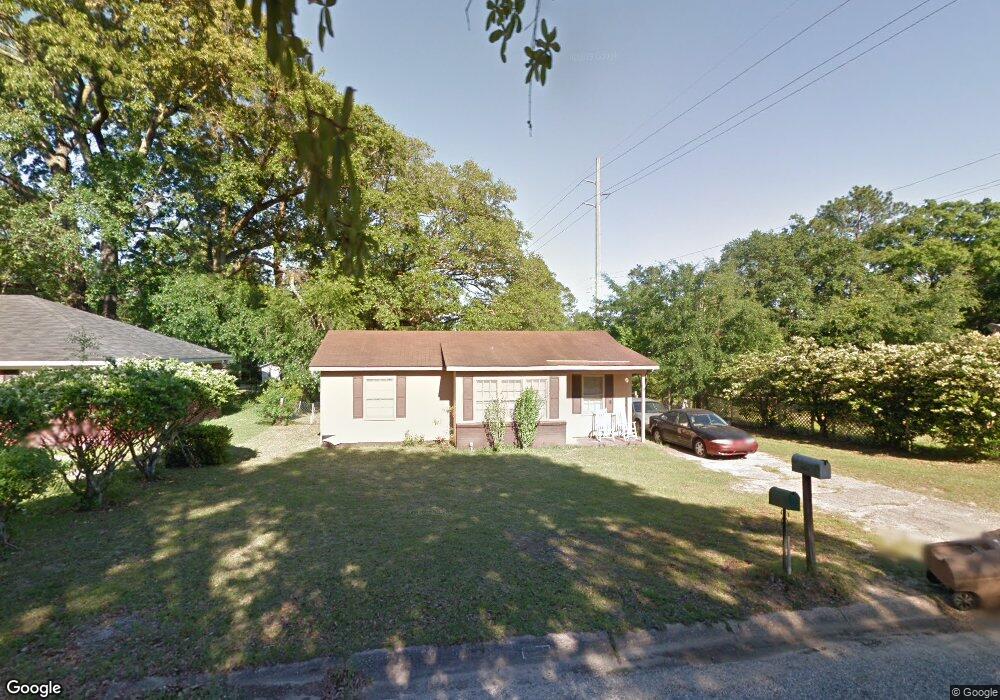
2108 Baker Rd Mobile, AL 36618
Autumndale NeighborhoodEstimated Value: $57,169 - $136,000
Studio
1
Bath
964
Sq Ft
$104/Sq Ft
Est. Value
About This Home
This home is located at 2108 Baker Rd, Mobile, AL 36618 and is currently estimated at $100,292, approximately $104 per square foot. 2108 Baker Rd is a home located in Mobile County with nearby schools including Forest Hill Elementary School, CL Scarborough Middle School, and Mattie T Blount High School.
Ownership History
Date
Name
Owned For
Owner Type
Purchase Details
Closed on
Dec 14, 2021
Sold by
Williams Arthur and Williams Dianne
Bought by
Williams Geraldine Ann and Williams Danny Lee
Current Estimated Value
Purchase Details
Closed on
Jul 22, 1998
Sold by
Ruth Wright Anna
Bought by
Ramey Willie L and Ramey Evelean
Home Financials for this Owner
Home Financials are based on the most recent Mortgage that was taken out on this home.
Original Mortgage
$36,853
Outstanding Balance
$6,947
Interest Rate
7.02%
Mortgage Type
FHA
Estimated Equity
$93,345
Create a Home Valuation Report for This Property
The Home Valuation Report is an in-depth analysis detailing your home's value as well as a comparison with similar homes in the area
Home Values in the Area
Average Home Value in this Area
Purchase History
| Date | Buyer | Sale Price | Title Company |
|---|---|---|---|
| Williams Geraldine Ann | -- | None Available | |
| Ramey Willie L | -- | -- |
Source: Public Records
Mortgage History
| Date | Status | Borrower | Loan Amount |
|---|---|---|---|
| Open | Ramey Willie L | $36,853 |
Source: Public Records
Tax History
| Year | Tax Paid | Tax Assessment Tax Assessment Total Assessment is a certain percentage of the fair market value that is determined by local assessors to be the total taxable value of land and additions on the property. | Land | Improvement |
|---|---|---|---|---|
| 2025 | -- | $3,700 | $1,000 | $2,700 |
| 2024 | -- | $3,550 | $1,000 | $2,550 |
| 2023 | $438 | $3,500 | $1,000 | $2,500 |
| 2022 | $428 | $3,370 | $1,000 | $2,370 |
| 2021 | $391 | $3,080 | $800 | $2,280 |
| 2020 | $366 | $2,880 | $600 | $2,280 |
| 2019 | $354 | $2,790 | $600 | $2,190 |
| 2018 | $354 | $5,580 | $0 | $0 |
| 2017 | $338 | $5,320 | $0 | $0 |
| 2016 | $488 | $7,680 | $0 | $0 |
| 2013 | $532 | $7,640 | $0 | $0 |
Source: Public Records
Map
Nearby Homes
- 2113 Cornell Dr
- 4060 Dickson Ln
- 2205 Beau Terra Dr W
- 2004 Beau Terra Dr W
- 2210 Wolf Ridge Rd
- 0 Junius Ln
- 1758 La Pine Dr
- 1757 Le Grande Dr
- 871 Kuffskie Ln
- 4409 Eastview Dr
- 1561 Phillips Ln
- 1701 Phillips Ln
- 6632 Monarch Cir
- 3531 Anton St
- 21 Brucewood Dr W
- 3514 Anton St
- 6 Brucewood Dr W
- 1811 Butler St
- 4453 Myers Rd
- 2621 Berkley Ave
- 2112 Baker Rd
- 2104 Baker Rd
- 2116 Baker Rd
- 2008 Holleman Cir S
- 2109 Baker Rd
- 2100 Baker Rd
- 2113 Baker Rd
- 2101 Baker Rd
- 2120 Baker Rd
- 2004 Holleman Cir S
- 2019 Holleman Cir N
- 2021 Holleman Cir N
- 2117 Baker Rd
- 2005 Holleman Cir S
- 2017 Holleman Cir N
- 4016 Baker Rd
- 2124 Baker Rd
- 2121 Baker Rd
- 2104 Hamilton Rd
- 2108 Hamilton Rd
Your Personal Tour Guide
Ask me questions while you tour the home.