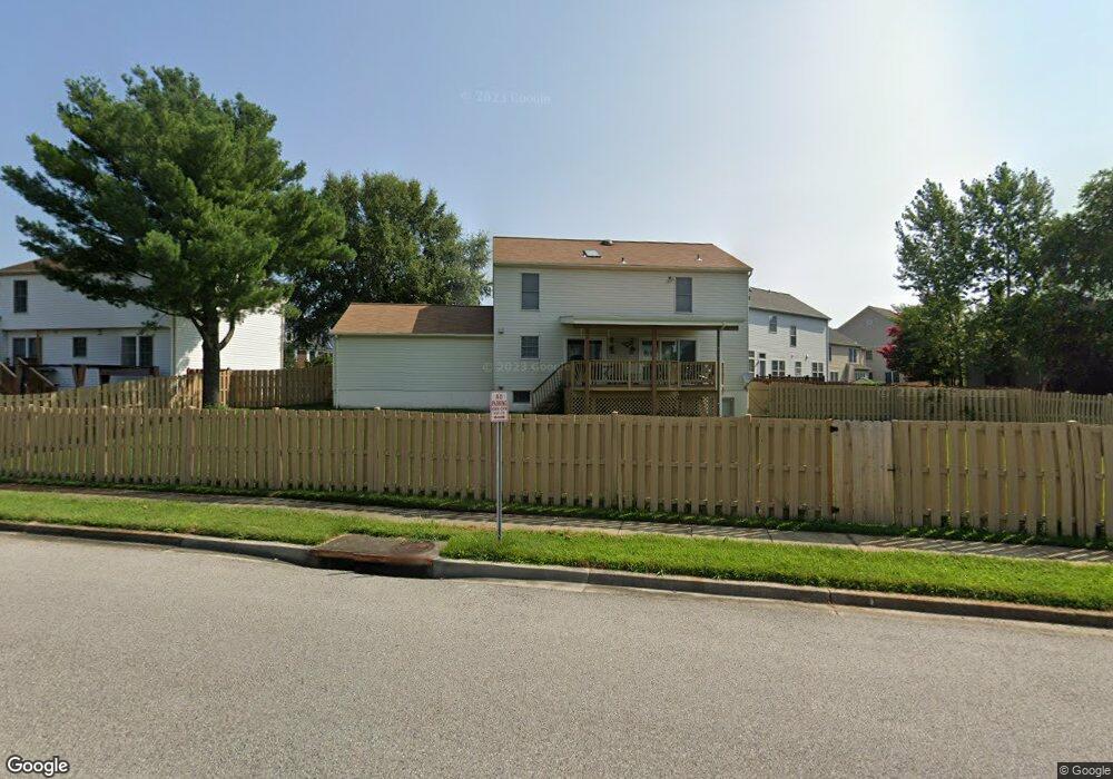
2109 Brink Ct Odenton, MD 21113
Estimated Value: $617,851 - $648,000
Studio
3
Baths
2,128
Sq Ft
$296/Sq Ft
Est. Value
About This Home
This home is located at 2109 Brink Ct, Odenton, MD 21113 and is currently estimated at $630,463, approximately $296 per square foot. 2109 Brink Ct is a home located in Anne Arundel County with nearby schools including Seven Oaks Elementary School, MacArthur Middle School, and Meade High School.
Ownership History
Date
Name
Owned For
Owner Type
Purchase Details
Closed on
May 21, 2004
Sold by
Janes Donn E
Bought by
Davis Darius L and Davis Dessolene W
Current Estimated Value
Purchase Details
Closed on
Mar 6, 2003
Sold by
Cendant Mobility Serices Corp
Bought by
Janes Donn E and Janes Candace S
Purchase Details
Closed on
Nov 25, 1994
Sold by
Cook Marlon G
Bought by
Stewart Dan T
Home Financials for this Owner
Home Financials are based on the most recent Mortgage that was taken out on this home.
Original Mortgage
$184,000
Interest Rate
8.91%
Create a Home Valuation Report for This Property
The Home Valuation Report is an in-depth analysis detailing your home's value as well as a comparison with similar homes in the area
Home Values in the Area
Average Home Value in this Area
Purchase History
We collect this data history from publicly available records. To have your information removed, we recommend requesting removal directly through your county’s website.
| Date | Buyer | Sale Price | Title Company |
|---|---|---|---|
| Davis Darius L | $351,000 | -- | |
| Janes Donn E | $320,900 | -- | |
| Cendant Mobility Serices Corp | $313,900 | -- | |
| Stewart Dan T | $189,900 | -- |
Source: Public Records
Mortgage History
We collect this data history from publicly available records. To have your information removed, we recommend requesting removal directly through your county’s website.
| Date | Status | Borrower | Loan Amount |
|---|---|---|---|
| Previous Owner | Stewart Dan T | $184,000 | |
| Closed | Janes Donn E | -- |
Source: Public Records
Tax History
| Year | Tax Paid | Tax Assessment Tax Assessment Total Assessment is a certain percentage of the fair market value that is determined by local assessors to be the total taxable value of land and additions on the property. | Land | Improvement |
|---|---|---|---|---|
| 2025 | $4,040 | $486,600 | $176,200 | $310,400 |
| 2024 | $4,040 | $456,967 | $0 | $0 |
| 2023 | $3,436 | $427,333 | $0 | $0 |
| 2022 | $3,636 | $397,700 | $152,600 | $245,100 |
| 2020 | $3,471 | $381,433 | $0 | $0 |
| 2019 | $3,412 | $373,300 | $124,000 | $249,300 |
| 2018 | $3,682 | $363,133 | $0 | $0 |
| 2017 | $3,209 | $352,967 | $0 | $0 |
| 2016 | -- | $342,800 | $0 | $0 |
| 2015 | -- | $342,300 | $0 | $0 |
| 2014 | -- | $341,800 | $0 | $0 |
Source: Public Records
Map
Nearby Homes
- 2104 Commissary Cir
- 2102 Commissary Cir
- 2012 Bunker Hill Ct
- 2110 Commodore Ct
- 2244 Commissary Cir
- 2211 Commissary Cir
- 2242 Commissary Cir
- 2224 Canteen Cir
- 170 Hidden Hill Cir
- 330 Timberbrook Ct
- 209 Edge Creek Ln
- 2006 Militia Ct
- 231 Kirbys Landing Ct Unit 8
- 233 Kirbys Landing Ct
- 1969 Buckwheat Ct
- 1823 Jaybird Ct
- 8219 Tomlinson Ct
- 331 Assembly Point Ct
- 8212 Tomlinson Ct
- 8210 Tomlinson Ct
- 2106 Brink Ct
- 2104 Brink Ct
- 2108 Brink Ct
- 2029 Brigadier Blvd
- 2031 Brigadier Blvd
- 2102 Brink Ct
- 2110 Brink Ct
- 2027 Brigadier Blvd
- 2033 Brigadier Blvd
- 2105 Brink Ct
- 2107 Brink Ct
- 2100 Brink Ct
- 2112 Brink Ct
- 2113 Brink Ct
- 2025 Brigadier Blvd
- 2111 Brink Ct
- 2103 Brink Ct
- 2035 Brigadier Blvd
- 2101 Brink Ct
- 2034 Brigadier Blvd
Your Personal Tour Guide
Ask me questions while you tour the home.