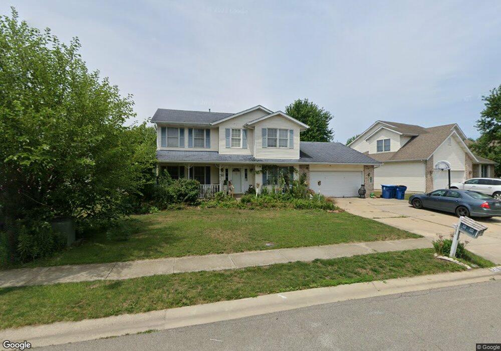
2109 Disar Dr Springfield, IL 62711
Estimated Value: $330,177 - $382,000
Studio
--
Bath
--
Sq Ft
11,761
Sq Ft Lot
About This Home
This home is located at 2109 Disar Dr, Springfield, IL 62711 and is currently estimated at $358,044. 2109 Disar Dr is a home located in Sangamon County with nearby schools including Lindsay School, U.S. Grant Middle School, and Springfield High School.
Ownership History
Date
Name
Owned For
Owner Type
Purchase Details
Closed on
Aug 28, 2018
Sold by
Boggs Kenneth W
Bought by
Boggs Juanita A
Current Estimated Value
Home Financials for this Owner
Home Financials are based on the most recent Mortgage that was taken out on this home.
Original Mortgage
$163,400
Outstanding Balance
$119,604
Interest Rate
4.5%
Mortgage Type
New Conventional
Estimated Equity
$238,440
Purchase Details
Closed on
Sep 29, 2009
Purchase Details
Closed on
Jul 30, 2007
Purchase Details
Closed on
Jan 18, 2006
Purchase Details
Closed on
Feb 15, 2005
Purchase Details
Closed on
Feb 6, 2003
Purchase Details
Closed on
Sep 9, 1996
Purchase Details
Closed on
Mar 14, 1996
Create a Home Valuation Report for This Property
The Home Valuation Report is an in-depth analysis detailing your home's value as well as a comparison with similar homes in the area
Purchase History
| Date | Buyer | Sale Price | Title Company |
|---|---|---|---|
| Boggs Juanita A | -- | Amrock Title | |
| -- | -- | -- | |
| -- | $201,000 | -- | |
| -- | $184,800 | -- | |
| -- | -- | -- | |
| -- | -- | -- | |
| -- | $163,000 | -- | |
| -- | $27,300 | -- |
Source: Public Records
Mortgage History
| Date | Status | Borrower | Loan Amount |
|---|---|---|---|
| Open | Boggs Juanita A | $163,400 |
Source: Public Records
Tax History
| Year | Tax Paid | Tax Assessment Tax Assessment Total Assessment is a certain percentage of the fair market value that is determined by local assessors to be the total taxable value of land and additions on the property. | Land | Improvement |
|---|---|---|---|---|
| 2024 | $7,014 | $90,765 | $13,895 | $76,870 |
| 2023 | $6,697 | $82,906 | $12,692 | $70,214 |
| 2022 | $6,369 | $78,158 | $12,039 | $66,119 |
| 2021 | $6,139 | $75,231 | $11,588 | $63,643 |
| 2020 | $6,017 | $75,344 | $11,605 | $63,739 |
| 2019 | $5,905 | $75,082 | $11,565 | $63,517 |
| 2018 | $5,721 | $74,716 | $11,509 | $63,207 |
| 2017 | $5,597 | $73,750 | $11,360 | $62,390 |
| 2016 | $5,480 | $72,674 | $11,194 | $61,480 |
| 2015 | $5,421 | $71,805 | $11,060 | $60,745 |
| 2014 | $5,102 | $71,342 | $10,989 | $60,353 |
| 2013 | $4,988 | $68,467 | $10,989 | $57,478 |
Source: Public Records
Map
Nearby Homes
- LOT 54 Chestnut Dr
- 4521 Barrington Dr
- 2311 Asheville Dr
- 1412 Winston Dr
- 5404 Jaeger Dr
- 1621 Briarcreek Ln
- 2862 Reseda Rd Unit LOT16
- 5225 Jade Ln Unit LOT19
- 5301 Jade Ln Unit LOT20
- 5220 Jade Ln Unit LOT39
- 5305 Jade Ln Unit LOT21
- 5309 Jade Ln Unit LOT22
- 5224 Jade Ln Unit LOT38
- 6013 Hedley Rd
- 5904 Hedley Rd
- 5313 Jade Ln Unit LOT23
- 5300 Jade Ln Unit LOT37
- 2871 Reseda Rd Unit LOT40
- 5401 Jade Ln Unit LOT24
- 5221 Verdant Ln
- 2113 Disar Dr
- 2105 Disar Dr
- 2201 Disar Dr
- 2112 Disar Dr
- 2101 Disar Dr
- 2116 Disar Dr
- 2108 Disar Dr
- 2104 Disar Dr
- 2200 Disar Dr
- 2205 Disar Dr
- 2204 Disar Dr
- 4672 Barrington Dr
- 2205 Palo Alto Dr
- 2201 Palo Alto Dr
- 2209 Disar Dr
- 2209 Palo Alto Dr
- 2301 Palo Alto Dr
- 2208 Disar Dr
- 4683 Barrington Dr
- 2105 Palo Alto Dr
Your Personal Tour Guide
Ask me questions while you tour the home.