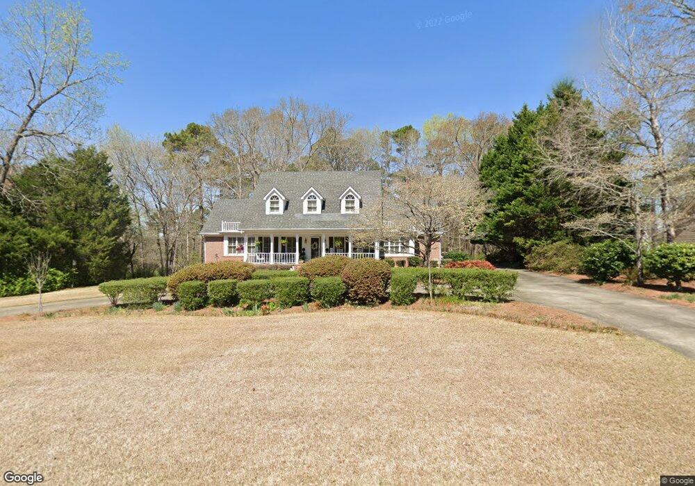
211 Ashford Cir Lagrange, GA 30240
Estimated Value: $364,000 - $443,000
4
Beds
3
Baths
2,571
Sq Ft
$158/Sq Ft
Est. Value
About This Home
This home is located at 211 Ashford Cir, Lagrange, GA 30240 and is currently estimated at $406,774, approximately $158 per square foot. 211 Ashford Cir is a home located in Troup County with nearby schools including Franklin Forest Elementary School, Hollis Hand Elementary School, and Ethel W. Kight Elementary School.
Ownership History
Date
Name
Owned For
Owner Type
Purchase Details
Closed on
May 6, 1993
Sold by
John T Pearce
Bought by
Williamson Larry E and Williamson Norma S
Current Estimated Value
Purchase Details
Closed on
Mar 18, 1988
Sold by
West Ga Estates Inc
Bought by
John T Pearce
Purchase Details
Closed on
Jun 14, 1985
Sold by
Heinrich J Boggess
Bought by
West Ga Estates Inc
Create a Home Valuation Report for This Property
The Home Valuation Report is an in-depth analysis detailing your home's value as well as a comparison with similar homes in the area
Purchase History
| Date | Buyer | Sale Price | Title Company |
|---|---|---|---|
| Williamson Larry E | $25,500 | -- | |
| John T Pearce | $27,500 | -- | |
| West Ga Estates Inc | -- | -- |
Source: Public Records
Tax History
| Year | Tax Paid | Tax Assessment Tax Assessment Total Assessment is a certain percentage of the fair market value that is determined by local assessors to be the total taxable value of land and additions on the property. | Land | Improvement |
|---|---|---|---|---|
| 2025 | $3,834 | $146,200 | $18,000 | $128,200 |
| 2024 | $3,655 | $136,000 | $18,000 | $118,000 |
| 2023 | $2,694 | $118,680 | $14,000 | $104,680 |
| 2022 | $3,085 | $112,520 | $14,000 | $98,520 |
| 2021 | $3,081 | $104,160 | $14,000 | $90,160 |
| 2020 | $3,081 | $104,160 | $14,000 | $90,160 |
| 2019 | $2,968 | $100,400 | $14,000 | $86,400 |
| 2018 | $2,968 | $100,400 | $14,000 | $86,400 |
| 2017 | $2,968 | $100,400 | $14,000 | $86,400 |
| 2016 | $3,036 | $102,633 | $14,000 | $88,633 |
| 2015 | $3,041 | $102,633 | $14,000 | $88,633 |
| 2014 | $2,991 | $100,806 | $14,000 | $86,806 |
| 2013 | -- | $93,492 | $14,000 | $79,492 |
Source: Public Records
Map
Nearby Homes
- 103 Woodchase
- 103 Windridge
- 107 Windridge
- 109 Windridge
- 205 River Oaks Dr
- 114 Red Oak Trail
- 209 River Oaks Dr
- 130 Sunny Point Cir
- 103 Powers Ct
- 110 Pond View Point
- 127 Ashling Dr
- 91 Richmond Dr
- 1784 Mooty Bridge Rd
- 115 Meadowland Trail
- 1351 New Franklin Rd
- 100 Deer Creek Dr
- 203 View Pointe Ln
- 1218 New Franklin Rd
- 102 Beech Creek Dr
- 204 Dixie Creek Dr
- 213 Ashford Cir
- 209 Ashford Cir
- 110 Moss Creek Dr Unit 40
- 110 Moss Creek Unit 40
- 112 Moss Creek Dr Unit 39
- 210 Ashford Cir
- 212 Ashford Cir
- 108 Moss Creek Dr
- 114 Moss Creek Dr
- 215 Ashford Cir
- 208 Ashford Cir
- 207 Ashford Cir
- 214 Ashford Cir
- 106 Moss Creek Dr
- 206 Ashford Cir
- 116 Moss Creek Dr
- 111 Moss Creek Dr Unit 69
- 109 Saint Clare Ct
- 216 Ashford Cir
- 217 Ashford Cir
Your Personal Tour Guide
Ask me questions while you tour the home.