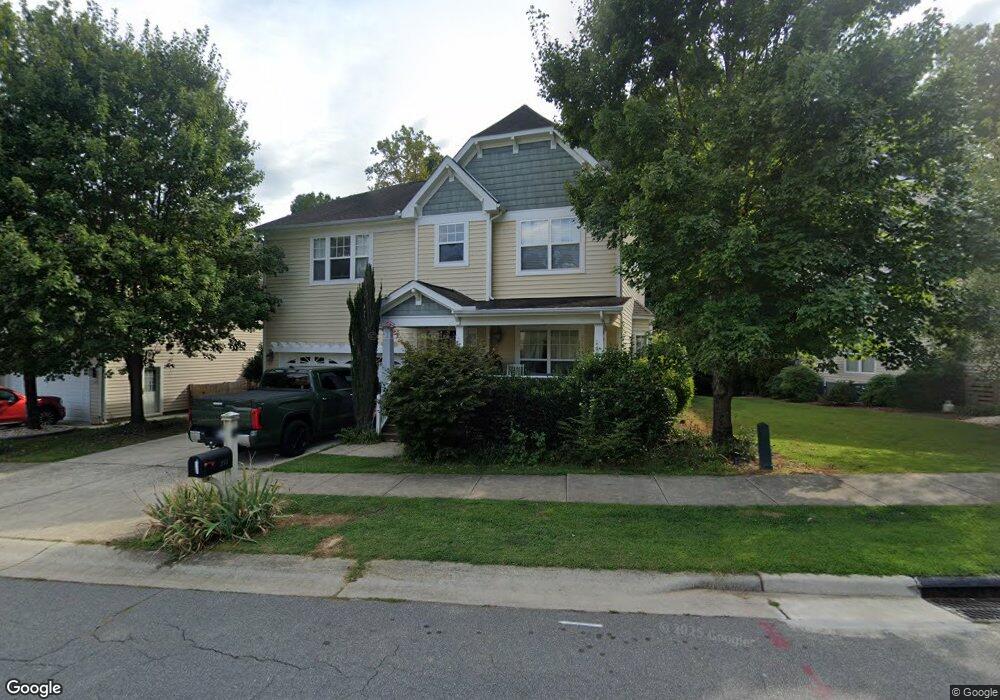
211 Brook Chase Ln Durham, NC 27705
Croasdaile NeighborhoodEstimated Value: $630,663 - $726,000
5
Beds
3
Baths
3,376
Sq Ft
$199/Sq Ft
Est. Value
About This Home
This home is located at 211 Brook Chase Ln, Durham, NC 27705 and is currently estimated at $671,916, approximately $199 per square foot. 211 Brook Chase Ln is a home located in Durham County with nearby schools including Hillandale Elementary School, George L Carrington Middle, and Riverside High School.
Ownership History
Date
Name
Owned For
Owner Type
Purchase Details
Closed on
Feb 27, 2007
Sold by
K Hovnanian Homes Of North Carolina Inc
Bought by
Yap Jasper and Yap Maria Victoria
Current Estimated Value
Home Financials for this Owner
Home Financials are based on the most recent Mortgage that was taken out on this home.
Original Mortgage
$272,250
Outstanding Balance
$176,687
Interest Rate
7.62%
Mortgage Type
Purchase Money Mortgage
Estimated Equity
$495,229
Create a Home Valuation Report for This Property
The Home Valuation Report is an in-depth analysis detailing your home's value as well as a comparison with similar homes in the area
Home Values in the Area
Average Home Value in this Area
Purchase History
We collect this data history from publicly available records. To have your information removed, we recommend requesting removal directly through your county’s website.
| Date | Buyer | Sale Price | Title Company |
|---|---|---|---|
| Yap Jasper | $340,500 | None Available |
Source: Public Records
Mortgage History
We collect this data history from publicly available records. To have your information removed, we recommend requesting removal directly through your county’s website.
| Date | Status | Borrower | Loan Amount |
|---|---|---|---|
| Open | Yap Jasper | $272,250 | |
| Closed | Yap Jasper | $51,000 |
Source: Public Records
Tax History
| Year | Tax Paid | Tax Assessment Tax Assessment Total Assessment is a certain percentage of the fair market value that is determined by local assessors to be the total taxable value of land and additions on the property. | Land | Improvement |
|---|---|---|---|---|
| 2025 | $6,100 | $615,342 | $103,500 | $511,842 |
| 2024 | $5,206 | $373,249 | $51,705 | $321,544 |
| 2023 | $4,889 | $373,249 | $51,705 | $321,544 |
| 2022 | $4,777 | $373,249 | $51,705 | $321,544 |
| 2021 | $4,729 | $371,245 | $51,705 | $319,540 |
| 2020 | $4,618 | $371,245 | $51,705 | $319,540 |
| 2019 | $4,618 | $371,245 | $51,705 | $319,540 |
| 2018 | $4,352 | $320,791 | $40,215 | $280,576 |
| 2017 | $4,319 | $320,791 | $40,215 | $280,576 |
| 2016 | $4,174 | $320,791 | $40,215 | $280,576 |
| 2015 | $4,822 | $348,308 | $63,696 | $284,612 |
| 2014 | $4,822 | $348,308 | $63,696 | $284,612 |
Source: Public Records
Map
Nearby Homes
- 1501 Balsawood Dr
- 1513 Cole Mill Rd
- 1201 Opal Ln
- 1213 Opal Ln
- 1217 Opal Ln
- 3735 Stoneybrook Dr
- 1221 Opal Ln
- 1229 Opal Ln
- 2013 Skipping Stone Dr
- 512 Soapstone Dr
- 508 Soapstone Dr
- 621 Blackwood Ct
- 609 Blackwood Ct
- 605 Blackwood Ct
- 2116 Skipping Stone Dr
- 2205 Skipping Stone Dr
- 802 Blackberry Ln
- 602 Culpepper Ct
- 4 Astor Ct
- 204 Cedar Ridge Way
- 209 Brook Chase Ln
- 213 Brook Chase Ln
- 207 Brook Chase Ln
- 210 Brook Chase Ln
- 102 Hay Sedge Ct
- 208 Brook Chase Ln
- 205 Brook Chase Ln
- 104 Hay Sedge Ct
- 103 Hay Sedge Ct
- 117 Fox Run Ct
- 103 Fox Run Ct
- 116 Fox Run Ct
- 108 Hay Sedge Ct
- 305 Brook Chase Ln
- 5 Duffers Place
- 302 Brook Chase Ln
- 302 Brook Chase Ln Unit 69
- 114 Fox Run Ct
- 102 Fox Run Ct
- 109 Hay Sedge Ct
Your Personal Tour Guide
Ask me questions while you tour the home.