Estimated Value: $173,000 - $226,000
Studio
--
Bath
1,300
Sq Ft
$160/Sq Ft
Est. Value
About This Home
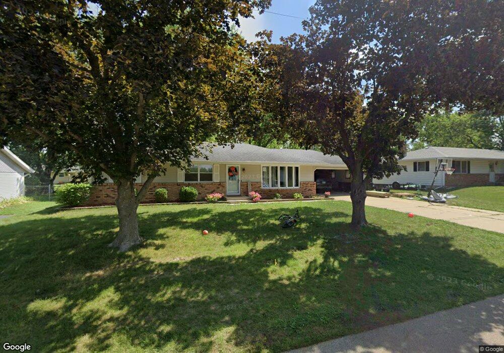
This home is located at 211 S Colfax St, Byron, IL 61010 and is currently estimated at $207,980, approximately $159 per square foot. 211 S Colfax St is a home located in Ogle County with nearby schools including Mary Morgan Elementary School, Byron Middle School, and Byron High School.
Ownership History
Date
Name
Owned For
Owner Type
Purchase Details
Closed on
May 21, 2021
Sold by
Hillis Rentals Llc
Bought by
Hedberg David
Current Estimated Value
Home Financials for this Owner
Home Financials are based on the most recent Mortgage that was taken out on this home.
Original Mortgage
$157,590
Outstanding Balance
$142,367
Interest Rate
2.9%
Mortgage Type
FHA
Estimated Equity
$65,613
Purchase Details
Closed on
Dec 30, 2014
Sold by
Hillis David K and Hillis Ashley N
Bought by
Hillis Rentals Llc
Purchase Details
Closed on
Nov 24, 2008
Sold by
Hillis Leilani R
Bought by
Hillis David K
Create a Home Valuation Report for This Property
The Home Valuation Report is an in-depth analysis detailing your home's value as well as a comparison with similar homes in the area
Home Values in the Area
Average Home Value in this Area
Purchase History
| Date | Buyer | Sale Price | Title Company |
|---|---|---|---|
| Hedberg David | $165,000 | None Available | |
| Hillis Rentals Llc | -- | -- | |
| Hillis David K | $125,000 | None Available |
Source: Public Records
Mortgage History
| Date | Status | Borrower | Loan Amount |
|---|---|---|---|
| Open | Hedberg David | $157,590 |
Source: Public Records
Tax History
| Year | Tax Paid | Tax Assessment Tax Assessment Total Assessment is a certain percentage of the fair market value that is determined by local assessors to be the total taxable value of land and additions on the property. | Land | Improvement |
|---|---|---|---|---|
| 2024 | $3,954 | $52,219 | $11,229 | $40,990 |
| 2023 | $3,680 | $49,643 | $10,675 | $38,968 |
| 2022 | $3,433 | $46,038 | $9,900 | $36,138 |
| 2021 | $3,892 | $44,072 | $9,477 | $34,595 |
| 2020 | $3,397 | $40,891 | $9,291 | $31,600 |
| 2019 | $3,409 | $39,604 | $8,999 | $30,605 |
| 2018 | $3,410 | $38,582 | $8,767 | $29,815 |
| 2017 | $3,375 | $38,582 | $8,767 | $29,815 |
| 2016 | $2,671 | $37,874 | $8,606 | $29,268 |
| 2015 | $2,528 | $36,664 | $8,331 | $28,333 |
| 2014 | $2,502 | $36,664 | $8,331 | $28,333 |
| 2013 | $2,595 | $37,135 | $8,438 | $28,697 |
Source: Public Records
Map
Nearby Homes
- 820 Crest View Trail
- 932 W 2nd St
- 8890 Hales Corner Rd Rd
- 509 N Walnut St
- 151 N Fox Run Ln
- 265 Creekside Dr
- 617 E 3rd St
- 1538 Southfield Ln
- 713 Birch St
- 00 E Ashelford Dr Unit LOT 8
- 00 E Ashelford Dr
- 8668 Yosemite Dr
- 1245 Glacier Dr
- 5115 Hamlet Cir
- 1257 Glacier Dr
- 1903 Silverthorn Dr
- 1368 Joanne Terrace
- 8894 Illinois 2
- 5206 E Hubbard Trail
- 6980 N Summit Dr
- 207 S Colfax St
- 219 S Colfax St
- 212 S West St
- 208 S West St
- 230 S West St
- 203 S Colfax St
- 225 S Colfax St
- 202 S West St
- 304 S West St
- 228 S Colfax St
- 231 S Colfax St
- 227 S Colfax St
- 240 S West St
- 213 S West St
- 133 S Colfax St
- 231 S West St
- 220 S Colfax St
- 130 S Colfax St
- 166 S West St
- 123 S Colfax St
Your Personal Tour Guide
Ask me questions while you tour the home.