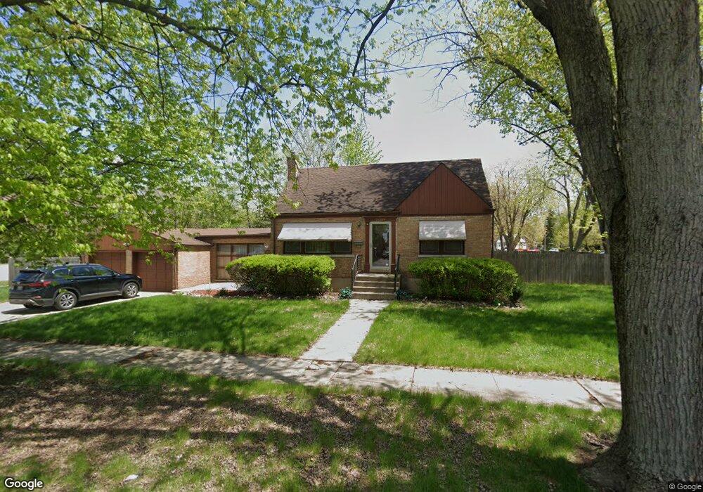
21109 Maple St Matteson, IL 60443
Old Matteson NeighborhoodEstimated Value: $157,000 - $218,000
About This Home
This home is located at 21109 Maple St, Matteson, IL 60443 and is currently estimated at $184,837, approximately $161 per square foot. 21109 Maple St is a home located in Cook County with nearby schools including Illinois School, Matteson Elementary School, and Sauk Elementary School.
Ownership History
We collect this data history from publicly available records. To have your information removed, we recommend requesting removal directly through your county’s website.
Purchase Details
Purchase Details
Purchase Details
Home Values in the Area
Average Home Value in this Area
Purchase History
We collect this data history from publicly available records. To have your information removed, we recommend requesting removal directly through your county’s website.
| Date | Buyer | Sale Price | Title Company |
|---|---|---|---|
| -- | None Listed On Document | ||
| $52,000 | Chicago Title | ||
| -- | Attorney |
Tax History
We collect this data history from publicly available records. To have your information removed, we recommend requesting removal directly through your county’s website.
| Year | Tax Paid | Tax Assessment Tax Assessment Total Assessment is a certain percentage of the fair market value that is determined by local assessors to be the total taxable value of land and additions on the property. | Land | Improvement |
|---|---|---|---|---|
| 2025 | $6,099 | $14,758 | $2,590 | $12,168 |
| 2024 | $6,099 | $14,758 | $2,590 | $12,168 |
| 2023 | $5,072 | $14,758 | $2,590 | $12,168 |
| 2022 | $5,072 | $9,349 | $2,266 | $7,083 |
| 2021 | $5,141 | $9,348 | $2,265 | $7,083 |
| 2020 | $4,761 | $9,348 | $2,265 | $7,083 |
| 2019 | $5,285 | $10,212 | $2,104 | $8,108 |
| 2018 | $3,507 | $10,212 | $2,104 | $8,108 |
| 2017 | $3,396 | $10,212 | $2,104 | $8,108 |
| 2016 | $3,771 | $10,166 | $1,942 | $8,224 |
| 2015 | $3,677 | $10,166 | $1,942 | $8,224 |
| 2014 | $3,587 | $10,166 | $1,942 | $8,224 |
| 2013 | $3,504 | $10,748 | $1,942 | $8,806 |
Map
- 21142 Locust St
- 1034 Pine Ave
- 3732 214th St
- 20864 Thornwood Dr
- 3615 214th St
- 3704 214th Place
- 21406 S Jean Ave
- 831 Violet Ln
- 3761 215th St
- 20920 Governors Hwy
- 118 Indiana St
- 126 Indiana St
- 4110 Applewood Ln
- 3862 216th St
- 21607 Main St
- 4018 Violet Ln
- 20535 Arcadian Dr
- 20535 Marathon Ct
- 3817 216th Place
- 20636 Greenwood Dr
- 3722 211th Place
- 3714 211th Place
- 3710 211th Place
- 3715 211th Place
- 3706 211th Place
- 3727 211th Place
- 3711 211th Place
- 3705 211th Place
- 21127 Maple St
- 1050 Elliot Ct
- 3702 211th Place
- 21112 Maple St
- 21108 Maple St
- 21133 Maple St
- 21116 Maple St
- 3637 211th Place
- 21143 Maple St
- 3634 211th Place
- 21145 Maple St
- 21120 Maple St
Ask me questions while you tour the home.