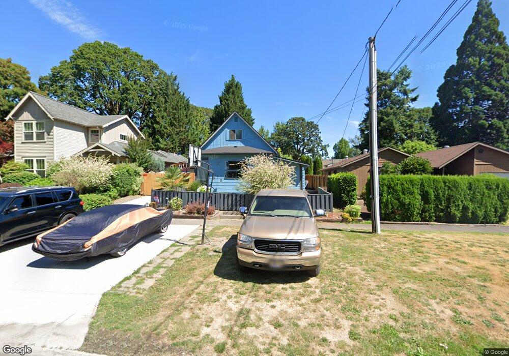
2113 15th Ave Forest Grove, OR 97116
Estimated Value: $399,000 - $468,000
3
Beds
2
Baths
1,290
Sq Ft
$325/Sq Ft
Est. Value
About This Home
This home is located at 2113 15th Ave, Forest Grove, OR 97116 and is currently estimated at $418,914, approximately $324 per square foot. 2113 15th Ave is a home located in Washington County with nearby schools including Joseph Gale Elementary School, Tom McCall Upper Elementary School, and Neil Armstrong Middle School.
Ownership History
Date
Name
Owned For
Owner Type
Purchase Details
Closed on
Oct 14, 2018
Sold by
Roth Curtis
Bought by
Hering Washington Sarah
Current Estimated Value
Home Financials for this Owner
Home Financials are based on the most recent Mortgage that was taken out on this home.
Original Mortgage
$223,500
Interest Rate
4.6%
Mortgage Type
New Conventional
Purchase Details
Closed on
May 6, 1999
Sold by
Roth Niles and Roth Jean
Bought by
Decker Pat
Create a Home Valuation Report for This Property
The Home Valuation Report is an in-depth analysis detailing your home's value as well as a comparison with similar homes in the area
Purchase History
| Date | Buyer | Sale Price | Title Company |
|---|---|---|---|
| Hering Washington Sarah | $280,000 | First American Title | |
| Decker Pat | $80,000 | First American Title Ins Co |
Source: Public Records
Mortgage History
| Date | Status | Borrower | Loan Amount |
|---|---|---|---|
| Closed | Hering Washington Sarah | $223,500 |
Source: Public Records
Tax History
| Year | Tax Paid | Tax Assessment Tax Assessment Total Assessment is a certain percentage of the fair market value that is determined by local assessors to be the total taxable value of land and additions on the property. | Land | Improvement |
|---|---|---|---|---|
| 2026 | $3,464 | $194,530 | -- | -- |
| 2025 | $3,464 | $188,870 | -- | -- |
| 2024 | $3,342 | $183,370 | -- | -- |
| 2023 | $3,342 | $176,820 | $0 | $0 |
| 2022 | $2,902 | $176,820 | $0 | $0 |
| 2021 | $2,865 | $166,670 | $0 | $0 |
| 2020 | $2,849 | $161,820 | $0 | $0 |
| 2019 | $2,786 | $157,110 | $0 | $0 |
| 2018 | $2,451 | $138,450 | $0 | $0 |
| 2017 | $2,375 | $134,420 | $0 | $0 |
| 2016 | $2,308 | $130,510 | $0 | $0 |
| 2015 | $2,220 | $126,710 | $0 | $0 |
| 2014 | $2,209 | $123,020 | $0 | $0 |
Source: Public Records
Map
Nearby Homes
Your Personal Tour Guide
Ask me questions while you tour the home.