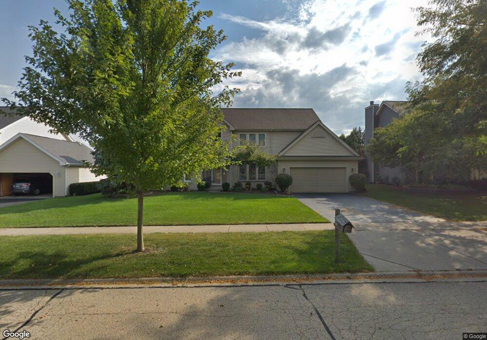
2113 Spaulding Ave West Dundee, IL 60118
Estimated Value: $464,869 - $483,000
About This Home
This home is located at 2113 Spaulding Ave, West Dundee, IL 60118 and is currently estimated at $473,967, approximately $189 per square foot. 2113 Spaulding Ave is a home located in Kane County with nearby schools including Dundee Highlands Elementary School, Dundee Middle School, and Harry D Jacobs High School.
Ownership History
We collect this data history from publicly available records. To have your information removed, we recommend requesting removal directly through your county’s website.
Purchase Details
Home Financials for this Owner
Home Financials are based on the most recent Mortgage that was taken out on this home.Purchase Details
Home Financials for this Owner
Home Financials are based on the most recent Mortgage that was taken out on this home.Purchase Details
Home Financials for this Owner
Home Financials are based on the most recent Mortgage that was taken out on this home.Home Values in the Area
Average Home Value in this Area
Purchase History
We collect this data history from publicly available records. To have your information removed, we recommend requesting removal directly through your county’s website.
| Date | Buyer | Sale Price | Title Company |
|---|---|---|---|
| $335,000 | Baird & Warner Title Service | ||
| $249,500 | Chicago Title Insurance Co | ||
| $232,000 | -- |
Mortgage History
We collect this data history from publicly available records. To have your information removed, we recommend requesting removal directly through your county’s website.
| Date | Status | Borrower | Loan Amount |
|---|---|---|---|
| Previous Owner | $200,000 | ||
| Previous Owner | $220,000 | ||
| Previous Owner | $185,600 |
Tax History
We collect this data history from publicly available records. To have your information removed, we recommend requesting removal directly through your county’s website.
| Year | Tax Paid | Tax Assessment Tax Assessment Total Assessment is a certain percentage of the fair market value that is determined by local assessors to be the total taxable value of land and additions on the property. | Land | Improvement |
|---|---|---|---|---|
| 2024 | $8,926 | $125,506 | $24,969 | $100,537 |
| 2023 | $8,294 | $112,926 | $22,466 | $90,460 |
| 2022 | $8,926 | $112,319 | $22,466 | $89,853 |
| 2021 | $8,589 | $106,051 | $21,212 | $84,839 |
| 2020 | $9,246 | $107,763 | $20,735 | $87,028 |
| 2019 | $8,952 | $102,300 | $19,684 | $82,616 |
| 2018 | $9,215 | $102,619 | $19,883 | $82,736 |
| 2017 | $8,780 | $95,996 | $18,600 | $77,396 |
| 2016 | $9,016 | $93,578 | $23,811 | $69,767 |
| 2015 | -- | $87,686 | $22,312 | $65,374 |
| 2014 | -- | $85,265 | $21,696 | $63,569 |
| 2013 | -- | $87,875 | $22,360 | $65,515 |
Map
- 2011 Glenmoor Dr
- 2433 Smalley Ct
- 818 Lindsay Ln
- 1027 Shagbark Ln
- 1025 Shagbark Ln
- 1021 Shagbark Ln
- 1019 Shagbark Ln
- 1017 Shagbark Ln
- 1015 Shagbark Ln
- 1009 Shagbark Ln
- 1601 Higgins Rd
- 524 Edinburgh Ln
- 1023 Shagbark Ln
- 1031 Shagbark Ln
- 921 Shagbark Ln
- 2661 Chesire Ct
- 123 Harvest Ln
- 2660 Chesire Ct
- 1503 Laurel Ct
- 2653 Maple Cir Unit 2
- 2109 Spaulding Ave Unit 2
- 2127 Spaulding Ave
- 734 Macgregor Ct
- 730 Macgregor Ct
- 2139 Spaulding Ave
- 2065 Spaulding Ave
- 2114 Spaulding Ave
- 2110 Spaulding Ave
- 2128 Spaulding Ave Unit 2
- 722 Macgregor Ct
- 716 Campbell Ct
- 2134 Spaulding Ave
- 2068 Spaulding Ave
- 2145 Spaulding Ave
- 2061 Spaulding Ave
- 728 Campbell Ct
- 706 Macgregor Ct
- 721 Macgregor Ct
- 712 Campbell Ct
- 956 Pember Cir
Ask me questions while you tour the home.