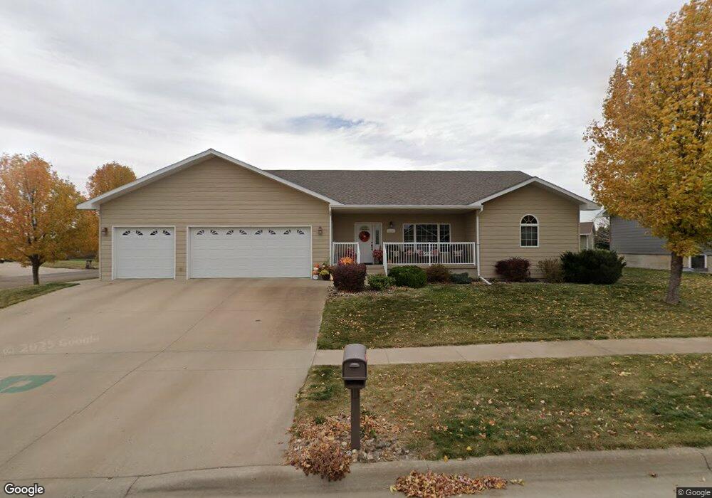
2114 Lancaster Loop Pierre, SD 57501
Estimated Value: $502,093 - $607,000
--
Bed
4
Baths
2,315
Sq Ft
$235/Sq Ft
Est. Value
About This Home
This home is located at 2114 Lancaster Loop, Pierre, SD 57501 and is currently estimated at $544,273, approximately $235 per square foot. 2114 Lancaster Loop is a home with nearby schools including T.F. Riggs High School and Pierre SDA School.
Ownership History
Date
Name
Owned For
Owner Type
Purchase Details
Closed on
Mar 14, 2005
Sold by
Zulk Mary and Tyler Lyle B
Bought by
Midwest Development Of Pierre Inc
Current Estimated Value
Create a Home Valuation Report for This Property
The Home Valuation Report is an in-depth analysis detailing your home's value as well as a comparison with similar homes in the area
Home Values in the Area
Average Home Value in this Area
Purchase History
| Date | Buyer | Sale Price | Title Company |
|---|---|---|---|
| Midwest Development Of Pierre Inc | $6,250 | -- |
Source: Public Records
Tax History
| Year | Tax Paid | Tax Assessment Tax Assessment Total Assessment is a certain percentage of the fair market value that is determined by local assessors to be the total taxable value of land and additions on the property. | Land | Improvement |
|---|---|---|---|---|
| 2025 | $5,884 | $501,168 | $50,833 | $450,335 |
| 2024 | $5,879 | $479,723 | $50,833 | $428,890 |
| 2023 | $5,349 | $467,073 | $48,644 | $418,429 |
| 2022 | $5,034 | $395,019 | $46,328 | $348,691 |
| 2021 | $4,931 | $352,695 | $41,364 | $311,331 |
| 2020 | $5,048 | $342,422 | $40,159 | $302,263 |
| 2019 | $5,039 | $342,422 | $40,159 | $302,263 |
| 2018 | $4,678 | $332,448 | $38,989 | $293,459 |
| 2017 | -- | $306,633 | $37,132 | $269,501 |
| 2016 | $4,895 | $306,633 | $37,132 | $269,501 |
| 2015 | -- | $297,701 | $36,050 | $261,651 |
| 2014 | -- | $289,030 | $35,000 | $254,030 |
| 2013 | -- | $289,030 | $35,000 | $254,030 |
| 2011 | -- | $252,093 | $30,369 | $221,724 |
Source: Public Records
Map
Nearby Homes
- 0 Brookstone Lp
- 1814 Camden Ct
- 2013 Ridgeway Place
- 1621 Abbey Rd
- 131 Hampton Dr
- 1217 Hilgers Dr
- 0 Woodview Dr
- Lot 13R N Garfield Ave
- TBD Lilac Dr
- 149 Polaris Ave
- 104 Mercury St
- 6228/6229 Hwy 1804
- 620 N Harrison Ave
- 109 Baja Dr
- 2106 Antelope St
- 404 Yucca Dr
- 2004 Buffalo St
- 219 Mars St
- 313 N Taylor Ave
- 900 N Euclid Ave
- 2118 Lancaster Loop
- 2110 Lancaster Loop
- 2121 Lancaster Loop
- 2125 Lancaster Loop
- 2133 Lancaster Loop
- 2122 Lancaster Loop
- 2026 Lancaster Place
- 2106 Lancaster Loop
- 2027 Lancaster Place
- 2137 Lancaster Loop
- 2117 Lancaster Loop
- 2145 Lancaster Loop
- 2126 Lancaster Loop
- 1919 Abbey Rd
- 2113 Lancaster Loop
- 2102 Lancaster Loop
- 2022 Lancaster Place
- 2023 Lancaster Place
- 2109 Lancaster Loop
- 2149 Lancaster Loop
Your Personal Tour Guide
Ask me questions while you tour the home.