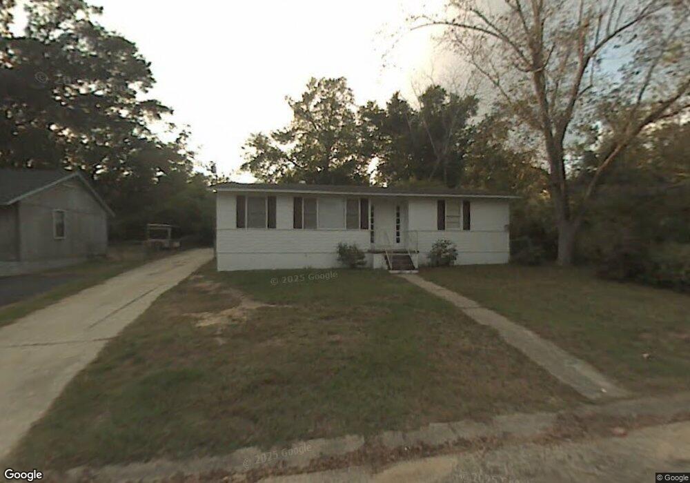
2115 Hamilton Rd Mobile, AL 36618
Autumndale NeighborhoodEstimated Value: $93,000 - $138,000
Studio
1
Bath
1,113
Sq Ft
$98/Sq Ft
Est. Value
About This Home
This home is located at 2115 Hamilton Rd, Mobile, AL 36618 and is currently estimated at $109,211, approximately $98 per square foot. 2115 Hamilton Rd is a home located in Mobile County with nearby schools including Forest Hill Elementary School, CL Scarborough Middle School, and Mattie T Blount High School.
Ownership History
Date
Name
Owned For
Owner Type
Purchase Details
Closed on
Apr 29, 2002
Sold by
Smith Eluid and Smith Naomi
Bought by
Hamilton Paul R and Hamilton Charlene R
Current Estimated Value
Home Financials for this Owner
Home Financials are based on the most recent Mortgage that was taken out on this home.
Original Mortgage
$40,800
Outstanding Balance
$17,394
Interest Rate
7.5%
Estimated Equity
$91,817
Create a Home Valuation Report for This Property
The Home Valuation Report is an in-depth analysis detailing your home's value as well as a comparison with similar homes in the area
Home Values in the Area
Average Home Value in this Area
Purchase History
| Date | Buyer | Sale Price | Title Company |
|---|---|---|---|
| Hamilton Paul R | $45,000 | -- |
Source: Public Records
Mortgage History
| Date | Status | Borrower | Loan Amount |
|---|---|---|---|
| Open | Hamilton Paul R | $40,800 |
Source: Public Records
Tax History
| Year | Tax Paid | Tax Assessment Tax Assessment Total Assessment is a certain percentage of the fair market value that is determined by local assessors to be the total taxable value of land and additions on the property. | Land | Improvement |
|---|---|---|---|---|
| 2025 | $649 | $10,060 | $2,000 | $8,060 |
| 2024 | $649 | $9,480 | $2,000 | $7,480 |
| 2023 | $588 | $9,260 | $2,000 | $7,260 |
| 2022 | $563 | $8,860 | $2,000 | $6,860 |
| 2021 | $521 | $8,200 | $1,600 | $6,600 |
| 2020 | $498 | $7,840 | $1,200 | $6,640 |
| 2019 | $474 | $7,460 | $0 | $0 |
| 2018 | $474 | $7,460 | $0 | $0 |
| 2017 | $451 | $7,100 | $0 | $0 |
| 2016 | $662 | $10,420 | $0 | $0 |
| 2013 | $709 | $10,220 | $0 | $0 |
Source: Public Records
Map
Nearby Homes
- 2113 Cornell Dr
- 2004 Beau Terra Dr W
- 2205 Beau Terra Dr W
- 4060 Dickson Ln
- 1758 La Pine Dr
- 1757 Le Grande Dr
- 2210 Wolf Ridge Rd
- 0 Junius Ln
- 871 Kuffskie Ln
- 4409 Eastview Dr
- 1561 Phillips Ln
- 1701 Phillips Ln
- 6632 Monarch Cir
- 21 Brucewood Dr W
- 3531 Anton St
- 6 Brucewood Dr W
- 3514 Anton St
- 1724 Sandalwood Dr
- 1121 Stevens Ln
- 1811 Butler St
- 2119 Hamilton Rd
- 2111 Hamilton Rd
- 2120 Wolf Ridge Rd
- 2124 Wolf Ridge Rd
- 2116 Wolf Ridge Rd
- 2107 Hamilton Rd
- 2121 Hamilton Rd
- 2121 Hamilton Rd
- 2116 Hamilton Rd
- 2112 Hamilton Rd
- 2112 Wolf Ridge Rd
- 2128 Wolf Ridge Rd
- 2108 Hamilton Rd
- 2120 Hamilton Rd
- 2125 Hamilton Rd
- 2105 Hamilton Rd
- 2132 Wolf Ridge Rd
- 2108 Wolf Ridge Rd
- 2104 Hamilton Rd
- 2129 Hamilton Rd
Your Personal Tour Guide
Ask me questions while you tour the home.