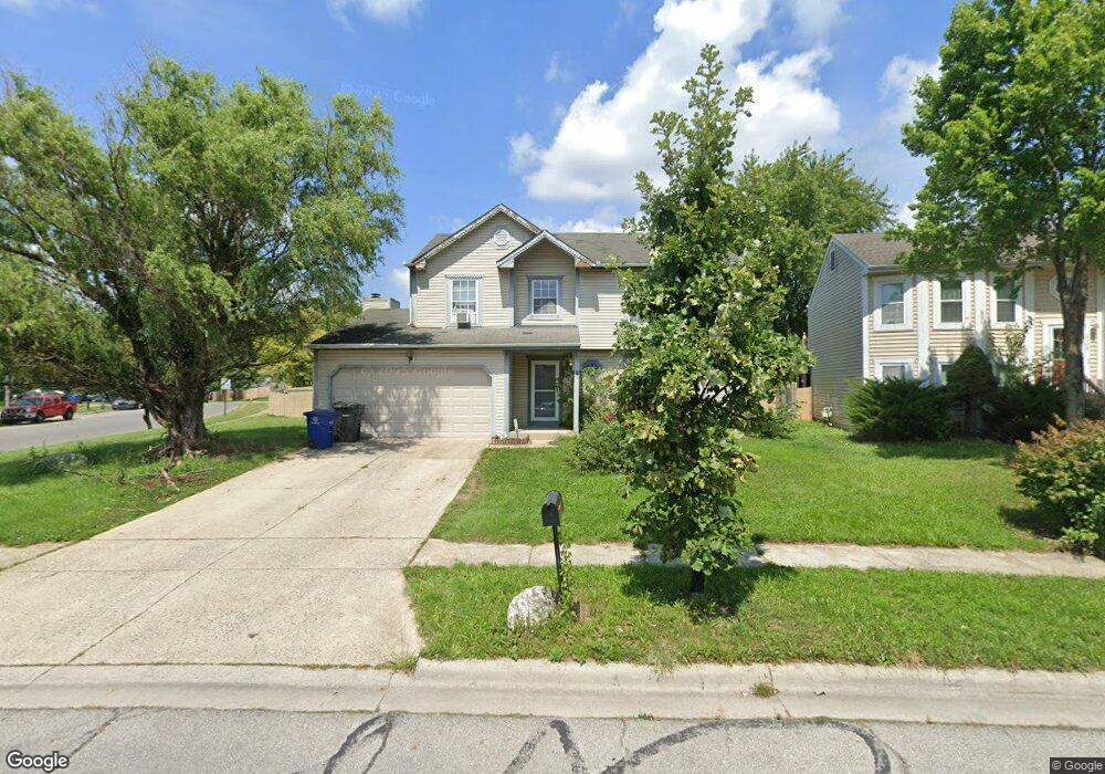
2116 Carrollton Dr Columbus, OH 43223
Estimated Value: $309,000 - $345,000
4
Beds
4
Baths
1,922
Sq Ft
$166/Sq Ft
Est. Value
About This Home
This home is located at 2116 Carrollton Dr, Columbus, OH 43223 and is currently estimated at $319,288, approximately $166 per square foot. 2116 Carrollton Dr is a home located in Franklin County with nearby schools including Finland Elementary School, Franklin Woods Intermediate School, and Finland Middle School.
Ownership History
Date
Name
Owned For
Owner Type
Purchase Details
Closed on
Aug 29, 2006
Sold by
Stone Kathleen A and Stone Theodore F
Bought by
Williams Teddye A and Williams Charlene
Current Estimated Value
Home Financials for this Owner
Home Financials are based on the most recent Mortgage that was taken out on this home.
Original Mortgage
$118,800
Outstanding Balance
$70,675
Interest Rate
6.88%
Mortgage Type
Purchase Money Mortgage
Estimated Equity
$248,613
Purchase Details
Closed on
Feb 21, 2006
Sold by
Obsieye Elmi A and Obsieye Ismeal Amina
Bought by
Stone Kathleen A
Home Financials for this Owner
Home Financials are based on the most recent Mortgage that was taken out on this home.
Original Mortgage
$77,600
Interest Rate
6.2%
Mortgage Type
Fannie Mae Freddie Mac
Purchase Details
Closed on
Jun 1, 1993
Bought by
Bosley Sandra D
Purchase Details
Closed on
Sep 16, 1992
Create a Home Valuation Report for This Property
The Home Valuation Report is an in-depth analysis detailing your home's value as well as a comparison with similar homes in the area
Home Values in the Area
Average Home Value in this Area
Purchase History
We collect this data history from publicly available records. To have your information removed, we recommend requesting removal directly through your county’s website.
| Date | Buyer | Sale Price | Title Company |
|---|---|---|---|
| Williams Teddye A | $148,500 | National T | |
| Stone Kathleen A | $97,000 | National T | |
| Bosley Sandra D | $99,800 | -- | |
| -- | $700,000 | -- |
Source: Public Records
Mortgage History
We collect this data history from publicly available records. To have your information removed, we recommend requesting removal directly through your county’s website.
| Date | Status | Borrower | Loan Amount |
|---|---|---|---|
| Open | Williams Teddye A | $118,800 | |
| Closed | Stone Kathleen A | $77,600 |
Source: Public Records
Tax History
| Year | Tax Paid | Tax Assessment Tax Assessment Total Assessment is a certain percentage of the fair market value that is determined by local assessors to be the total taxable value of land and additions on the property. | Land | Improvement |
|---|---|---|---|---|
| 2025 | $3,503 | $96,080 | $21,910 | $74,170 |
| 2024 | $3,503 | $96,080 | $21,910 | $74,170 |
| 2023 | $3,441 | $96,075 | $21,910 | $74,165 |
| 2022 | $3,044 | $62,370 | $13,160 | $49,210 |
| 2021 | $3,512 | $62,370 | $13,160 | $49,210 |
| 2020 | $3,165 | $62,370 | $13,160 | $49,210 |
| 2019 | $2,716 | $48,410 | $10,540 | $37,870 |
| 2018 | $2,599 | $48,410 | $10,540 | $37,870 |
| 2017 | $2,593 | $48,410 | $10,540 | $37,870 |
| 2016 | $2,495 | $41,230 | $7,490 | $33,740 |
| 2015 | $2,494 | $41,230 | $7,490 | $33,740 |
| 2014 | $2,497 | $41,230 | $7,490 | $33,740 |
| 2013 | $1,304 | $43,400 | $7,875 | $35,525 |
Source: Public Records
Map
Nearby Homes
- 1380 Stanwix Ct
- 2210 October Ridge Dr
- 2142 Summer Breeze Dr
- 1994 Arden Forest Ln
- 2169 Summer Breeze Dr
- 1390 Gray Meadow Dr
- 1606 Autumn Village Dr
- 2253 Autumn Village Ct
- 1947 Hopkins Ave
- 1852 Richmond Rd
- 1290 Woodbrook Ln Unit 252
- 1906 Marsdale Ave
- 1920 Marsdale Ave
- 1492 Pine Wild Dr
- 2180 Eakin Rd
- 1308 Woodbrook Ln Unit D
- 0 S Central Ave
- 1326 Woodbrook Ln Unit 234
- 1976 Westfield Dr S
- 2375 Woodbrook Cir S Unit 167
- 2108 Carrollton Dr
- 1400 Stanwix Ct
- 1388 Stanwix Ct
- 2121 Big Tree Dr
- 2109 Big Tree Dr
- 2129 Big Tree Dr
- 2111 Carrollton Dr
- 2105 Carrollton Dr
- 2103 Big Tree Dr
- 1397 Gorham Dr
- 2137 Big Tree Dr
- 2093 Carrollton Dr
- 1389 Gorham Dr
- 1364 Stanwix Ct
- 1399 Stanwix Ct
- 2091 Big Tree Dr
- 1415 Buffalo Creek Ct
- 1391 Stanwix Ct
- 2081 Carrollton Dr
- 1381 Gorham Dr
Your Personal Tour Guide
Ask me questions while you tour the home.