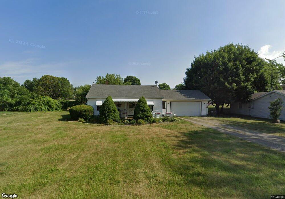
2117 Harmon St NE Canton, OH 44705
Fairmount NeighborhoodEstimated Value: $80,000 - $93,041
2
Beds
1
Bath
806
Sq Ft
$108/Sq Ft
Est. Value
About This Home
This home is located at 2117 Harmon St NE, Canton, OH 44705 and is currently estimated at $86,760, approximately $107 per square foot. 2117 Harmon St NE is a home located in Stark County with nearby schools including Frazer Elementary School, Glenwood Intermediate School, and GlenOak High School.
Ownership History
Date
Name
Owned For
Owner Type
Purchase Details
Closed on
Aug 3, 2000
Sold by
Tucci Betty J
Bought by
Boyle Maryann M
Current Estimated Value
Home Financials for this Owner
Home Financials are based on the most recent Mortgage that was taken out on this home.
Original Mortgage
$35,000
Outstanding Balance
$12,664
Interest Rate
8.19%
Mortgage Type
Purchase Money Mortgage
Estimated Equity
$74,096
Purchase Details
Closed on
Mar 31, 2000
Sold by
Estate Of Jess L Adams
Bought by
Adams Katherine J
Create a Home Valuation Report for This Property
The Home Valuation Report is an in-depth analysis detailing your home's value as well as a comparison with similar homes in the area
Home Values in the Area
Average Home Value in this Area
Purchase History
| Date | Buyer | Sale Price | Title Company |
|---|---|---|---|
| Boyle Maryann M | $35,000 | -- | |
| Adams Katherine J | -- | -- |
Source: Public Records
Mortgage History
| Date | Status | Borrower | Loan Amount |
|---|---|---|---|
| Open | Boyle Maryann M | $35,000 |
Source: Public Records
Tax History
| Year | Tax Paid | Tax Assessment Tax Assessment Total Assessment is a certain percentage of the fair market value that is determined by local assessors to be the total taxable value of land and additions on the property. | Land | Improvement |
|---|---|---|---|---|
| 2025 | -- | $27,340 | $10,920 | $16,420 |
| 2024 | -- | $27,340 | $10,920 | $16,420 |
| 2023 | $1,255 | $19,400 | $5,570 | $13,830 |
| 2022 | $1,204 | $19,400 | $5,570 | $13,830 |
| 2021 | $1,266 | $19,400 | $5,570 | $13,830 |
| 2020 | $836 | $16,110 | $4,800 | $11,310 |
| 2019 | $1,529 | $16,110 | $4,800 | $11,310 |
Source: Public Records
Map
Nearby Homes
- 2616 Taft Ave NE
- 2111 21st St NE
- 1614 Colonial Blvd NE
- 1629 23rd St NE
- 2408 21st St NE
- 1610 23rd St NE
- 1825 Bernice Ct NE
- 1529 23rd St NE
- 3002 Root Ave NE
- 1528 22nd St NE
- 2228 Saint Elmo Ave NE
- 2010 18th St NE
- 1410 Colonial Blvd NE
- 1824 Root Ave NE
- 1742 Taft Ave NE
- 1857 Maple Ave NE
- 2211 17th St NE
- 2005 17th St NE
- 2656 22nd St NE
- 2216 17th St NE
- 2123 Harmon St NE
- 2105 Harmon St NE
- 2122 Harmon St NE
- 2131 Harmon St NE
- 2137 Harmon St NE
- 2113 26th St NE
- 2028 Harmon St NE
- 2127 26th St NE
- 2103 26th St NE
- 2136 Harmon St NE
- 2016 Harmon St NE
- 2133 26th St NE
- 2137 26th St NE
- 2600 Harrisburg Rd NE
- 2201 Harmon St NE
- 2122 26th St NE
- 2114 26th St NE
- 2114 26th St NE
- 2106 26th St NE
- 2626 Harrisburg Rd NE
Your Personal Tour Guide
Ask me questions while you tour the home.