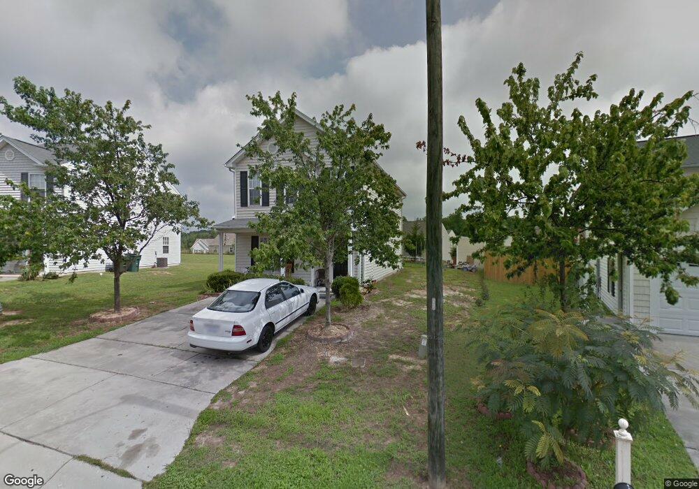
2117 Lime St Durham, NC 27704
Northeast Durham NeighborhoodEstimated Value: $309,750 - $327,000
3
Beds
3
Baths
1,556
Sq Ft
$205/Sq Ft
Est. Value
About This Home
This home is located at 2117 Lime St, Durham, NC 27704 and is currently estimated at $318,438, approximately $204 per square foot. 2117 Lime St is a home located in Durham County with nearby schools including Merrick-Moore Elementary School, John W Neal Middle School, and Southern School of Energy & Sustainability.
Ownership History
Date
Name
Owned For
Owner Type
Purchase Details
Closed on
Sep 4, 2004
Sold by
Anderson Homes Inc
Bought by
Perez Chavez Rafael
Current Estimated Value
Home Financials for this Owner
Home Financials are based on the most recent Mortgage that was taken out on this home.
Original Mortgage
$130,655
Outstanding Balance
$64,081
Interest Rate
5.73%
Mortgage Type
FHA
Estimated Equity
$254,357
Purchase Details
Closed on
Mar 25, 2004
Sold by
East Geer Ventures Llc
Bought by
Anderson Homes Inc
Create a Home Valuation Report for This Property
The Home Valuation Report is an in-depth analysis detailing your home's value as well as a comparison with similar homes in the area
Home Values in the Area
Average Home Value in this Area
Purchase History
| Date | Buyer | Sale Price | Title Company |
|---|---|---|---|
| Perez Chavez Rafael | $135,500 | -- | |
| Anderson Homes Inc | $140,000 | -- |
Source: Public Records
Mortgage History
| Date | Status | Borrower | Loan Amount |
|---|---|---|---|
| Open | Perez Chavez Rafael | $130,655 |
Source: Public Records
Tax History
| Year | Tax Paid | Tax Assessment Tax Assessment Total Assessment is a certain percentage of the fair market value that is determined by local assessors to be the total taxable value of land and additions on the property. | Land | Improvement |
|---|---|---|---|---|
| 2025 | $3,031 | $305,745 | $71,875 | $233,870 |
| 2024 | $1,982 | $142,078 | $22,960 | $119,118 |
| 2023 | $1,861 | $142,078 | $22,960 | $119,118 |
| 2022 | $1,818 | $142,078 | $22,960 | $119,118 |
| 2021 | $1,810 | $142,078 | $22,960 | $119,118 |
| 2020 | $1,767 | $142,078 | $22,960 | $119,118 |
| 2019 | $1,767 | $142,078 | $22,960 | $119,118 |
| 2018 | $1,702 | $125,457 | $25,830 | $99,627 |
| 2017 | $1,689 | $125,457 | $25,830 | $99,627 |
| 2016 | $1,632 | $125,457 | $25,830 | $99,627 |
| 2015 | $2,055 | $148,420 | $28,800 | $119,620 |
| 2014 | $2,055 | $148,420 | $28,800 | $119,620 |
Source: Public Records
Map
Nearby Homes
- 2027 Buffalo Way
- 2300 Crestwood Ridge Dr
- 2304 Crestwood Ridge Dr
- 2040 Feather Rock Dr
- 2129 Crestwood Ridge Dr
- 1905 Milan St
- 2206 E Club Blvd
- 2112 Crestwood Ridge Dr
- 18 Syracuse Place
- 2632 Melrose Ave
- 1515 Milan St
- 1832 E Geer St
- 1823 E Geer St
- 1100 Merlin St
- 1012 Merlin St
- 1010 Merlin St
- 1008 Merlin St
- 1009 Merlin St
- 1103 Merlin St
- 1013 Merlin St
- 2119 Lime St
- 2115 Lime St
- 1730 Great Bend Dr
- 2113 Lime St
- 1734 Great Bend Dr
- 1728 Great Bend Dr
- 2116 Lime St
- 1736 Great Bend Dr
- 1726 Great Bend Dr
- 2111 Lime St
- 2112 Lime St
- 1722 Great Bend Dr
- 2109 Lime St
- 1718 Great Bend Dr
- 2204 Buffalo Way
- 2202 Buffalo Way
- 2114 Buffalo Way
- 2206 Buffalo Way
- 1714 Great Bend Dr
- 1733 Great Bend Dr
Your Personal Tour Guide
Ask me questions while you tour the home.