Estimated Value: $132,000 - $189,000
3
Beds
2
Baths
1,192
Sq Ft
$139/Sq Ft
Est. Value
About This Home
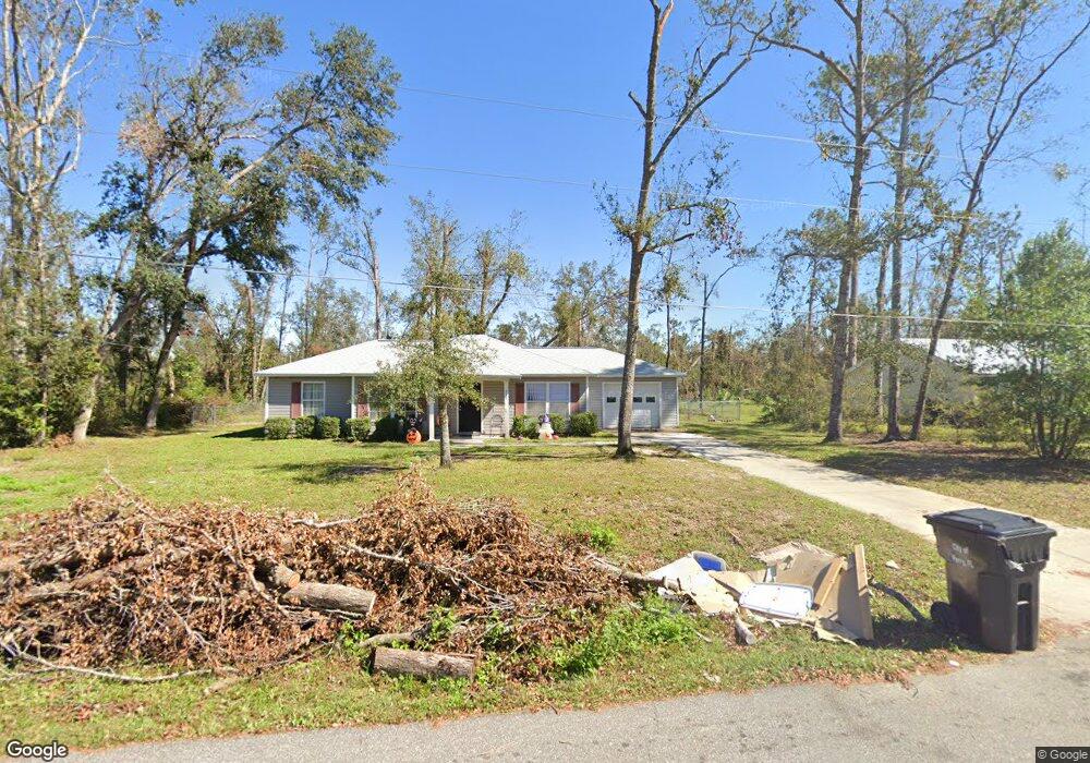
This home is located at 212 Marjorie Dr, Perry, FL 32348 and is currently estimated at $165,202, approximately $138 per square foot. 212 Marjorie Dr is a home located in Taylor County with nearby schools including Perry Primary School, Taylor County Elementary School, and Taylor County Middle School.
Ownership History
Date
Name
Owned For
Owner Type
Purchase Details
Closed on
Aug 21, 2015
Sold by
Mock Andrew and Mock Jozee Layne Bass
Bought by
Mclean Caroline L
Current Estimated Value
Home Financials for this Owner
Home Financials are based on the most recent Mortgage that was taken out on this home.
Original Mortgage
$98,188
Outstanding Balance
$77,693
Interest Rate
4.37%
Mortgage Type
FHA
Estimated Equity
$87,509
Purchase Details
Closed on
Oct 18, 2011
Sold by
Wiley Austin P
Bought by
Mock Andrew
Home Financials for this Owner
Home Financials are based on the most recent Mortgage that was taken out on this home.
Original Mortgage
$96,938
Interest Rate
4.2%
Mortgage Type
New Conventional
Purchase Details
Closed on
Sep 21, 2010
Sold by
Baggett Keith and Baggett Victoria Florentino
Bought by
Wiley Austin P
Home Financials for this Owner
Home Financials are based on the most recent Mortgage that was taken out on this home.
Original Mortgage
$74,625
Interest Rate
4.45%
Mortgage Type
New Conventional
Create a Home Valuation Report for This Property
The Home Valuation Report is an in-depth analysis detailing your home's value as well as a comparison with similar homes in the area
Home Values in the Area
Average Home Value in this Area
Purchase History
| Date | Buyer | Sale Price | Title Company |
|---|---|---|---|
| Mclean Caroline L | $100,000 | Attorney | |
| Mock Andrew | $95,000 | Frith Abstract & Title Co | |
| Wiley Austin P | $99,500 | Attorney |
Source: Public Records
Mortgage History
| Date | Status | Borrower | Loan Amount |
|---|---|---|---|
| Open | Mclean Caroline L | $98,188 | |
| Previous Owner | Mock Andrew | $96,938 | |
| Previous Owner | Wiley Austin P | $74,625 |
Source: Public Records
Tax History
| Year | Tax Paid | Tax Assessment Tax Assessment Total Assessment is a certain percentage of the fair market value that is determined by local assessors to be the total taxable value of land and additions on the property. | Land | Improvement |
|---|---|---|---|---|
| 2025 | $2,822 | $157,190 | $26,000 | $131,190 |
| 2024 | $2,475 | $157,190 | $26,000 | $131,190 |
| 2023 | $2,475 | $119,790 | $0 | $0 |
| 2022 | $2,266 | $131,520 | $25,000 | $106,520 |
| 2021 | $2,072 | $110,400 | $25,000 | $85,400 |
| 2020 | $1,839 | $90,000 | $25,000 | $65,000 |
| 2019 | $1,743 | $91,190 | $25,000 | $66,190 |
| 2018 | $1,517 | $74,480 | $9,000 | $65,480 |
| 2017 | $1,554 | $73,960 | $9,000 | $64,960 |
| 2016 | $1,562 | $74,680 | $9,000 | $65,680 |
| 2015 | $746 | $75,400 | $9,000 | $66,400 |
| 2014 | -- | $76,827 | $0 | $0 |
Source: Public Records
Map
Nearby Homes
- 102 S Claire Dr
- 202 Puckett Rd
- 200 Davis Dr
- 415 Judson Dr
- 150 Houck Rd
- 0 Airport Rd Unit 25458733
- 95 Houck Rd
- 206 Pineland St
- 106 Crit Jones Dr
- 104 Crit Jones Dr
- 3756 Cash More St
- 823 S Warner Ave
- 1302 S Center St
- TBD Shady Oaks Ln
- 00 Shady Oaks Ln
- 139 E Center St
- 831 U S 27
- 110 Ridge Rd
- 1012 S Orange St
- 1100 S Wilder St
- 210 Marjorie Dr
- 209 Marjorie Dr
- 213 Marjorie Dr
- 216 Marjorie Dr
- 208 Kate Dr
- 208 Marjorie Dr
- 206 Woodgate Dr
- 212 Kate Dr
- 410 Mitchell Dr
- 218 Marjorie Dr
- 204 Woodgate Dr
- 414 Mitchell Dr
- 412 Mitchell Dr
- 204 Kate Dr
- 200 Woodgate Dr
- 119 Grove Ave
- 205 Woodgate Dr
- 117 Grove Ave
- 115 Grove Ave
- 302 Magnolia Rd
Your Personal Tour Guide
Ask me questions while you tour the home.