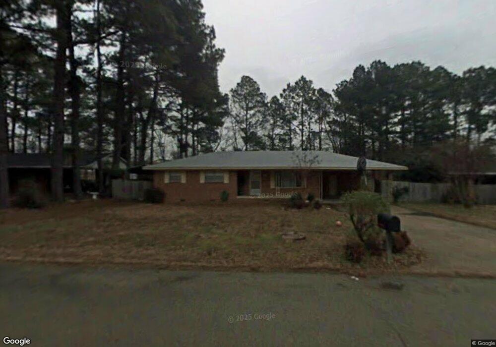
212 Scott St Jonesboro, AR 72401
Estimated Value: $124,177 - $215,000
Studio
2
Baths
1,603
Sq Ft
$102/Sq Ft
Est. Value
About This Home
This home is located at 212 Scott St, Jonesboro, AR 72401 and is currently estimated at $163,044, approximately $101 per square foot. 212 Scott St is a home located in Craighead County with nearby schools including Annie Camp Junior High School, The Academies at Jonesboro High School, and Montessori School of Jonesboro.
Ownership History
Date
Name
Owned For
Owner Type
Purchase Details
Closed on
Dec 30, 2005
Sold by
The Bancorpsouth Bank
Bought by
Ollison William
Current Estimated Value
Home Financials for this Owner
Home Financials are based on the most recent Mortgage that was taken out on this home.
Original Mortgage
$47,500
Interest Rate
6.23%
Mortgage Type
New Conventional
Purchase Details
Closed on
Aug 26, 2005
Sold by
Reams Walter J and Reams Hazel R
Bought by
American State Bank
Purchase Details
Closed on
Sep 28, 2001
Bought by
Reams
Purchase Details
Closed on
May 17, 2000
Bought by
Scrape
Purchase Details
Closed on
Sep 13, 1995
Bought by
Homes
Create a Home Valuation Report for This Property
The Home Valuation Report is an in-depth analysis detailing your home's value as well as a comparison with similar homes in the area
Home Values in the Area
Average Home Value in this Area
Purchase History
| Date | Buyer | Sale Price | Title Company |
|---|---|---|---|
| Ollison William | $48,000 | The Title Company | |
| American State Bank | -- | None Available | |
| Reams | $64,000 | -- | |
| Scrape | $58,000 | -- | |
| Homes | $60,000 | -- |
Source: Public Records
Mortgage History
| Date | Status | Borrower | Loan Amount |
|---|---|---|---|
| Closed | Ollison William | $47,500 |
Source: Public Records
Tax History
| Year | Tax Paid | Tax Assessment Tax Assessment Total Assessment is a certain percentage of the fair market value that is determined by local assessors to be the total taxable value of land and additions on the property. | Land | Improvement |
|---|---|---|---|---|
| 2025 | $484 | $23,554 | $2,400 | $21,154 |
| 2024 | $484 | $23,554 | $2,400 | $21,154 |
| 2023 | $47 | $23,554 | $2,400 | $21,154 |
| 2022 | $97 | $23,554 | $2,400 | $21,154 |
| 2021 | $109 | $15,100 | $2,400 | $12,700 |
| 2020 | $109 | $15,100 | $2,400 | $12,700 |
| 2019 | $109 | $15,100 | $2,400 | $12,700 |
| 2018 | $134 | $15,100 | $2,400 | $12,700 |
| 2017 | $134 | $15,100 | $2,400 | $12,700 |
| 2016 | $134 | $11,460 | $2,400 | $9,060 |
| 2015 | $484 | $11,460 | $2,400 | $9,060 |
| 2014 | $134 | $11,460 | $2,400 | $9,060 |
Source: Public Records
Map
Nearby Homes
- 319 Scott St
- 117 State St
- 3 + - Acres Melrose St
- 3.67 Acres Melrose St Unit Russell Drive
- 106 Leggett St
- 1700 Pineview St
- 1171 E Johnson Ave
- 2.47 acres W Washington
- 48 Address Package Nea
- 1916 Alex Dr
- none None
- 1920 Alex Dr
- 233 N Allis St
- 416 N Allis St
- 960 N Caraway Rd
- 1 acre Cr 714
- 2 acres Cr 714
- 2008 Alex Dr
- Lot 3 N Caraway Rd
- 918 Mays Rd
- 208 Scott St
- 219 Phillip Evans Pkwy
- 223 Phillip Evans Pkwy
- 215 Phillip Evans Pkwy
- 227 Phillip Evans Pkwy
- 204 Scott St
- 300 Scott St
- 216 Scott St
- 231 Phillip Evans Pkwy
- 211 Phillip Evans Pkwy
- 211 Scott St
- 315 Scott St
- 207 Scott St
- 317 Scott St
- 213 Scott St
- 304 Scott St
- 235 Phillip Evans Pkwy
- 1700 E Ave E
- 203 Scott St
- 301 Scott St
Your Personal Tour Guide
Ask me questions while you tour the home.