Estimated Value: $167,000 - $180,000
3
Beds
1
Bath
1,375
Sq Ft
$127/Sq Ft
Est. Value
About This Home
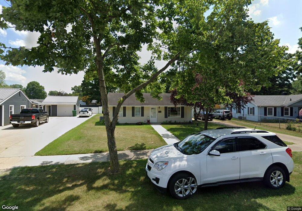
This home is located at 2123 Lewis Dr, Niles, MI 49120 and is currently estimated at $174,650, approximately $127 per square foot. 2123 Lewis Dr is a home located in Berrien County with nearby schools including James Ellis School, Howard-Ellis Elementary School, and Oak Manor Sixth Grade Center.
Ownership History
Date
Name
Owned For
Owner Type
Purchase Details
Closed on
Dec 21, 2015
Sold by
Krumroy Jack K and Krumroy Suzanne R
Bought by
Feltz Jerermy and Feltz Kimberly J
Current Estimated Value
Home Financials for this Owner
Home Financials are based on the most recent Mortgage that was taken out on this home.
Original Mortgage
$70,616
Outstanding Balance
$29,587
Interest Rate
3.96%
Mortgage Type
FHA
Estimated Equity
$145,063
Purchase Details
Closed on
Aug 11, 2015
Sold by
Krumroy Jack K and Krumroy Suzanne R
Bought by
Feltz Jeremy and Feltz Kimberly J
Purchase Details
Closed on
Feb 23, 2005
Sold by
Monroe Bruce Allen and Monroe Brenda Kay
Bought by
Krumroy Jack K and Krumroy Suzanne R
Home Financials for this Owner
Home Financials are based on the most recent Mortgage that was taken out on this home.
Original Mortgage
$82,353
Interest Rate
5.62%
Mortgage Type
Purchase Money Mortgage
Purchase Details
Closed on
Jul 1, 2004
Sold by
Monroe Bruce Allen
Bought by
Monroe Bruce Allen and Monroe Brenda Kay
Purchase Details
Closed on
Jul 2, 1984
Create a Home Valuation Report for This Property
The Home Valuation Report is an in-depth analysis detailing your home's value as well as a comparison with similar homes in the area
Home Values in the Area
Average Home Value in this Area
Purchase History
| Date | Buyer | Sale Price | Title Company |
|---|---|---|---|
| Feltz Jerermy | $76,000 | Attorney | |
| Feltz Jeremy | -- | Attorney | |
| Krumroy Jack K | $84,900 | -- | |
| Monroe Bruce Allen | -- | -- | |
| -- | $22,500 | -- |
Source: Public Records
Mortgage History
| Date | Status | Borrower | Loan Amount |
|---|---|---|---|
| Open | Feltz Jerermy | $70,616 | |
| Previous Owner | Krumroy Jack K | $82,353 |
Source: Public Records
Tax History
| Year | Tax Paid | Tax Assessment Tax Assessment Total Assessment is a certain percentage of the fair market value that is determined by local assessors to be the total taxable value of land and additions on the property. | Land | Improvement |
|---|---|---|---|---|
| 2025 | $1,668 | $75,000 | $0 | $0 |
| 2024 | $441 | $67,000 | $0 | $0 |
| 2023 | $420 | $54,700 | $0 | $0 |
| 2022 | $400 | $50,200 | $0 | $0 |
| 2021 | $1,436 | $44,100 | $6,100 | $38,000 |
| 2020 | $1,408 | $42,200 | $0 | $0 |
| 2019 | $1,342 | $36,000 | $6,100 | $29,900 |
Source: Public Records
Map
Nearby Homes
- 2112 Kathryn Dr
- 0 Kathryn St Unit Tract 1
- V/L Kathryn St Unit Tract 3
- 2451 Spansail Dr
- 1999 Baldwin Dr
- 1917 E Main St
- 1893 Lewis Dr
- 1989 Baldwin Dr
- 1638 Superior St
- 1621 Maple St
- 1515 Inner Dr
- 892 Sullivan Rd
- 324 S 15th St
- 1653 Regent St
- 1408 Silverbrook Ave
- 2298 Yankee St
- 1250 S 15th St
- 2330 E Main St Unit 62
- 115 Stowe Ct
- 1434 Sycamore St
- 2125 Lewis Dr
- 2121 Lewis Dr
- 2127 Lewis Dr
- 2112 Spansail Dr
- 2119 Lewis Dr
- 2114 Spansail Dr
- 2108 Spansail Dr
- 2129 Lewis Dr
- 2116 Spansail Dr
- 2106 Spansail Dr
- 2117 Lewis Dr
- 2122 Lewis Dr
- 2120 Lewis Dr
- 2124 Lewis Dr
- 2118 Spansail Dr
- 2104 Spansail Dr
- 2130 Lewis Dr
- 2118 Lewis Dr
- 2115 Lewis Dr
- 2131 Lewis Dr
Your Personal Tour Guide
Ask me questions while you tour the home.