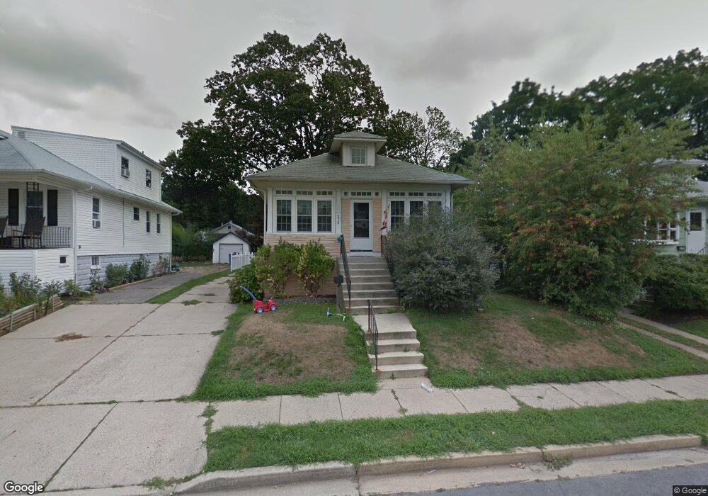
213 Barlow Ave Cherry Hill, NJ 08002
Estimated Value: $256,000 - $330,000
4
Beds
1
Bath
1,070
Sq Ft
$276/Sq Ft
Est. Value
About This Home
This home is located at 213 Barlow Ave, Cherry Hill, NJ 08002 and is currently estimated at $295,024, approximately $275 per square foot. 213 Barlow Ave is a home located in Camden County with nearby schools including Joyce Kilmer Elementary School, John A Carusi Middle School, and Cherry Hill High-West High School.
Ownership History
Date
Name
Owned For
Owner Type
Purchase Details
Closed on
Mar 24, 2006
Sold by
Greenblatt Robert
Bought by
Brown Victoria M
Current Estimated Value
Purchase Details
Closed on
Jul 28, 2005
Sold by
Thiel John H
Bought by
Greenblatt Robert
Home Financials for this Owner
Home Financials are based on the most recent Mortgage that was taken out on this home.
Original Mortgage
$128,835
Interest Rate
5.72%
Purchase Details
Closed on
Jun 28, 1994
Sold by
Doerr George
Bought by
Thiel John and Thiel Suzanne
Home Financials for this Owner
Home Financials are based on the most recent Mortgage that was taken out on this home.
Original Mortgage
$76,000
Interest Rate
8.51%
Create a Home Valuation Report for This Property
The Home Valuation Report is an in-depth analysis detailing your home's value as well as a comparison with similar homes in the area
Home Values in the Area
Average Home Value in this Area
Purchase History
We collect this data history from publicly available records. To have your information removed, we recommend requesting removal directly through your county’s website.
| Date | Buyer | Sale Price | Title Company |
|---|---|---|---|
| Brown Victoria M | $214,999 | -- | |
| Greenblatt Robert | $143,150 | -- | |
| Thiel John | $80,000 | -- |
Source: Public Records
Mortgage History
We collect this data history from publicly available records. To have your information removed, we recommend requesting removal directly through your county’s website.
| Date | Status | Borrower | Loan Amount |
|---|---|---|---|
| Previous Owner | Greenblatt Robert | $128,835 | |
| Previous Owner | Thiel John | $76,000 |
Source: Public Records
Tax History
| Year | Tax Paid | Tax Assessment Tax Assessment Total Assessment is a certain percentage of the fair market value that is determined by local assessors to be the total taxable value of land and additions on the property. | Land | Improvement |
|---|---|---|---|---|
| 2025 | $6,328 | $134,600 | $47,500 | $87,100 |
| 2024 | $5,656 | $134,600 | $47,500 | $87,100 |
| 2023 | $5,656 | $134,600 | $47,500 | $87,100 |
| 2022 | $5,500 | $134,600 | $47,500 | $87,100 |
| 2021 | $5,517 | $134,600 | $47,500 | $87,100 |
| 2020 | $5,450 | $134,600 | $47,500 | $87,100 |
| 2019 | $5,447 | $134,600 | $47,500 | $87,100 |
| 2018 | $5,432 | $134,600 | $47,500 | $87,100 |
| 2017 | $5,358 | $134,600 | $47,500 | $87,100 |
| 2016 | $5,287 | $134,600 | $47,500 | $87,100 |
| 2015 | $5,204 | $134,600 | $47,500 | $87,100 |
| 2014 | $5,085 | $134,600 | $47,500 | $87,100 |
Source: Public Records
Map
Nearby Homes
- 213 State St
- 214 State St
- 309 Union Ave
- 124 Ivins Ave
- 501 Church Rd
- 700 Church Rd
- 214 3rd Ave
- 303 Woodland Ave
- 322 Monroe Ave
- 315 Evergreen Ave
- 7320 Maple Ave Unit 235
- 7320 Maple Ave Unit 231
- 7340 Maple Ave
- 7508 Maple Ave
- 414 3rd Ave
- 1 Oakview Ave
- 126 Prospect St
- 4308 Volney Ave
- 29 Merwit Ct
- 526 Merchant St
- 211 Barlow Ave
- 215 Barlow Ave
- 209 Barlow Ave
- 217 Barlow Ave
- 212 Linderman Ave
- 214 Linderman Ave
- 210 Linderman Ave
- 207 Barlow Ave
- 219 Barlow Ave
- 208 Linderman Ave
- 216 Linderman Ave
- 212 Barlow Ave
- 210 Barlow Ave
- 206 Linderman Ave
- 218 Linderman Ave
- 205 Barlow Ave
- 216 Barlow Ave
- 208 Barlow Ave
- 218 Barlow Ave
- 206 Barlow Ave
Your Personal Tour Guide
Ask me questions while you tour the home.