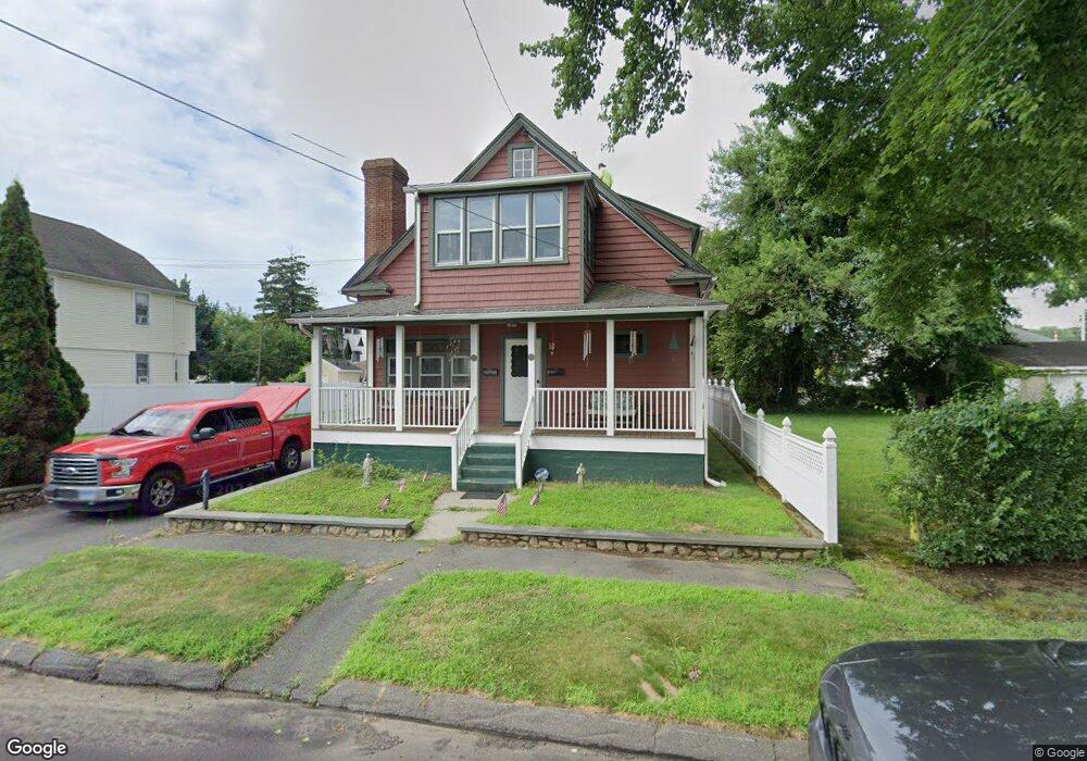
213 Berwick Ave Fairfield, CT 06825
Tunxis Hill NeighborhoodEstimated Value: $548,000 - $588,000
2
Beds
1
Bath
1,434
Sq Ft
$395/Sq Ft
Est. Value
About This Home
This home is located at 213 Berwick Ave, Fairfield, CT 06825 and is currently estimated at $566,802, approximately $395 per square foot. 213 Berwick Ave is a home located in Fairfield County with nearby schools including Mckinley Elementary School, Tomlinson Middle School, and Fairfield Warde High School.
Ownership History
Date
Name
Owned For
Owner Type
Purchase Details
Closed on
Jul 10, 1998
Sold by
Eshinsky Sergel A
Bought by
Pauliscsak Edward
Current Estimated Value
Home Financials for this Owner
Home Financials are based on the most recent Mortgage that was taken out on this home.
Original Mortgage
$130,000
Outstanding Balance
$26,650
Interest Rate
7.02%
Mortgage Type
Unknown
Estimated Equity
$540,152
Create a Home Valuation Report for This Property
The Home Valuation Report is an in-depth analysis detailing your home's value as well as a comparison with similar homes in the area
Home Values in the Area
Average Home Value in this Area
Purchase History
| Date | Buyer | Sale Price | Title Company |
|---|---|---|---|
| Pauliscsak Edward | $165,000 | -- | |
| Pauliscsak Edward | $165,000 | -- |
Source: Public Records
Mortgage History
| Date | Status | Borrower | Loan Amount |
|---|---|---|---|
| Closed | Pauliscsak Edward | $15,000 | |
| Open | Pauliscsak Edward | $130,000 | |
| Closed | Pauliscsak Edward | $130,000 |
Source: Public Records
Tax History
| Year | Tax Paid | Tax Assessment Tax Assessment Total Assessment is a certain percentage of the fair market value that is determined by local assessors to be the total taxable value of land and additions on the property. | Land | Improvement |
|---|---|---|---|---|
| 2025 | $6,904 | $243,180 | $163,380 | $79,800 |
| 2024 | $6,785 | $243,180 | $163,380 | $79,800 |
| 2023 | $6,690 | $243,180 | $163,380 | $79,800 |
| 2022 | $6,624 | $243,180 | $163,380 | $79,800 |
| 2021 | $6,561 | $243,180 | $163,380 | $79,800 |
| 2020 | $5,836 | $217,840 | $141,820 | $76,020 |
| 2019 | $5,836 | $217,840 | $141,820 | $76,020 |
| 2018 | $5,742 | $217,840 | $141,820 | $76,020 |
| 2017 | $5,625 | $217,840 | $141,820 | $76,020 |
| 2016 | $5,544 | $217,840 | $141,820 | $76,020 |
| 2015 | $5,397 | $217,700 | $147,000 | $70,700 |
| 2014 | $5,312 | $217,700 | $147,000 | $70,700 |
Source: Public Records
Map
Nearby Homes
- 130 Brentwood Ave
- 118 Berwick Ave
- 156 Halley Ave
- 187 Halley Ave
- 198 Castle Ave
- 37 Biro St
- 135 Grace St
- 65 Benton St
- 45 Sterling St
- 47 Sterling St
- 51 Sterling St
- 53 Sterling St
- 219 Orland St Unit 221
- 65 Mason St
- 287 Hansen Ave
- 206 Sterling St
- 245 Sunnyridge Ave Unit 1
- 12 Reynolds Dr
- 31 Whittier St
- 25 Whittier St
- 230 Berwick Ave
- 210 Berwick Ave
- 220 Berwick Ave
- 204 Berwick Ave
- 227 Berwick Ave
- 197 Berwick Ave
- 244 Berwick Ave
- 675 Kings Hwy E
- 174 Brentwood Ave
- 174 Brentwood Ave Unit 1st Floor
- 685 Kings Hwy E
- 190 Brentwood Ave
- 215 Berwick Ave
- 177 Berwick Ave
- 178 Brentwood Ave
- 170 Brentwood Ave
- 187 Berwick Ave
- 192 Berwick Ave
- 271 Fairchild Ave
- 257 Fairchild Ave
Your Personal Tour Guide
Ask me questions while you tour the home.