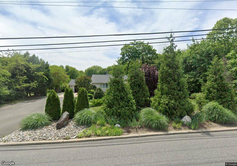
213 Harmony Rd Mickleton, NJ 08056
Estimated Value: $373,000 - $406,000
Studio
--
Bath
1,560
Sq Ft
$249/Sq Ft
Est. Value
About This Home
This home is located at 213 Harmony Rd, Mickleton, NJ 08056 and is currently estimated at $388,206, approximately $248 per square foot. 213 Harmony Rd is a home located in Gloucester County with nearby schools including Jeffrey Clark School, Samuel Mickle School, and Kingsway Regional Middle School.
Ownership History
Date
Name
Owned For
Owner Type
Purchase Details
Closed on
May 26, 2006
Sold by
Dunst Paul D
Bought by
Michael Mcgrath
Current Estimated Value
Home Financials for this Owner
Home Financials are based on the most recent Mortgage that was taken out on this home.
Original Mortgage
$199,920
Interest Rate
6.71%
Mortgage Type
Purchase Money Mortgage
Create a Home Valuation Report for This Property
The Home Valuation Report is an in-depth analysis detailing your home's value as well as a comparison with similar homes in the area
Home Values in the Area
Average Home Value in this Area
Purchase History
| Date | Buyer | Sale Price | Title Company |
|---|---|---|---|
| Michael Mcgrath | $249,900 | -- |
Source: Public Records
Mortgage History
| Date | Status | Borrower | Loan Amount |
|---|---|---|---|
| Previous Owner | Michael Mcgrath | $199,920 |
Source: Public Records
Tax History
| Year | Tax Paid | Tax Assessment Tax Assessment Total Assessment is a certain percentage of the fair market value that is determined by local assessors to be the total taxable value of land and additions on the property. | Land | Improvement |
|---|---|---|---|---|
| 2025 | $6,492 | $204,200 | $55,400 | $148,800 |
| 2024 | $6,285 | $204,200 | $55,400 | $148,800 |
| 2023 | $6,285 | $204,200 | $55,400 | $148,800 |
| 2022 | $6,108 | $204,200 | $55,400 | $148,800 |
| 2021 | $5,880 | $204,200 | $55,400 | $148,800 |
| 2020 | $6,177 | $204,200 | $55,400 | $148,800 |
| 2019 | $6,114 | $204,200 | $55,400 | $148,800 |
| 2018 | $6,370 | $193,200 | $50,500 | $142,700 |
| 2017 | $6,287 | $193,200 | $50,500 | $142,700 |
| 2016 | $6,213 | $193,200 | $50,500 | $142,700 |
| 2015 | $5,954 | $193,200 | $50,500 | $142,700 |
| 2014 | $5,587 | $193,200 | $50,500 | $142,700 |
Source: Public Records
Map
Nearby Homes
- 415 Country Way
- 424 Country Way
- 312 Croce Ave
- 241 Gaunt Dr
- 1224 Heddon Ave
- 37 Harmony Rd
- 255 Elizabeth Ave
- 1221 Walter Ave
- 1265 Walter Ave
- 311 Morton Ave
- L18 20 W Broad St
- 403 W Broad St
- 318 W Buck St
- 1534 Pine St
- 0 Lodge Ave
- 2214 Lamington Ct
- 1519 Pine St
- L8 Lodge Ave
- 2701 Lamington Ct
- 355 Friendship Rd
- 209 Harmony Rd
- 206 Harmony Rd
- 203 Harmony Rd
- 202 Harmony Rd
- 200 Harmony Rd
- 199 Harmony Rd
- 228 Harmony Rd
- 0 Harmony Rd
- 198 Harmony Rd
- 196 Harmony Rd
- 190 Harmony Rd
- 0 Swedesboro Ave
- 317 Swedesboro Ave
- 186 Harmony Rd
- 184 Harmony Rd
- 285 Swedesboro Ave
- 401 Harmony Rd
- 368 Swedesboro Ave
- 368 Swedesboro Rd
- 362 Swedesboro Ave
Your Personal Tour Guide
Ask me questions while you tour the home.