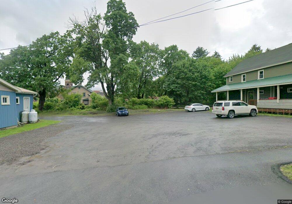
213 Rushbrook St Jermyn, PA 18433
Estimated Value: $364,618
Studio
--
Bath
3,016
Sq Ft
$121/Sq Ft
Est. Value
About This Home
This home is located at 213 Rushbrook St, Jermyn, PA 18433 and is currently estimated at $364,618, approximately $120 per square foot. 213 Rushbrook St is a home located in Lackawanna County with nearby schools including Lakeland Junior/Senior High School and Edison Early Learning Center.
Ownership History
Date
Name
Owned For
Owner Type
Purchase Details
Closed on
Aug 27, 2019
Sold by
Phillips Gary A
Bought by
Rossi Property Development Llc
Current Estimated Value
Home Financials for this Owner
Home Financials are based on the most recent Mortgage that was taken out on this home.
Original Mortgage
$180,000
Outstanding Balance
$119,983
Interest Rate
3.8%
Mortgage Type
Commercial
Estimated Equity
$244,635
Create a Home Valuation Report for This Property
The Home Valuation Report is an in-depth analysis detailing your home's value as well as a comparison with similar homes in the area
Home Values in the Area
Average Home Value in this Area
Purchase History
| Date | Buyer | Sale Price | Title Company |
|---|---|---|---|
| Rossi Property Development Llc | $240,000 | None Available |
Source: Public Records
Mortgage History
| Date | Status | Borrower | Loan Amount |
|---|---|---|---|
| Open | Rossi Property Development Llc | $180,000 |
Source: Public Records
Tax History
| Year | Tax Paid | Tax Assessment Tax Assessment Total Assessment is a certain percentage of the fair market value that is determined by local assessors to be the total taxable value of land and additions on the property. | Land | Improvement |
|---|---|---|---|---|
| 2025 | $478 | $1,300 | $1,300 | $0 |
| 2024 | $282 | $1,300 | $1,300 | $0 |
| 2023 | $282 | $1,300 | $1,300 | $0 |
| 2022 | $276 | $1,300 | $1,300 | $0 |
| 2021 | $276 | $1,300 | $1,300 | $0 |
| 2020 | $274 | $1,300 | $1,300 | $0 |
| 2019 | $261 | $1,300 | $0 | $1,300 |
| 2018 | $259 | $1,300 | $0 | $1,300 |
| 2017 | $259 | $1,300 | $0 | $1,300 |
| 2016 | $146 | $1,300 | $0 | $0 |
| 2015 | -- | $1,300 | $0 | $0 |
| 2014 | -- | $1,300 | $0 | $0 |
Source: Public Records
Map
Nearby Homes
- 705 Jefferson Ave
- 0 Pennsylvania 107
- 205 Depew Ave
- 414 Rushbrook St
- 103 5th St
- 210 Gorham Ave
- 302 Depew Ave
- 440 Washington Ave
- 432 Madison Ave
- 21 Maple St
- 727 Lackawanna Ave
- 439 Hudson St
- 0 Chestnut St
- 925 Lackawanna Ave
- 3 Old Mill Rd
- 119 Osprey Ln
- 717 N Main St
- 192 Shadow Wood Cir
- 344 Shadow Wood Cir
- 233 Shadow Wood Cir
- 215 Rushbrook St
- 203 Rushbrook St
- 645 Madison Ave
- 210 Rushbrook St
- 200 Rushbrook St
- 219 Rushbrook St
- 639 Madison Ave
- 703 Madison Ave
- 216 Rushbrook St
- 656 Jefferson Ave
- 650 Madison Ave
- 214 Rushbrook St Unit 216
- 637 Madison Ave
- 652 Jefferson Ave
- 705 Madison Ave
- 122 Rushbrook St
- 642 Jefferson Ave
- 635 Madison Ave
- 646 Madison Ave
- 225 Rushbrook St
Your Personal Tour Guide
Ask me questions while you tour the home.