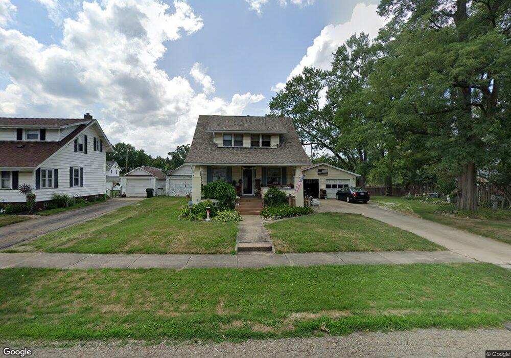
2131 Center Ave Alliance, OH 44601
Estimated Value: $175,000 - $191,000
Studio
--
Bath
--
Sq Ft
7,492
Sq Ft Lot Lot
About This Home
This home is located at 2131 Center Ave, Alliance, OH 44601 and is currently estimated at $183,000. 2131 Center Ave is a home located in Stark County with nearby schools including Alliance Elementary School at Rockhill, Alliance Intermediate School at Northside, and Alliance Middle School.
Ownership History
Date
Name
Owned For
Owner Type
Purchase Details
Closed on
Oct 21, 2002
Sold by
Shaw David L and Shaw Janet L
Bought by
Noble Charles E and Noble Lisa A
Current Estimated Value
Home Financials for this Owner
Home Financials are based on the most recent Mortgage that was taken out on this home.
Original Mortgage
$80,100
Interest Rate
6.29%
Mortgage Type
Purchase Money Mortgage
Create a Home Valuation Report for This Property
The Home Valuation Report is an in-depth analysis detailing your home's value as well as a comparison with similar homes in the area
Home Values in the Area
Average Home Value in this Area
Purchase History
We collect this data history from publicly available records. To have your information removed, we recommend requesting removal directly through your county’s website.
| Date | Buyer | Sale Price | Title Company |
|---|---|---|---|
| Noble Charles E | $89,000 | Union Title Co |
Source: Public Records
Mortgage History
We collect this data history from publicly available records. To have your information removed, we recommend requesting removal directly through your county’s website.
| Date | Status | Borrower | Loan Amount |
|---|---|---|---|
| Closed | Noble Charles E | $80,100 |
Source: Public Records
Tax History
| Year | Tax Paid | Tax Assessment Tax Assessment Total Assessment is a certain percentage of the fair market value that is determined by local assessors to be the total taxable value of land and additions on the property. | Land | Improvement |
|---|---|---|---|---|
| 2025 | -- | $6,900 | $5,080 | $1,820 |
| 2024 | -- | $6,900 | $5,080 | $1,820 |
| 2023 | $281 | $6,830 | $4,270 | $2,560 |
| 2022 | $283 | $6,830 | $4,270 | $2,560 |
| 2021 | $284 | $6,830 | $4,270 | $2,560 |
| 2020 | $265 | $5,950 | $3,710 | $2,240 |
| 2019 | $261 | $5,950 | $3,710 | $2,240 |
| 2018 | $262 | $5,950 | $3,710 | $2,240 |
| 2017 | $264 | $5,880 | $3,150 | $2,730 |
| 2016 | $266 | $5,880 | $3,150 | $2,730 |
| 2015 | $268 | $5,880 | $3,150 | $2,730 |
| 2014 | $275 | $5,740 | $3,080 | $2,660 |
| 2013 | $137 | $5,740 | $3,080 | $2,660 |
Source: Public Records
Map
Nearby Homes
- 0 Federal Ave
- 2435 Eastern Ave
- 2540 Edgewood Ave
- 2229 Western Ave
- 24865 Center Ave
- 2580 Edgewood Ave
- 2619 Center Ave
- 1794 Lilly Ln
- 1718 Fernwood Blvd
- 1120 W Milton St
- 2650 Center Ave
- 2520 Pleasant Place
- 1715 Western Ave
- 2150 Beechwood Ave
- 1038 Vincent Blvd
- 2144 Ridgewood Ave
- 1539 Parkway Blvd
- 3018 Blenheim Ave
- 1601 Raywood Rd
- 2616 Ridgewood Ave
- 2131 Center Ave
- 2141 Center Ave
- 2101 Center Ave
- 2151 Center Ave
- 2130 Blenheim Ave
- 2112 Blenheim Ave
- 2142 Blenheim Ave
- 2161 Center Ave
- 2100 Blenheim Ave
- 2110 Center Ave
- 2110 Center Ave
- 2097 Center Ave
- 2130 Center Ave
- 2150 Blenheim Ave
- 2100 Center Ave
- 2171 Center Ave
- 2095 Center Ave
- 2094 Blenheim Ave
- 2154 Center Ave
- 2160 Blenheim Ave
Your Personal Tour Guide
Ask me questions while you tour the home.