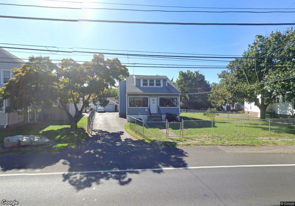
2131 State Rd Bensalem, PA 19020
Estimated Value: $333,000 - $450,000
4
Beds
2
Baths
1,656
Sq Ft
$236/Sq Ft
Est. Value
About This Home
This home is located at 2131 State Rd, Bensalem, PA 19020 and is currently estimated at $391,033, approximately $236 per square foot. 2131 State Rd is a home located in Bucks County with nearby schools including Robert K. Shafer Middle School, School Lane Charter School, and St Charles Borromeo School.
Ownership History
Date
Name
Owned For
Owner Type
Purchase Details
Closed on
Oct 7, 2004
Sold by
Drago Joseph T and Drago Dolores
Bought by
Windfelder Thomas J and Windfelder Patricia A
Current Estimated Value
Home Financials for this Owner
Home Financials are based on the most recent Mortgage that was taken out on this home.
Original Mortgage
$151,200
Outstanding Balance
$75,032
Interest Rate
5.8%
Mortgage Type
Unknown
Estimated Equity
$316,001
Purchase Details
Closed on
Nov 14, 1962
Bought by
Drago Josepht and Drago Dolores
Create a Home Valuation Report for This Property
The Home Valuation Report is an in-depth analysis detailing your home's value as well as a comparison with similar homes in the area
Home Values in the Area
Average Home Value in this Area
Purchase History
| Date | Buyer | Sale Price | Title Company |
|---|---|---|---|
| Windfelder Thomas J | $189,000 | -- | |
| Drago Josepht | -- | -- |
Source: Public Records
Mortgage History
| Date | Status | Borrower | Loan Amount |
|---|---|---|---|
| Open | Windfelder Thomas J | $151,200 |
Source: Public Records
Tax History
| Year | Tax Paid | Tax Assessment Tax Assessment Total Assessment is a certain percentage of the fair market value that is determined by local assessors to be the total taxable value of land and additions on the property. | Land | Improvement |
|---|---|---|---|---|
| 2025 | $3,580 | $16,400 | $3,320 | $13,080 |
| 2024 | $3,580 | $16,400 | $3,320 | $13,080 |
| 2023 | $3,479 | $16,400 | $3,320 | $13,080 |
| 2022 | $3,459 | $16,400 | $3,320 | $13,080 |
| 2021 | $3,459 | $16,400 | $3,320 | $13,080 |
| 2020 | $3,424 | $16,400 | $3,320 | $13,080 |
| 2019 | $3,348 | $16,400 | $3,320 | $13,080 |
| 2018 | $3,270 | $16,400 | $3,320 | $13,080 |
| 2017 | $3,250 | $16,400 | $3,320 | $13,080 |
| 2016 | $3,250 | $16,400 | $3,320 | $13,080 |
| 2015 | -- | $16,400 | $3,320 | $13,080 |
| 2014 | -- | $16,400 | $3,320 | $13,080 |
Source: Public Records
Map
Nearby Homes
- 2025 State Rd
- 110 Konefal St
- 109 Federal St
- 116b Konefal St
- 108A Dock St
- 135 Prince George St
- 129 Prince George St
- 541 Wicker Ave
- 117B Prince George St
- 128B Fleet Ct
- 124 Alexandria St
- 140A Gaslight Aly
- 146A Park Place
- 112 B King St
- 103 Waterside Mews
- 116B King St
- 114B King St
- 104B King St
- 98 King St
- 115A King St
- 2137 State Rd
- 2123 State Rd
- 320 Wallace Ave
- 315 Hemlock Ave
- 2113 State Rd
- 309 Hemlock Ave
- 335 Wallace Ave
- 2134 State Rd
- 318 Wallace Ave
- 301 Hemlock Ave
- 247 Hemlock Ave
- 2102 State Rd
- 242 Wallace Ave
- 312 Hemlock Ave
- 0 State Rd Unit PABU464634
- 0 State Rd Unit PABU464524
- 428 Wallace Ave
- 303 Wallace Ave
- 243 Hemlock Ave
- 252 Hemlock Ave
Your Personal Tour Guide
Ask me questions while you tour the home.