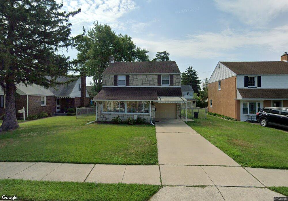
2132 6th Ave Morton, PA 19070
Estimated Value: $347,178 - $405,000
3
Beds
2
Baths
1,256
Sq Ft
$309/Sq Ft
Est. Value
About This Home
This home is located at 2132 6th Ave, Morton, PA 19070 and is currently estimated at $387,795, approximately $308 per square foot. 2132 6th Ave is a home located in Delaware County with nearby schools including Amosland El School, Ridley Middle School, and Ridley High School.
Ownership History
Date
Name
Owned For
Owner Type
Purchase Details
Closed on
Nov 20, 1995
Sold by
Dintino Anthony N and Dintino Emilia
Bought by
Dinyon Robert and Dinyon Elizabeth
Current Estimated Value
Home Financials for this Owner
Home Financials are based on the most recent Mortgage that was taken out on this home.
Original Mortgage
$112,500
Outstanding Balance
$1,563
Interest Rate
7.53%
Mortgage Type
Purchase Money Mortgage
Estimated Equity
$386,232
Create a Home Valuation Report for This Property
The Home Valuation Report is an in-depth analysis detailing your home's value as well as a comparison with similar homes in the area
Home Values in the Area
Average Home Value in this Area
Purchase History
| Date | Buyer | Sale Price | Title Company |
|---|---|---|---|
| Dinyon Robert | $125,000 | -- |
Source: Public Records
Mortgage History
| Date | Status | Borrower | Loan Amount |
|---|---|---|---|
| Open | Dinyon Robert | $112,500 |
Source: Public Records
Tax History
| Year | Tax Paid | Tax Assessment Tax Assessment Total Assessment is a certain percentage of the fair market value that is determined by local assessors to be the total taxable value of land and additions on the property. | Land | Improvement |
|---|---|---|---|---|
| 2025 | $7,266 | $209,270 | $64,730 | $144,540 |
| 2024 | $7,266 | $209,270 | $64,730 | $144,540 |
| 2023 | $6,950 | $209,270 | $64,730 | $144,540 |
| 2022 | $6,727 | $209,270 | $64,730 | $144,540 |
| 2021 | $10,414 | $209,270 | $64,730 | $144,540 |
| 2020 | $6,347 | $112,360 | $32,980 | $79,380 |
| 2019 | $6,231 | $112,360 | $32,980 | $79,380 |
| 2018 | $6,154 | $112,360 | $0 | $0 |
| 2017 | $6,154 | $112,360 | $0 | $0 |
| 2016 | $617 | $112,360 | $0 | $0 |
| 2015 | $617 | $112,360 | $0 | $0 |
| 2014 | $617 | $112,360 | $0 | $0 |
Source: Public Records
Map
Nearby Homes
- 522 Amosland Rd
- 409 Holmes Rd
- 743 Hickory Rd
- 363 Holmes Rd
- 1907 Pershing Ave
- 846 Bobwhite Ln
- 2704 Quaint St
- 363 Hutchinson Terrace
- 838 Springhill Rd
- 1712 Orchard Ave
- 21 Faraday Ct
- 429 Sutton Ave
- 880 Quaint St
- 2379 Mole Rd
- 216-218 President Ave
- 804 South Ave Unit D7
- 611 Glenfield Ave
- 150 Kedron Ave
- 139 Talbot Ave
- 1828 5th Ave
Your Personal Tour Guide
Ask me questions while you tour the home.