2135 Theda Ln Rolling Meadows, IL 60008
Rolling Meadows AreaEstimated Value: $327,000 - $371,000
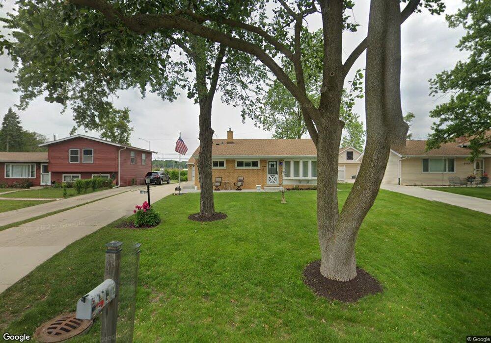
About This Home
This home is located at 2135 Theda Ln, Rolling Meadows, IL 60008 and is currently estimated at $348,502, approximately $339 per square foot. 2135 Theda Ln is a home located in Cook County with nearby schools including Kimball Hill Elementary School, Carl Sandburg Junior High School, and Rolling Meadows High School.
Ownership History
We collect this data history from publicly available records. To have your information removed, we recommend requesting removal directly through your county’s website.
Purchase Details
Home Values in the Area
Average Home Value in this Area
Purchase History
We collect this data history from publicly available records. To have your information removed, we recommend requesting removal directly through your county’s website.
| Date | Buyer | Sale Price | Title Company |
|---|---|---|---|
| -- | None Listed On Document |
Tax History
We collect this data history from publicly available records. To have your information removed, we recommend requesting removal directly through your county’s website.
| Year | Tax Paid | Tax Assessment Tax Assessment Total Assessment is a certain percentage of the fair market value that is determined by local assessors to be the total taxable value of land and additions on the property. | Land | Improvement |
|---|---|---|---|---|
| 2025 | $6,227 | $31,000 | $5,105 | $25,895 |
| 2024 | $6,227 | $26,000 | $4,320 | $21,680 |
| 2023 | $5,970 | $26,000 | $4,320 | $21,680 |
| 2022 | $5,970 | $26,000 | $4,320 | $21,680 |
| 2021 | $5,496 | $21,989 | $2,552 | $19,437 |
| 2020 | $5,499 | $21,989 | $2,552 | $19,437 |
| 2019 | $5,551 | $24,569 | $2,552 | $22,017 |
| 2018 | $4,500 | $19,523 | $2,356 | $17,167 |
| 2017 | $4,444 | $19,523 | $2,356 | $17,167 |
| 2016 | $4,699 | $19,523 | $2,356 | $17,167 |
| 2015 | $5,074 | $19,916 | $2,159 | $17,757 |
| 2014 | $4,996 | $19,916 | $2,159 | $17,757 |
| 2013 | $4,842 | $19,916 | $2,159 | $17,757 |
Map
- 2409 Robin Ln
- 3822 Ashley Ct
- 3419 Campbell St
- 1507 S Garden St
- 2600 Brookwood Way Dr Unit 114
- 2600 Brookwood Way Dr Unit 113
- 2650 Brookwood Way Dr Unit 223
- 4388 Lincoln Ct
- 4530 Fairfax Ave
- 3002 Owl Dr Unit 11
- 2702 Saint James St
- 2705 School Dr
- 4710 Euclid Ave Unit 1C
- 3265 Kirchoff Rd Unit 217
- 3265 Kirchoff Rd Unit 127
- 3265 Kirchoff Rd Unit 116
- 1751 Taft Ave
- 305 Lexington Ln
- 3000 California Ave
- 916 S Plum Grove Rd Unit 223
- 2101 Theda Ln
- 2115 Theda Ln
- 2155 Theda Ln
- 2175 Theda Ln
- 3811 Fremont St
- 2189 Theda Ln
- 2200 Theda Ln
- 3801 Fremont St
- 2200 Forest Ave
- 2201 Theda Ln
- 3797 Fremont St
- 2210 Theda Ln
- 4885 W Euclid Ave
- 2220 Forest Ave
- 2101 Rohlwing Rd
- 2225 Theda Ln
- 2105 Rohlwing Rd
- 2230 Theda Ln
- 3610 Fremont St Unit 6
- 2240 Forest Ave
Ask me questions while you tour the home.