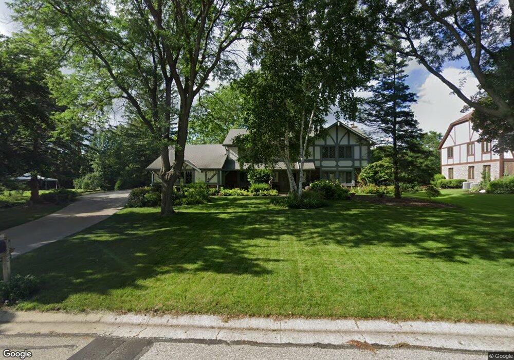
21380 Talbots Ln Brookfield, WI 53045
Estimated Value: $688,000 - $841,000
About This Home
This home is located at 21380 Talbots Ln, Brookfield, WI 53045 and is currently estimated at $782,220, approximately $227 per square foot. 21380 Talbots Ln is a home located in Waukesha County with nearby schools including Brookfield Elementary School, Wisconsin Hills Middle School, and Brookfield Central High School.
Ownership History
We collect this data history from publicly available records. To have your information removed, we recommend requesting removal directly through your county’s website.
Purchase Details
Home Financials for this Owner
Home Financials are based on the most recent Mortgage that was taken out on this home.Home Values in the Area
Average Home Value in this Area
Purchase History
We collect this data history from publicly available records. To have your information removed, we recommend requesting removal directly through your county’s website.
| Date | Buyer | Sale Price | Title Company |
|---|---|---|---|
| $310,000 | -- |
Mortgage History
We collect this data history from publicly available records. To have your information removed, we recommend requesting removal directly through your county’s website.
| Date | Status | Borrower | Loan Amount |
|---|---|---|---|
| Open | $210,000 |
Tax History
We collect this data history from publicly available records. To have your information removed, we recommend requesting removal directly through your county’s website.
| Year | Tax Paid | Tax Assessment Tax Assessment Total Assessment is a certain percentage of the fair market value that is determined by local assessors to be the total taxable value of land and additions on the property. | Land | Improvement |
|---|---|---|---|---|
| 2024 | $7,516 | $665,200 | $135,000 | $530,200 |
| 2023 | $7,528 | $665,200 | $135,000 | $530,200 |
| 2022 | $7,403 | $512,400 | $130,000 | $382,400 |
| 2021 | $7,846 | $512,400 | $130,000 | $382,400 |
| 2020 | $8,160 | $512,400 | $130,000 | $382,400 |
| 2019 | $7,847 | $512,400 | $130,000 | $382,400 |
| 2018 | $7,815 | $496,400 | $140,000 | $356,400 |
| 2017 | $8,882 | $496,400 | $140,000 | $356,400 |
| 2016 | $7,913 | $496,400 | $140,000 | $356,400 |
| 2015 | $7,862 | $496,400 | $140,000 | $356,400 |
| 2014 | $7,875 | $496,400 | $140,000 | $356,400 |
| 2013 | $8,156 | $496,400 | $140,000 | $356,400 |
Map
- 21660 Mayrose Blvd
- 21065 Bradford Ln
- 21300 Astolat Dr
- 21990 Holly Crest Dr
- 2820 Norman Dr
- 2840 Norman Dr
- 2270 Vincent Dr
- W221N3075 Greenwood Rd
- Lt118 Berwick Ct
- Lt120 Berwick Ct
- Lt116 Berwick Ct
- Lt114 Berwick Ct
- 21975 W North Ave
- W224N2618 Ridgewood Ln
- N32W22121 Hill n Dale Cir
- 2385 Buckingham Place
- W226N3045 Duplainville Rd
- 20000 Glenoaks Dr
- W227N2540 Meadowood Ln
- 2005 Derrin Ln
- 21385 Clearfield Ct
- 21345 Clearfield Ct
- 2680 Almesbury Ave
- 2660 Almesbury Ave
- 21370 Clearfield Ct
- 2640 Almesbury Ave
- 21305 Clearfield Ct
- 2700 Almesbury Ave
- 21340 Clearfield Ct
- 2620 Almesbury Ave
- 21340 Talbots Ln
- 21275 Clearfield Ct
- 21300 Clearfield Ct
- 2720 Almesbury Ave
- 2665 Almesbury Ave
- 21385 Cambridge Circle Lower Unit LWR
- 2685 Almesbury Ave
- 2645 Almesbury Ave
- 21355 Cambridge Circle Lower Unit LWR
- 21310 Talbots Ln
Ask me questions while you tour the home.