Estimated Value: $129,000 - $189,000
2
Beds
1
Bath
974
Sq Ft
$149/Sq Ft
Est. Value
About This Home
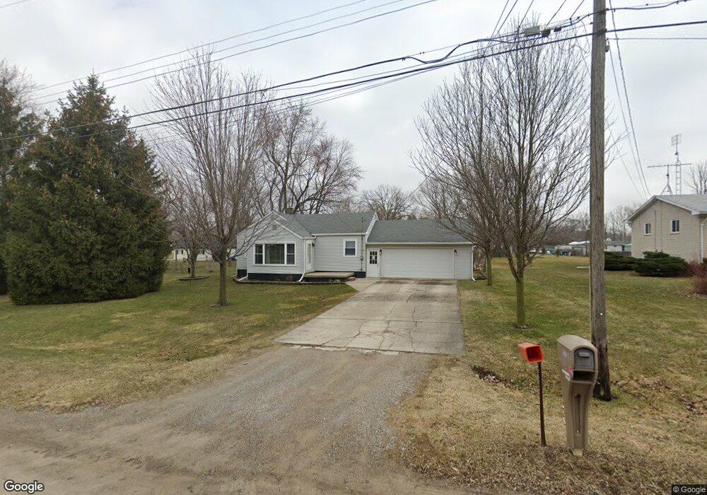
This home is located at 2139 Roslyn Ave, Flint, MI 48532 and is currently estimated at $145,533, approximately $149 per square foot. 2139 Roslyn Ave is a home located in Genesee County with nearby schools including Carman-Ainsworth High School, Genesee STEM Academy, and Genesee Academy.
Ownership History
Date
Name
Owned For
Owner Type
Purchase Details
Closed on
Nov 28, 2018
Sold by
Kovalcik Richard James and Kovalcik Laura Lee
Bought by
James Richard and Kovalcik Laura Lee
Current Estimated Value
Purchase Details
Closed on
Oct 24, 2002
Sold by
Kovalcik Richard J
Bought by
Kovalcik Richard J and Kovalcik Laura L
Home Financials for this Owner
Home Financials are based on the most recent Mortgage that was taken out on this home.
Original Mortgage
$69,600
Interest Rate
6.18%
Create a Home Valuation Report for This Property
The Home Valuation Report is an in-depth analysis detailing your home's value as well as a comparison with similar homes in the area
Home Values in the Area
Average Home Value in this Area
Purchase History
We collect this data history from publicly available records. To have your information removed, we recommend requesting removal directly through your county’s website.
| Date | Buyer | Sale Price | Title Company |
|---|---|---|---|
| James Richard | -- | None Available | |
| Kovalcik Richard J | -- | Guaranty Title Company |
Source: Public Records
Mortgage History
We collect this data history from publicly available records. To have your information removed, we recommend requesting removal directly through your county’s website.
| Date | Status | Borrower | Loan Amount |
|---|---|---|---|
| Closed | Kovalcik Richard J | $69,600 |
Source: Public Records
Tax History
| Year | Tax Paid | Tax Assessment Tax Assessment Total Assessment is a certain percentage of the fair market value that is determined by local assessors to be the total taxable value of land and additions on the property. | Land | Improvement |
|---|---|---|---|---|
| 2025 | $826 | $42,100 | $0 | $0 |
| 2024 | $804 | $38,700 | $0 | $0 |
| 2023 | $768 | $36,800 | $0 | $0 |
| 2022 | $697 | $33,900 | $0 | $0 |
| 2021 | $1,413 | $32,800 | $0 | $0 |
| 2020 | $690 | $32,400 | $0 | $0 |
| 2019 | $680 | $32,200 | $0 | $0 |
| 2018 | $1,308 | $30,500 | $0 | $0 |
| 2017 | $1,249 | $30,500 | $0 | $0 |
| 2016 | $1,277 | $30,400 | $0 | $0 |
| 2015 | $1,142 | $30,400 | $0 | $0 |
| 2014 | $677 | $29,300 | $0 | $0 |
| 2012 | -- | $27,300 | $27,300 | $0 |
Source: Public Records
Map
Nearby Homes
- 000 Corunna Rd
- 00 Corunna Rd
- 6172 W Court St
- 1420 Mintola Ave
- 6507 Corunna Rd Unit 6493 Corunna Rd.
- 2281 Nandi Hills Trail
- 6103 Trenton Dr
- 5323 Elmsford Dr
- 2400 Marlene Dr
- 7080 Aldredge Dr
- 2109 Deerfield Dr
- 2356 S Dye Rd
- 0000 Corunna Rd
- 2052 S Dye Rd
- 0000 Reuben Reuben St
- 2520 Nandi Hills Trail
- 1460 S Dye Rd
- 0 S Dye Rd
- 5227 Dania St
- 7035 Saratoga Dr
- 2129 Roslyn Ave Unit Bldg-Unit
- 2129 Roslyn Ave
- 6205 Bailey St
- 2116 Noble Ave
- 2122 Noble Ave
- 2130 Noble Ave
- 2151 Roslyn Ave
- 2136 Noble Ave
- 2148 Noble Ave
- 2142 Noble Ave
- 6208 Bailey St
- 2160 Noble Ave
- 2165 Roslyn Ave
- 2098 Noble Ave
- 2087 Roslyn Ave
- 6226 Bailey St
- 2138 Roland Ave
- 2168 Noble Ave
- 2086 Noble Ave
- 2124 Roland Ave
Your Personal Tour Guide
Ask me questions while you tour the home.