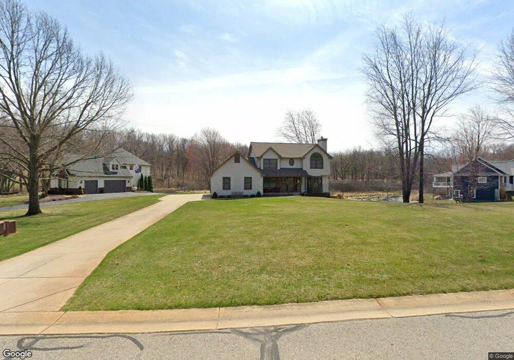
2139 Sundance Ridge Unit 13 Howell, MI 48843
Estimated Value: $453,000 - $539,000
Studio
2
Baths
2,242
Sq Ft
$218/Sq Ft
Est. Value
About This Home
This home is located at 2139 Sundance Ridge Unit 13, Howell, MI 48843 and is currently estimated at $489,834, approximately $218 per square foot. 2139 Sundance Ridge Unit 13 is a home located in Livingston County with nearby schools including Parker Middle School and Howell High School.
Ownership History
Date
Name
Owned For
Owner Type
Purchase Details
Closed on
Jun 17, 1999
Sold by
Prawdzik Robert L and Prawdzik Renee L
Bought by
Atkins James Michael and Atkins Wendy Marylyn
Current Estimated Value
Home Financials for this Owner
Home Financials are based on the most recent Mortgage that was taken out on this home.
Original Mortgage
$225,000
Interest Rate
7.15%
Mortgage Type
Balloon
Purchase Details
Closed on
Mar 25, 1999
Sold by
Pybus Richard K and Pybus Carolyn E
Bought by
Prawdzik Robert L and Prawdzik Renee L
Home Financials for this Owner
Home Financials are based on the most recent Mortgage that was taken out on this home.
Original Mortgage
$177,500
Interest Rate
7.04%
Mortgage Type
Construction
Create a Home Valuation Report for This Property
The Home Valuation Report is an in-depth analysis detailing your home's value as well as a comparison with similar homes in the area
Home Values in the Area
Average Home Value in this Area
Purchase History
| Date | Buyer | Sale Price | Title Company |
|---|---|---|---|
| Atkins James Michael | $260,000 | American Title Co | |
| Prawdzik Robert L | $55,000 | American Title Co |
Source: Public Records
Mortgage History
| Date | Status | Borrower | Loan Amount |
|---|---|---|---|
| Closed | Atkins James Michael | $225,000 | |
| Previous Owner | Prawdzik Robert L | $177,500 |
Source: Public Records
Tax History
| Year | Tax Paid | Tax Assessment Tax Assessment Total Assessment is a certain percentage of the fair market value that is determined by local assessors to be the total taxable value of land and additions on the property. | Land | Improvement |
|---|---|---|---|---|
| 2025 | $2,151 | $212,900 | $0 | $0 |
| 2024 | $2,090 | $207,300 | $0 | $0 |
| 2023 | $1,996 | $173,600 | $0 | $0 |
| 2022 | $2,715 | $151,000 | $0 | $0 |
| 2021 | $2,647 | $151,000 | $0 | $0 |
| 2020 | $2,814 | $146,400 | $0 | $0 |
| 2019 | $2,658 | $144,800 | $0 | $0 |
| 2018 | $2,629 | $143,000 | $0 | $0 |
| 2017 | $2,592 | $135,700 | $0 | $0 |
| 2016 | $2,577 | $126,800 | $0 | $0 |
| 2014 | $2,299 | $112,000 | $0 | $0 |
| 2012 | $2,299 | $99,800 | $0 | $0 |
Source: Public Records
Map
Nearby Homes
- 2285 White Hawk Dr
- 2509 Rubbins Rd
- 2853 Rubbins Rd
- 5150 Edward James Dr
- 2878 Clivedon Rd
- 1 Brighton Rd
- 0000 Brighton Rd
- 111 Oak Bark Dr
- 5186 Pinckney Rd
- 4539 Parker Dr
- 1286 Gray Fox Ct
- 4609 Parker Dr
- 3760 Southwick Dr
- 05 Prince Edward Dr
- 4681 Roya Trail
- 2105 Webster Park Dr
- 2146 Webster Park Dr
- 3530 Kipling Cir
- 2234 Ridgewood Dr Unit 17
- 3362 Prescott Dr
- 2111 Sundance Ridge Unit 12
- 2167 Sundance Ridge #14
- 2167 Sundance Ridge
- 2167 Sundance Ridge Unit 14
- 2195 Sundance Ridge #15
- 2195 Sundance Ridge
- 2195 Sundance Ridge Unit 15
- 2150 Sundance Ridge Unit 6
- 2100 Sundance Ridge Unit 7
- 2223 Sundance Ridge Unit 16
- 2055 Sundance Ridge
- 2055 Sundance Ridge Unit 10
- 2055 Sundance Ridge #10
- 2040 Sundance Ridge
- 2027 Sundance Ridge
- 2027 Sundance Ridge Unit 9
- 2251 Sundance Ridge Unit 17
- 1987 Sundance Ridge
- 2279 Sundance Ridge Unit Bldg-Unit
- 2279 Sundance Ridge
Your Personal Tour Guide
Ask me questions while you tour the home.