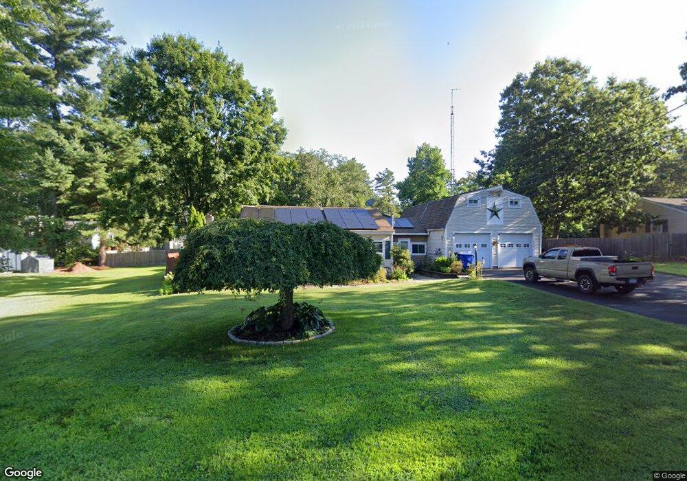
214 Birch Rd West Suffield, CT 06093
Estimated Value: $310,000 - $345,082
3
Beds
2
Baths
1,090
Sq Ft
$302/Sq Ft
Est. Value
About This Home
This home is located at 214 Birch Rd, West Suffield, CT 06093 and is currently estimated at $328,771, approximately $301 per square foot. 214 Birch Rd is a home located in Hartford County with nearby schools including A. Ward Spaulding School, Mcalister Intermediate School, and Suffield Middle School.
Ownership History
Date
Name
Owned For
Owner Type
Purchase Details
Closed on
Feb 23, 2021
Sold by
Ditommaso Stephen F
Bought by
Ditommaso Stephen F and Ditommaso Angela L
Current Estimated Value
Purchase Details
Closed on
Sep 21, 2016
Sold by
Ditommaso Stephen F
Bought by
Ditommaso Stephen F
Create a Home Valuation Report for This Property
The Home Valuation Report is an in-depth analysis detailing your home's value as well as a comparison with similar homes in the area
Home Values in the Area
Average Home Value in this Area
Purchase History
We collect this data history from publicly available records. To have your information removed, we recommend requesting removal directly through your county’s website.
| Date | Buyer | Sale Price | Title Company |
|---|---|---|---|
| Ditommaso Stephen F | -- | None Available | |
| Ditommaso Stephen F | -- | None Available | |
| Ditommaso Stephen F | -- | -- | |
| Ditommaso Stephen F | -- | -- | |
| Ditommaso Stephen F | -- | -- |
Source: Public Records
Mortgage History
We collect this data history from publicly available records. To have your information removed, we recommend requesting removal directly through your county’s website.
| Date | Status | Borrower | Loan Amount |
|---|---|---|---|
| Previous Owner | Ditommaso Stephen F | $50,000 | |
| Previous Owner | Ditommaso Stephen F | $80,000 |
Source: Public Records
Tax History
| Year | Tax Paid | Tax Assessment Tax Assessment Total Assessment is a certain percentage of the fair market value that is determined by local assessors to be the total taxable value of land and additions on the property. | Land | Improvement |
|---|---|---|---|---|
| 2025 | $4,903 | $209,440 | $56,070 | $153,370 |
| 2024 | $4,740 | $209,440 | $56,070 | $153,370 |
| 2023 | $4,839 | $169,120 | $55,930 | $113,190 |
| 2022 | $4,839 | $169,120 | $55,930 | $113,190 |
| 2021 | $4,844 | $169,120 | $55,930 | $113,190 |
| 2020 | $4,844 | $169,120 | $55,930 | $113,190 |
| 2019 | $4,857 | $169,120 | $55,930 | $113,190 |
| 2018 | $4,185 | $142,730 | $54,110 | $88,620 |
| 2017 | $4,123 | $142,730 | $54,110 | $88,620 |
| 2016 | $3,930 | $139,370 | $50,750 | $88,620 |
| 2015 | $3,872 | $139,370 | $50,750 | $88,620 |
| 2014 | $3,780 | $139,370 | $50,750 | $88,620 |
Source: Public Records
Map
Nearby Homes
- 218 Griffin Rd
- 440 Lakeview Dr
- 2 Stratton Farms Rd
- 12 Knollwood Rd
- 877 Newgate Rd
- 9 Candlewood Ln
- 216 College Hwy
- 6 Birch Rd
- 141 Point Grove Rd
- Lot 28F Oak St
- 4 Pearl Brook Rd
- 105 Lakeview St
- 80 Bungalow St
- 7 Copper Hill Terrace
- 1013 Ratley Rd
- 36 Fern Hollow Dr
- 150 S Longyard Rd
- 77R Old Stagecoach Rd
- 233 Mort Vining Rd
- 7 Rising Corner Rd
Your Personal Tour Guide
Ask me questions while you tour the home.