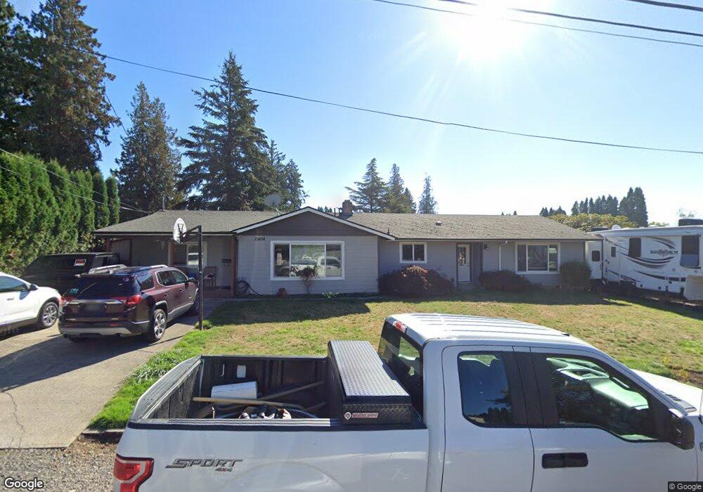
21434 SE Oak St Gresham, OR 97030
North Central NeighborhoodEstimated Value: $453,401 - $520,000
4
Beds
2
Baths
2,254
Sq Ft
$213/Sq Ft
Est. Value
About This Home
This home is located at 21434 SE Oak St, Gresham, OR 97030 and is currently estimated at $479,600, approximately $212 per square foot. 21434 SE Oak St is a home located in Multnomah County with nearby schools including North Gresham Elementary School, Clear Creek Middle School, and Gresham High School.
Ownership History
Date
Name
Owned For
Owner Type
Purchase Details
Closed on
Aug 29, 2003
Sold by
Follette Carolyn
Bought by
Follette Allen D and Follette Carolyn J
Current Estimated Value
Home Financials for this Owner
Home Financials are based on the most recent Mortgage that was taken out on this home.
Original Mortgage
$37,900
Interest Rate
5.98%
Mortgage Type
Stand Alone Second
Purchase Details
Closed on
Jan 10, 2003
Sold by
Follette Carolyn
Bought by
Follette Carolyn and Follette Allen
Home Financials for this Owner
Home Financials are based on the most recent Mortgage that was taken out on this home.
Original Mortgage
$168,000
Interest Rate
6.15%
Mortgage Type
Purchase Money Mortgage
Purchase Details
Closed on
Dec 3, 2001
Sold by
Bank Of New York
Bought by
Follette Carolyn
Home Financials for this Owner
Home Financials are based on the most recent Mortgage that was taken out on this home.
Original Mortgage
$154,350
Interest Rate
9.37%
Mortgage Type
Purchase Money Mortgage
Purchase Details
Closed on
Sep 18, 2001
Sold by
Hathaway Timothy
Bought by
Bank Of New York
Purchase Details
Closed on
Oct 26, 1999
Sold by
Hathaway Timothy
Bought by
Hathaway Timothy and Hathaway Lisa
Home Financials for this Owner
Home Financials are based on the most recent Mortgage that was taken out on this home.
Original Mortgage
$136,000
Interest Rate
8.9%
Mortgage Type
Stand Alone Second
Purchase Details
Closed on
Feb 6, 1998
Sold by
Hathaway Timothy and Hathaway Debra Kaye
Bought by
Hathaway Timothy
Create a Home Valuation Report for This Property
The Home Valuation Report is an in-depth analysis detailing your home's value as well as a comparison with similar homes in the area
Home Values in the Area
Average Home Value in this Area
Purchase History
| Date | Buyer | Sale Price | Title Company |
|---|---|---|---|
| Follette Allen D | -- | Transcontinental Title Co | |
| Follette Carolyn | -- | Fidelity Natl Title Co Of Or | |
| Follette Carolyn | $162,500 | First American Title Co | |
| Bank Of New York | $151,279 | -- | |
| Hathaway Timothy | -- | Pacific Nw Title | |
| Hathaway Timothy | -- | -- |
Source: Public Records
Mortgage History
| Date | Status | Borrower | Loan Amount |
|---|---|---|---|
| Previous Owner | Follette Allen D | $37,900 | |
| Previous Owner | Follette Carolyn | $168,000 | |
| Previous Owner | Follette Carolyn | $154,350 | |
| Previous Owner | Hathaway Timothy | $136,000 | |
| Closed | Hathaway Timothy | $34,000 |
Source: Public Records
Tax History
| Year | Tax Paid | Tax Assessment Tax Assessment Total Assessment is a certain percentage of the fair market value that is determined by local assessors to be the total taxable value of land and additions on the property. | Land | Improvement |
|---|---|---|---|---|
| 2025 | $4,901 | $240,850 | -- | -- |
| 2024 | $4,692 | $233,840 | -- | -- |
| 2023 | $4,274 | $227,030 | $0 | $0 |
| 2022 | $4,155 | $220,420 | $0 | $0 |
| 2021 | $4,050 | $214,000 | $0 | $0 |
| 2020 | $3,811 | $207,770 | $0 | $0 |
| 2019 | $3,711 | $201,720 | $0 | $0 |
| 2018 | $3,539 | $195,850 | $0 | $0 |
| 2017 | $3,395 | $190,150 | $0 | $0 |
| 2016 | $2,993 | $184,620 | $0 | $0 |
Source: Public Records
Map
Nearby Homes
- 21525 SE Oak St
- 209 SE 214th Ave
- 21400 SE Stark St Unit 2
- 21260 SE Stark St
- 132 SE 214th Ave
- 21553 SE Ankeny Terrace
- 21532 SE Alder St
- 210 SE 218th Ave
- 21016 SE Stark St Unit 71
- 21016 SE Stark St Unit 69
- 2013 NW Bella Vista Dr
- 1035 SE 225th Ave
- 21033 SE Clay Ct
- 150 NE 202nd Ave
- 1811 NW 19th St
- 760 NE Pacific Dr
- 1861 NW Wonderview Ave
- 0 NE 202nd Ave
- 522 SE 199th Ave
- 1305 NE Village St
- 21456 SE Oak St
- 414 SE 214th Ave
- 21433 SE Oak St
- 436 SE 214th Ave
- 324 SE 214th Ave
- 21506 SE Oak St
- 21459 SE Stark St
- 21417 SE Oak St
- 21455 SE Oak St
- 21421 SE Oak St
- 21415 SE Stark St
- 21518 SE Oak St
- 314 SE 214th Ave
- 21511 SE Oak St
- 21534 SE Oak St
- 21442 SE Ash St
- 222 SE 214th Ave
- 411 SE 214th Ave
- 331 SE 214th Ave
- 0 SE Stark St
Your Personal Tour Guide
Ask me questions while you tour the home.