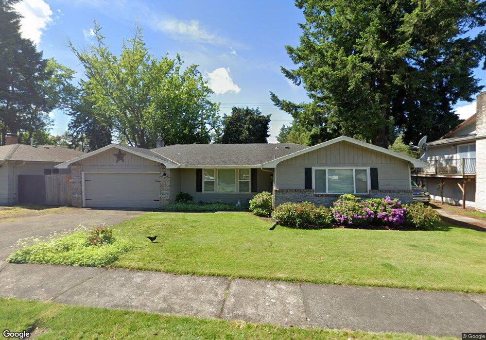
21444 SE Main St Gresham, OR 97030
North Central NeighborhoodEstimated Value: $450,000 - $476,600
About This Home
This home is located at 21444 SE Main St, Gresham, OR 97030 and is currently estimated at $459,150, approximately $286 per square foot. 21444 SE Main St is a home located in Multnomah County with nearby schools including North Gresham Elementary School, Clear Creek Middle School, and Gresham High School.
Ownership History
We collect this data history from publicly available records. To have your information removed, we recommend requesting removal directly through your county’s website.
Purchase Details
Home Financials for this Owner
Home Financials are based on the most recent Mortgage that was taken out on this home.Purchase Details
Purchase Details
Home Financials for this Owner
Home Financials are based on the most recent Mortgage that was taken out on this home.Purchase Details
Home Financials for this Owner
Home Financials are based on the most recent Mortgage that was taken out on this home.Purchase Details
Home Values in the Area
Average Home Value in this Area
Purchase History
We collect this data history from publicly available records. To have your information removed, we recommend requesting removal directly through your county’s website.
| Date | Buyer | Sale Price | Title Company |
|---|---|---|---|
| $450,000 | Wfg Title | ||
| -- | None Listed On Document | ||
| $200,000 | Chicago Title Insurance Co | ||
| $162,000 | Chicago Title | ||
| -- | First American Title Co |
Mortgage History
We collect this data history from publicly available records. To have your information removed, we recommend requesting removal directly through your county’s website.
| Date | Status | Borrower | Loan Amount |
|---|---|---|---|
| Previous Owner | $202,000 | ||
| Previous Owner | $90,000 | ||
| Previous Owner | $159,497 |
Tax History
We collect this data history from publicly available records. To have your information removed, we recommend requesting removal directly through your county’s website.
| Year | Tax Paid | Tax Assessment Tax Assessment Total Assessment is a certain percentage of the fair market value that is determined by local assessors to be the total taxable value of land and additions on the property. | Land | Improvement |
|---|---|---|---|---|
| 2025 | $4,768 | $234,320 | -- | -- |
| 2024 | $4,565 | $227,500 | -- | -- |
| 2023 | $4,159 | $220,880 | $0 | $0 |
| 2022 | $4,042 | $214,450 | $0 | $0 |
| 2021 | $3,941 | $208,210 | $0 | $0 |
| 2020 | $3,708 | $202,150 | $0 | $0 |
| 2019 | $3,611 | $196,270 | $0 | $0 |
| 2018 | $3,443 | $190,560 | $0 | $0 |
| 2017 | $3,303 | $185,010 | $0 | $0 |
| 2016 | $2,913 | $179,630 | $0 | $0 |
| 2015 | $2,850 | $174,400 | $0 | $0 |
| 2014 | $2,780 | $169,330 | $0 | $0 |
Map
- 1230 SE 214th Ave
- 830 NW Council Dr
- 1207 SE 217th Ave
- 1258 NW Shattuck Way Unit 308
- 1211 SE 212th Ave
- 2243 NW Norman Ave
- 1431 NW 19th St
- 2356 NW Ava Ave
- 21532 SE Alder St
- 2013 NW Bella Vista Dr
- 1510 NW Towle Terrace
- 1494 NW 15th St
- 1926 NW 18th St
- 21260 SE Stark St
- 21016 SE Stark St Unit 71
- 21016 SE Stark St Unit 69
- 1861 NW Wonderview Ave
- 1987 NW 17th St
- 1035 SE 225th Ave
- 1304 NW Victoria Ave
- 21432 SE Main St
- 21450 SE Main St
- 21420 SE Main St
- 21414 SE Salmon St
- 21506 SE Main St
- 21507 SE Main St
- 1036 NW Burnside Rd Unit 8
- 1036 NW Burnside Rd
- 1044 NW Burnside Rd Unit 7
- 1044 NW Burnside Rd
- 1048 NW Burnside Rd Unit 6
- 1048 NW Burnside Rd
- 1052 NW Burnside Rd Unit 5
- 1052 NW Burnside Rd
- 1032 NW Burnside Rd Unit 9
- 1028 NW Burnside Rd Unit 10
- 1028 NW Burnside Rd
- 1056 NW Council Dr
- 1056 NW Burnside Rd Unit 4
- 1056 NW Burnside Rd
Ask me questions while you tour the home.