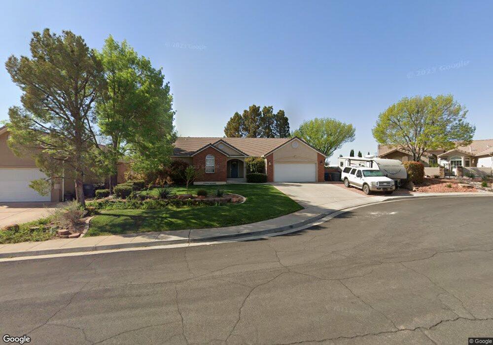
2146 E 170 Cir S St. George, UT 84790
Estimated Value: $458,506 - $579,000
5
Beds
3
Baths
2,900
Sq Ft
$178/Sq Ft
Est. Value
About This Home
This home is located at 2146 E 170 Cir S, St. George, UT 84790 and is currently estimated at $515,377, approximately $177 per square foot. 2146 E 170 Cir S is a home located in Washington County with nearby schools including Panorama School, Fossil Ridge Intermediate School, and Pine View Middle School.
Ownership History
Date
Name
Owned For
Owner Type
Purchase Details
Closed on
Jan 15, 2019
Sold by
Householder Jerry and Householder Katrina
Bought by
Argyle Brady Shane
Current Estimated Value
Home Financials for this Owner
Home Financials are based on the most recent Mortgage that was taken out on this home.
Original Mortgage
$276,700
Outstanding Balance
$243,779
Interest Rate
4.8%
Mortgage Type
New Conventional
Estimated Equity
$271,598
Create a Home Valuation Report for This Property
The Home Valuation Report is an in-depth analysis detailing your home's value as well as a comparison with similar homes in the area
Purchase History
We collect this data history from publicly available records. To have your information removed, we recommend requesting removal directly through your county’s website.
| Date | Buyer | Sale Price | Title Company |
|---|---|---|---|
| Argyle Brady Shane | -- | Eagle Gate Title Ins Agency |
Source: Public Records
Mortgage History
We collect this data history from publicly available records. To have your information removed, we recommend requesting removal directly through your county’s website.
| Date | Status | Borrower | Loan Amount |
|---|---|---|---|
| Open | Argyle Brady Shane | $276,700 |
Source: Public Records
Tax History
| Year | Tax Paid | Tax Assessment Tax Assessment Total Assessment is a certain percentage of the fair market value that is determined by local assessors to be the total taxable value of land and additions on the property. | Land | Improvement |
|---|---|---|---|---|
| 2025 | $1,764 | $258,940 | $64,350 | $194,590 |
| 2023 | $1,825 | $272,690 | $57,200 | $215,490 |
| 2022 | $1,945 | $273,350 | $57,475 | $215,875 |
| 2021 | $1,739 | $364,400 | $88,000 | $276,400 |
| 2020 | $2,841 | $308,400 | $66,000 | $242,400 |
| 2019 | $1,465 | $282,400 | $66,000 | $216,400 |
| 2018 | $1,368 | $136,015 | $0 | $0 |
| 2017 | $1,263 | $122,100 | $0 | $0 |
| 2016 | $1,322 | $118,140 | $0 | $0 |
| 2015 | $1,274 | $109,285 | $0 | $0 |
| 2014 | $1,257 | $108,515 | $0 | $0 |
Source: Public Records
Map
Nearby Homes
- 2163 E 170 South Cir
- 2226 E 140 S
- 2226 E Crimson Cir
- 4204 S Crimson Cir Unit 10
- 4186 S Crimson Cir Unit 13
- 201 S 2020 East Cir
- 5664 S Carnelian Pkwy
- 711 W Juniper Hill Dr
- 1908 E 40 South Cir
- 0 S Mall Dr
- 316 S 2450 E Unit 41
- 232 S Acantilado Cir
- 2721 E Riverside Dr Unit 38
- 2721 E Riverside Dr
- 210 N Mall Dr Unit 119
- 210 N Mall Dr Unit 35
- 145 N Mall Dr Unit 57
- 86 S Acantilado Dr
- 4972 S Lakefront Ln
- 204 N 2000 E
- 2158 E 170 South Cir
- 2158 E 170 South Cir
- 2158 E 170 Cir S
- 2146 E 170 South Cir
- 2159 E 220 South Cir
- 2156 E 220 South Cir
- 2147 E 220 Cir S
- 2147 E 220 South Cir
- 177 S 2170 E
- 2149 E 170 South Cir
- 2134 E 170 South Cir
- 2163 E 170 Cir S
- 209 S 2170 E
- 165 S 2170 E
- 2140 E 220 South Cir
- 2140 E 220 Cir S
- 2137 E 170 South Cir
- 2174 E 140 S
- 2129 E 170 South Cir
- 2160 E 140 S
Your Personal Tour Guide
Ask me questions while you tour the home.