Estimated Value: $149,000 - $204,000
About This Home
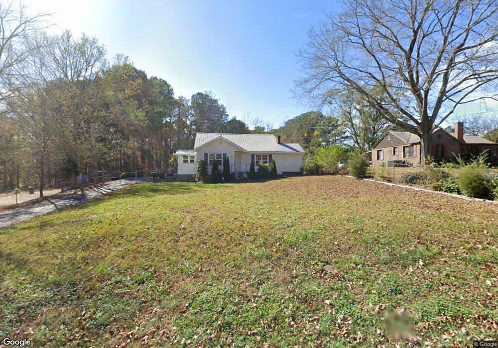
This home is located at 215 Carrollton St, Waco, GA 30182 and is currently estimated at $176,677, approximately $132 per square foot. 215 Carrollton St is a home with nearby schools including Haralson County High School.
Ownership History
We collect this data history from publicly available records. To have your information removed, we recommend requesting removal directly through your county’s website.
Purchase Details
Home Financials for this Owner
Home Financials are based on the most recent Mortgage that was taken out on this home.Purchase Details
Purchase Details
Purchase Details
Home Values in the Area
Average Home Value in this Area
Purchase History
We collect this data history from publicly available records. To have your information removed, we recommend requesting removal directly through your county’s website.
| Date | Buyer | Sale Price | Title Company |
|---|---|---|---|
| $83,600 | -- | ||
| -- | -- | ||
| -- | -- | ||
| -- | -- |
Mortgage History
We collect this data history from publicly available records. To have your information removed, we recommend requesting removal directly through your county’s website.
| Date | Status | Borrower | Loan Amount |
|---|---|---|---|
| Open | $84,444 |
Tax History
We collect this data history from publicly available records. To have your information removed, we recommend requesting removal directly through your county’s website.
| Year | Tax Paid | Tax Assessment Tax Assessment Total Assessment is a certain percentage of the fair market value that is determined by local assessors to be the total taxable value of land and additions on the property. | Land | Improvement |
|---|---|---|---|---|
| 2025 | $1,500 | $68,213 | $10,260 | $57,953 |
| 2024 | $1,513 | $50,435 | $4,834 | $45,601 |
| 2023 | $1,667 | $53,411 | $4,560 | $48,851 |
| 2022 | $893 | $32,489 | $4,560 | $27,929 |
| 2021 | $1,107 | $30,974 | $4,560 | $26,414 |
| 2020 | $1,107 | $31,428 | $4,560 | $26,868 |
| 2019 | $1,078 | $30,619 | $4,560 | $26,059 |
| 2018 | $662 | $22,558 | $4,560 | $17,998 |
| 2017 | $711 | $21,113 | $4,560 | $16,553 |
| 2016 | $749 | $24,460 | $4,560 | $19,900 |
| 2015 | $735 | $23,967 | $4,560 | $19,407 |
| 2014 | $815 | $26,988 | $7,200 | $19,788 |
Map
- 167 Carrollton St
- 0 Blvd
- US Highway 78
- 87 Garland Dr
- 381 King St
- 1830 US Highway 27
- 0 US Highway 27
- 0 Stonebridge Blvd Unit 143588
- 0 Stonebridge Blvd Unit 7742415
- 0 Mt Zion St Unit 7399245
- 1817 Buncombe Waco Rd
- 415 Mount Zion St
- 620 Mill Run Dr
- 510 Mill Run Dr
- TBD Bremen Mount Zion Rd
- 406 Mill Run Dr
- 201 Stonebridge Blvd
- 327 Crest Pointe S
- 111 Ayers St
- 6315 Highway 78
- 229 Carrollton St
- 239 Carrollton St
- 205 Carrollton St
- 189 Carrollton St
- 230 Carrollton St
- 255 Carrollton St
- 267 Carrollton St
- 285 Houston St
- 200 Carrollton St
- 190 Carrollton St
- 0 Houston St Unit 7117531
- 164 Carrollton St
- 154 Carrollton St
- 148 Carrollton St
- 293 Carrollton St
- 138 Atlantic Ave
- 150 Atlantic Ave
- 56 Atlantic Ave
- 121 Atlantic Ave
- 158 Atlantic Ave
Ask me questions while you tour the home.