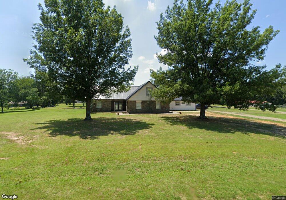
215 Mize Loop Muldrow, OK 74948
Estimated Value: $299,000 - $379,000
4
Beds
3
Baths
2,282
Sq Ft
$144/Sq Ft
Est. Value
About This Home
This home is located at 215 Mize Loop, Muldrow, OK 74948 and is currently estimated at $328,137, approximately $143 per square foot. 215 Mize Loop is a home with nearby schools including Liberty Public School.
Ownership History
Date
Name
Owned For
Owner Type
Purchase Details
Closed on
Apr 3, 2013
Sold by
Brown Michael David
Bought by
Mullins Michael Andrew and Riddle Tessa Renae
Current Estimated Value
Purchase Details
Closed on
Dec 22, 2004
Sold by
Bray Margaret R
Bought by
Brown Bobby L
Purchase Details
Closed on
Jul 28, 2003
Sold by
Ellis Dequita and Ellis Larry
Bought by
Bray Margaret R
Create a Home Valuation Report for This Property
The Home Valuation Report is an in-depth analysis detailing your home's value as well as a comparison with similar homes in the area
Home Values in the Area
Average Home Value in this Area
Purchase History
| Date | Buyer | Sale Price | Title Company |
|---|---|---|---|
| Mullins Michael Andrew | $25,000 | None Available | |
| Brown Bobby L | $110,000 | -- | |
| Bray Margaret R | -- | -- |
Source: Public Records
Tax History
| Year | Tax Paid | Tax Assessment Tax Assessment Total Assessment is a certain percentage of the fair market value that is determined by local assessors to be the total taxable value of land and additions on the property. | Land | Improvement |
|---|---|---|---|---|
| 2025 | $1,144 | $16,937 | $2,000 | $14,937 |
| 2024 | $1,144 | $16,444 | $1,942 | $14,502 |
| 2023 | $1,109 | $15,965 | $1,942 | $14,023 |
| 2022 | $1,041 | $15,500 | $1,942 | $13,558 |
| 2021 | $1,008 | $15,048 | $1,947 | $13,101 |
| 2020 | $1,008 | $15,048 | $1,947 | $13,101 |
| 2019 | $1,034 | $15,411 | $1,947 | $13,464 |
| 2018 | $1,006 | $15,014 | $1,874 | $13,140 |
| 2017 | $975 | $14,577 | $1,798 | $12,779 |
| 2016 | $944 | $14,154 | $1,707 | $12,447 |
| 2015 | $915 | $13,741 | $1,620 | $12,121 |
| 2014 | $958 | $13,340 | $1,556 | $11,784 |
Source: Public Records
Map
Nearby Homes
- 110907 S 4760 Rd
- 0000 Cottonwood Rd
- 407 W Ray Fine Blvd
- 400 W Ray Fine Blvd
- 476120 E 1091 Rd
- 109137 S 4762 Rd
- 404 W Ray Fine Blvd
- 505 Mayfield Dr
- 1505 Cherokee Rd
- 1009 SE 10th St
- 505 Juniper Ln
- 200 S Jeff Ln
- 910 James St
- 476967 E 1090 Rd
- 103 NE 1st St
- 474243 E 1097 Rd
- TBD U S Highway 64
- 701 E Shawntel Smith Blvd
- 904 Short St
- 476690 E 1086 Rd
- 110429 S 4757 Rd
- 110442 S 4756 Rd
- 110447 S 4757 Rd
- 110480 S 4757 Rd
- 110583 S 4756 Rd
- 110481 S 4756 Rd
- 110469 S 4757 Rd
- 110490 S 4756 Rd
- 110601 S 4756 Rd
- 110532 S 4757 Rd
- 475571 E 1105 Rd
- 110521 S 4756 Rd
- 110568 S 4756 Rd
- 110527 S 4757 Rd
- 110694 S 4756 Rd
- 110747 S 4756 Rd
- 110734 S 4756 Rd
- 110795 S 4765 Rd
- 110766 S 4756 Rd
- 110204 S 4755 Rd
Your Personal Tour Guide
Ask me questions while you tour the home.