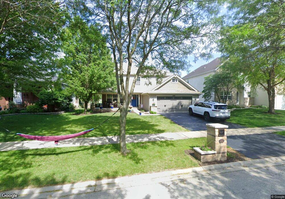
2152 Whitethorn Dr Aurora, IL 60503
Far Southeast NeighborhoodEstimated Value: $430,565 - $500,000
Studio
1
Bath
2,288
Sq Ft
$205/Sq Ft
Est. Value
About This Home
This home is located at 2152 Whitethorn Dr, Aurora, IL 60503 and is currently estimated at $468,891, approximately $204 per square foot. 2152 Whitethorn Dr is a home located in Will County with nearby schools including Homestead Elementary School, Murphy Junior High School, and Oswego East High School.
Ownership History
Date
Name
Owned For
Owner Type
Purchase Details
Closed on
Jan 3, 2003
Sold by
Standard Bank & Trust Co
Bought by
Partlow Richard B and Partlow Karyn L
Current Estimated Value
Home Financials for this Owner
Home Financials are based on the most recent Mortgage that was taken out on this home.
Original Mortgage
$200,000
Interest Rate
5%
Mortgage Type
Purchase Money Mortgage
Create a Home Valuation Report for This Property
The Home Valuation Report is an in-depth analysis detailing your home's value as well as a comparison with similar homes in the area
Home Values in the Area
Average Home Value in this Area
Purchase History
We collect this data history from publicly available records. To have your information removed, we recommend requesting removal directly through your county’s website.
| Date | Buyer | Sale Price | Title Company |
|---|---|---|---|
| Partlow Richard B | $250,000 | -- |
Source: Public Records
Mortgage History
We collect this data history from publicly available records. To have your information removed, we recommend requesting removal directly through your county’s website.
| Date | Status | Borrower | Loan Amount |
|---|---|---|---|
| Previous Owner | Partlow Richard B | $200,000 |
Source: Public Records
Tax History
| Year | Tax Paid | Tax Assessment Tax Assessment Total Assessment is a certain percentage of the fair market value that is determined by local assessors to be the total taxable value of land and additions on the property. | Land | Improvement |
|---|---|---|---|---|
| 2024 | $11,875 | $136,704 | $25,530 | $111,174 |
| 2023 | $11,218 | $120,763 | $22,553 | $98,210 |
| 2022 | $9,793 | $104,406 | $21,336 | $83,070 |
| 2021 | $9,732 | $99,434 | $20,320 | $79,114 |
| 2020 | $9,317 | $97,858 | $19,998 | $77,860 |
| 2019 | $9,729 | $95,100 | $19,434 | $75,666 |
| 2018 | $9,789 | $92,600 | $19,007 | $73,593 |
| 2017 | $9,704 | $90,209 | $18,516 | $71,693 |
| 2016 | $9,614 | $88,267 | $18,117 | $70,150 |
| 2015 | $9,275 | $84,872 | $17,420 | $67,452 |
| 2014 | $9,275 | $76,690 | $17,420 | $59,270 |
| 2013 | $9,275 | $76,690 | $17,420 | $59,270 |
Source: Public Records
Map
Nearby Homes
- 3383 Fulshear Cir
- 3379 Fulshear Cir
- 3288 Wildlight Rd
- 3102 Adelwood Cir
- 3264 Oak Creek Ln
- 3252 Oak Creek Ln
- 1948 Barrington Ct
- 4467 Monroe Ct
- 2255 Georgetown Cir
- 2727 Northmoor Dr
- 2682 Avondale Cir
- 3160 Cambria Ct Unit 413
- 2925 Madison Dr
- 1767 Delta Dr
- 2665 Barrington Cir
- 2495 Hafenrichter Rd
- 2967 Madison Dr
- 2623 Shenandoah Ct
- 2969 Francis Ct
- 2630 Camberley Cir
- 2162 Whitethorn Dr
- 2142 Whitethorn Dr
- 2132 Whitethorn Dr
- 0 Whitehorn Dr Unit 9272520
- 2978 Red Barn Ct
- 2182 Whitethorn Dr
- 2121 Whitethorn Dr
- 2122 Whitethorn Dr
- 2968 Red Barn Ct
- 2112 Whitethorn Dr
- 2081 Whitethorn Dr
- 2192 Whitethorn Dr
- 2977 Red Barn Ct
- 2958 Red Barn Ct
- 2102 Whitethorn Dr
- 2071 Whitethorn Dr
- 2967 Red Barn Ct
- 2948 Red Barn Ct
- 2092 Whitethorn Dr
- 2061 Whitethorn Dr
Your Personal Tour Guide
Ask me questions while you tour the home.