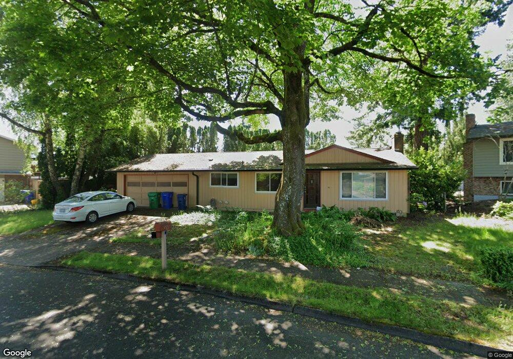
21532 SE Main St Gresham, OR 97030
North Central NeighborhoodEstimated Value: $430,000 - $432,094
3
Beds
2
Baths
1,344
Sq Ft
$320/Sq Ft
Est. Value
About This Home
This home is located at 21532 SE Main St, Gresham, OR 97030 and is currently estimated at $430,524, approximately $320 per square foot. 21532 SE Main St is a home located in Multnomah County with nearby schools including North Gresham Elementary School, Clear Creek Middle School, and Gresham High School.
Ownership History
Date
Name
Owned For
Owner Type
Purchase Details
Closed on
Aug 23, 2010
Sold by
Larkins Bradford J
Bought by
Keahi Derek
Current Estimated Value
Home Financials for this Owner
Home Financials are based on the most recent Mortgage that was taken out on this home.
Original Mortgage
$162,807
Outstanding Balance
$107,100
Interest Rate
4.52%
Mortgage Type
FHA
Estimated Equity
$323,424
Purchase Details
Closed on
Sep 21, 2000
Sold by
Larkins Lauren K
Bought by
Larkins Bradford J
Home Financials for this Owner
Home Financials are based on the most recent Mortgage that was taken out on this home.
Original Mortgage
$90,200
Interest Rate
8.07%
Mortgage Type
Purchase Money Mortgage
Create a Home Valuation Report for This Property
The Home Valuation Report is an in-depth analysis detailing your home's value as well as a comparison with similar homes in the area
Home Values in the Area
Average Home Value in this Area
Purchase History
| Date | Buyer | Sale Price | Title Company |
|---|---|---|---|
| Keahi Derek | $165,000 | First American | |
| Larkins Bradford J | $29,215 | Oregon Title Insurance Co |
Source: Public Records
Mortgage History
| Date | Status | Borrower | Loan Amount |
|---|---|---|---|
| Open | Keahi Derek | $162,807 | |
| Previous Owner | Larkins Bradford J | $90,200 |
Source: Public Records
Tax History
| Year | Tax Paid | Tax Assessment Tax Assessment Total Assessment is a certain percentage of the fair market value that is determined by local assessors to be the total taxable value of land and additions on the property. | Land | Improvement |
|---|---|---|---|---|
| 2025 | $4,310 | $211,820 | -- | -- |
| 2024 | $4,126 | $205,660 | -- | -- |
| 2023 | $3,759 | $199,670 | $0 | $0 |
| 2022 | $3,654 | $193,860 | $0 | $0 |
| 2021 | $3,562 | $188,220 | $0 | $0 |
| 2020 | $3,352 | $182,740 | $0 | $0 |
| 2019 | $3,264 | $177,420 | $0 | $0 |
| 2018 | $3,112 | $172,260 | $0 | $0 |
| 2017 | $2,986 | $167,250 | $0 | $0 |
| 2016 | $2,633 | $162,380 | $0 | $0 |
Source: Public Records
Map
Nearby Homes
- 21033 SE Clay Ct
- 21532 SE Alder St
- 2013 NW Bella Vista Dr
- 21400 SE Stark St Unit 2
- 1811 NW 19th St
- 21260 SE Stark St
- 1035 SE 225th Ave
- 21016 SE Stark St Unit 71
- 21016 SE Stark St Unit 69
- 21525 SE Oak St
- 1861 NW Wonderview Ave
- 210 SE 218th Ave
- 209 SE 214th Ave
- 54 NW 13th St
- 1596 NW Riverview Ave
- 21553 SE Ankeny Terrace
- 1325 NW 9th St
- 132 SE 214th Ave
- 450 NE 22nd St
- 349 NE 18th St
- 1330 SE 216th Ave
- 21526 SE Main St
- 21548 SE Main St
- 1355 SE 216th Ave
- 21522 SE Main St
- 21539 SE Main St
- 21547 SE Main St
- 857 NW Burnside Rd
- 21533 SE Fariss Rd
- 21531 SE Main St
- 21545 SE Fariss Rd
- 21555 SE Main St
- 21514 SE Main St
- 1331 SE 216th Ave
- 21565 SE Fariss Rd
- 21517 SE Main St
- 21611 SE Main St
- 1396 SE 216th Ave
- 1450 SE 216th Ave
- 21507 SE Main St
Your Personal Tour Guide
Ask me questions while you tour the home.