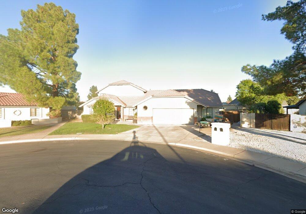
2155 N Ashbrook Mesa, AZ 85213
North Central Mesa NeighborhoodEstimated Value: $655,859 - $742,000
Studio
3
Baths
3,132
Sq Ft
$224/Sq Ft
Est. Value
About This Home
This home is located at 2155 N Ashbrook, Mesa, AZ 85213 and is currently estimated at $701,965, approximately $224 per square foot. 2155 N Ashbrook is a home located in Maricopa County with nearby schools including Hermosa Vista Elementary School, Franklin at Brimhall Elementary School, and Franklin West Elementary School.
Ownership History
Date
Name
Owned For
Owner Type
Purchase Details
Closed on
Feb 1, 2005
Sold by
Morris Delores H
Bought by
Hardy Leta and Hardy Mark J
Current Estimated Value
Purchase Details
Closed on
Apr 10, 1995
Sold by
Walker Eleanore F and Hartman Joseph T
Bought by
Hardy Mark J and Hardy Thalya J
Home Financials for this Owner
Home Financials are based on the most recent Mortgage that was taken out on this home.
Original Mortgage
$161,500
Interest Rate
6.37%
Mortgage Type
New Conventional
Purchase Details
Closed on
Mar 21, 1995
Sold by
Jensen Jerry B and Jensen Kit O
Bought by
Walker Eleanore F and Hartman Joseph T
Home Financials for this Owner
Home Financials are based on the most recent Mortgage that was taken out on this home.
Original Mortgage
$161,500
Interest Rate
6.37%
Mortgage Type
New Conventional
Create a Home Valuation Report for This Property
The Home Valuation Report is an in-depth analysis detailing your home's value as well as a comparison with similar homes in the area
Home Values in the Area
Average Home Value in this Area
Purchase History
| Date | Buyer | Sale Price | Title Company |
|---|---|---|---|
| Hardy Leta | -- | -- | |
| Hardy Mark J | $179,500 | Chicago Title Insurance Co | |
| Walker Eleanore F | $179,500 | Chicago Title Insurance Co |
Source: Public Records
Mortgage History
| Date | Status | Borrower | Loan Amount |
|---|---|---|---|
| Previous Owner | Hardy Mark J | $161,500 |
Source: Public Records
Tax History
| Year | Tax Paid | Tax Assessment Tax Assessment Total Assessment is a certain percentage of the fair market value that is determined by local assessors to be the total taxable value of land and additions on the property. | Land | Improvement |
|---|---|---|---|---|
| 2025 | $2,667 | $32,115 | -- | -- |
| 2024 | $2,696 | $30,586 | -- | -- |
| 2023 | $2,696 | $48,330 | $9,660 | $38,670 |
| 2022 | $2,637 | $38,200 | $7,640 | $30,560 |
| 2021 | $2,709 | $37,260 | $7,450 | $29,810 |
| 2020 | $2,673 | $32,160 | $6,430 | $25,730 |
| 2019 | $2,476 | $30,320 | $6,060 | $24,260 |
| 2018 | $2,364 | $28,270 | $5,650 | $22,620 |
| 2017 | $2,290 | $27,920 | $5,580 | $22,340 |
| 2016 | $2,249 | $27,480 | $5,490 | $21,990 |
| 2015 | $2,123 | $25,430 | $5,080 | $20,350 |
Source: Public Records
Map
Nearby Homes
- 2064 E Kenwood Cir
- 2057 N Ashbrook
- 2306 N Acacia
- 1858 E Kramer St
- 1854 E Kramer St
- 1850 E Kramer St
- 1851 E Kramer St
- 1846 E Kramer St
- 1847 E Kramer St
- 1842 E Kramer St
- 1843 E Kramer St
- 1821 E Lynwood St
- 1844 E Leland Cir
- 2161 E Menlo Cir
- 2025 E Mallory St
- 1832 E Menlo St
- 1711 E Lockwood St
- 1714 E Kramer St
- 2455 N Kachina
- 1709 E Kael St
- 2163 N Ashbrook
- 2147 N Ashbrook
- 2037 E Lockwood St
- 2205 N Ashbrook
- 2045 E Lockwood St
- 2044 E Kael Cir
- 2139 N Ashbrook
- 2021 E Lockwood St
- 2152 N Ashbrook
- 2053 E Lockwood St
- 2144 N Ashbrook
- 2035 E Kael Cir
- 2035 E Kael Cir
- 2131 N Ashbrook
- 2052 E Kael Cir
- 2005 E Lockwood St
- 2043 E Kael Cir
- 2136 N Ashbrook
- 2042 E Lockwood St
- 2061 E Lockwood St
Your Personal Tour Guide
Ask me questions while you tour the home.