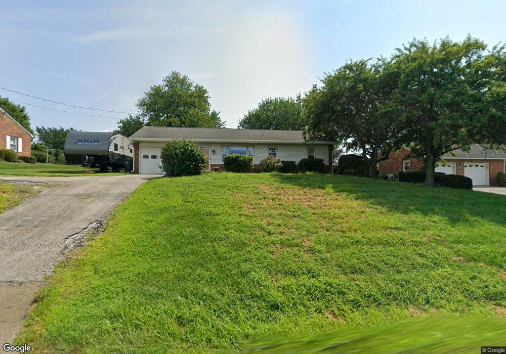
216 E Main St Fawn Grove, PA 17321
Estimated Value: $259,000 - $339,000
3
Beds
1
Bath
1,189
Sq Ft
$241/Sq Ft
Est. Value
About This Home
This home is located at 216 E Main St, Fawn Grove, PA 17321 and is currently estimated at $286,444, approximately $240 per square foot. 216 E Main St is a home located in York County with nearby schools including South Eastern Intermediate School, South Eastern Middle School, and Kennard-Dale High School.
Ownership History
Date
Name
Owned For
Owner Type
Purchase Details
Closed on
Jun 22, 2022
Sold by
Bankert Arthur E and Bankert Mary R
Bought by
Bankert Arthur E
Current Estimated Value
Purchase Details
Closed on
Aug 22, 2001
Sold by
Glackin Carl R and Glackin Melissa A
Bought by
Bankert Arthur E and Bankert Mary R
Home Financials for this Owner
Home Financials are based on the most recent Mortgage that was taken out on this home.
Original Mortgage
$50,000
Interest Rate
7.21%
Purchase Details
Closed on
Apr 4, 1997
Bought by
Glackin David L and Glackin Margaret M
Create a Home Valuation Report for This Property
The Home Valuation Report is an in-depth analysis detailing your home's value as well as a comparison with similar homes in the area
Purchase History
| Date | Buyer | Sale Price | Title Company |
|---|---|---|---|
| Bankert Arthur E | -- | Anderson D Reed | |
| Bankert Arthur E | -- | Anderson D Reed | |
| Bankert Arthur E | $129,900 | -- | |
| Glackin David L | -- | -- |
Source: Public Records
Mortgage History
| Date | Status | Borrower | Loan Amount |
|---|---|---|---|
| Previous Owner | Bankert Arthur E | $50,000 |
Source: Public Records
Tax History
| Year | Tax Paid | Tax Assessment Tax Assessment Total Assessment is a certain percentage of the fair market value that is determined by local assessors to be the total taxable value of land and additions on the property. | Land | Improvement |
|---|---|---|---|---|
| 2025 | $4,061 | $130,380 | $32,100 | $98,280 |
| 2024 | $4,061 | $130,380 | $32,100 | $98,280 |
| 2023 | $4,061 | $130,380 | $32,100 | $98,280 |
| 2022 | $4,061 | $130,380 | $32,100 | $98,280 |
| 2021 | $3,931 | $130,380 | $32,100 | $98,280 |
| 2020 | $3,931 | $130,380 | $32,100 | $98,280 |
| 2019 | $3,918 | $130,380 | $32,100 | $98,280 |
| 2018 | $3,918 | $130,380 | $32,100 | $98,280 |
| 2017 | $3,918 | $130,380 | $32,100 | $98,280 |
| 2016 | $0 | $130,380 | $32,100 | $98,280 |
| 2015 | -- | $130,380 | $32,100 | $98,280 |
| 2014 | -- | $130,380 | $32,100 | $98,280 |
Source: Public Records
Map
Nearby Homes
- 26 W Main St
- 31 N Market St
- 474 Mount Olivet Church Rd
- 54 Mitchell Rd
- 3054 Whiteford Rd
- 65 Watters Rd
- 2913 Whiteford Rd
- 267 Cook Rd
- 2183 Amoss Mill Rd
- 1527 Main St
- 242 Wiley Mill Rd
- 00 Robin Trail
- 520 Wheeler School Rd
- 1038 Woodshire Ln
- Lot C Bryansville Rd
- 46 Corn Tassel Rd
- 4210 Graceton Rd
- 375 Meadow Trail
- 0 Neill Run Rd
- 712 Saint Marys Rd
Your Personal Tour Guide
Ask me questions while you tour the home.