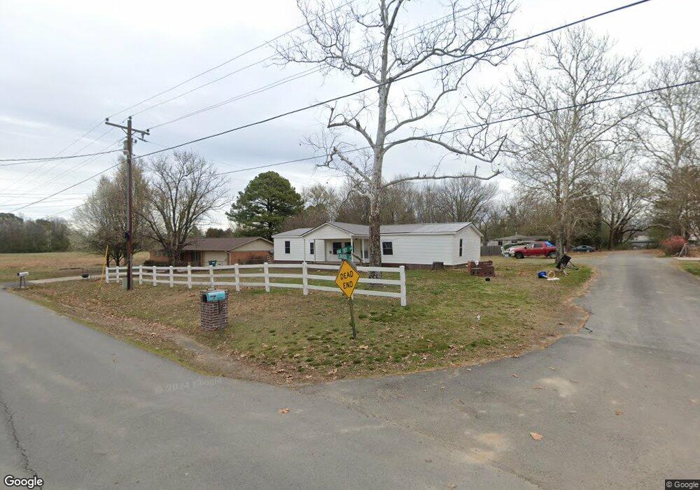
216 Oak Tree Rd Damascus, AR 72039
Estimated Value: $90,000 - $298,000
Studio
--
Bath
1,064
Sq Ft
$151/Sq Ft
Est. Value
About This Home
This home is located at 216 Oak Tree Rd, Damascus, AR 72039 and is currently estimated at $160,160, approximately $150 per square foot. 216 Oak Tree Rd is a home with nearby schools including South Side Elementary School and South Side High School.
Ownership History
Date
Name
Owned For
Owner Type
Purchase Details
Closed on
Oct 29, 2020
Sold by
Connor Michael G and Connor Teresa
Bought by
Walley Adam and Walley Stephanie
Current Estimated Value
Home Financials for this Owner
Home Financials are based on the most recent Mortgage that was taken out on this home.
Original Mortgage
$44,184
Outstanding Balance
$38,942
Interest Rate
2.9%
Mortgage Type
FHA
Estimated Equity
$121,218
Purchase Details
Closed on
Jun 22, 2010
Sold by
Hutchcraft John and Hutchcraft Kiim
Bought by
Connor Michael G
Purchase Details
Closed on
Nov 18, 1997
Bought by
Jesse D Lyon - Dc
Purchase Details
Closed on
Nov 8, 1996
Bought by
Lyon
Purchase Details
Closed on
Jan 27, 1996
Bought by
Marie Marie E and Marie Lyon
Create a Home Valuation Report for This Property
The Home Valuation Report is an in-depth analysis detailing your home's value as well as a comparison with similar homes in the area
Purchase History
| Date | Buyer | Sale Price | Title Company |
|---|---|---|---|
| Walley Adam | $45,000 | None Available | |
| Connor Michael G | $13,000 | Conway Title Services & Escr | |
| Jesse D Lyon - Dc | -- | -- | |
| Lyon | $19,000 | -- | |
| Marie Marie E | -- | -- |
Source: Public Records
Mortgage History
| Date | Status | Borrower | Loan Amount |
|---|---|---|---|
| Open | Walley Adam | $44,184 |
Source: Public Records
Tax History
| Year | Tax Paid | Tax Assessment Tax Assessment Total Assessment is a certain percentage of the fair market value that is determined by local assessors to be the total taxable value of land and additions on the property. | Land | Improvement |
|---|---|---|---|---|
| 2025 | $617 | $19,840 | $300 | $19,540 |
| 2024 | $87 | $11,540 | $300 | $11,240 |
| 2023 | $162 | $11,540 | $300 | $11,240 |
| 2022 | $564 | $11,540 | $300 | $11,240 |
| 2021 | $564 | $11,540 | $300 | $11,240 |
| 2020 | $238 | $11,540 | $300 | $11,240 |
| 2019 | $217 | $4,430 | $300 | $4,130 |
| 2018 | $217 | $4,430 | $300 | $4,130 |
| 2017 | $215 | $4,430 | $300 | $4,130 |
| 2015 | -- | $4,440 | $300 | $4,140 |
| 2014 | -- | $4,440 | $300 | $4,140 |
| 2013 | -- | $4,440 | $300 | $4,140 |
Source: Public Records
Map
Nearby Homes
- 17225 Highway 65 S
- 18 Arkansas 124
- 9 Cherokee Rd
- 27 Highway 124 W
- 000 Scratch Gravel Rd
- 000 Scratch Gravel Rd Unit LotWP001
- 80 Spires Rd
- 00 Spires Rd
- 000 Spires Rd
- 0 S Broadway and Hwy 65 Dr
- 16503 Damascus Ar 72039 Hwy
- 10 Leonard Loop
- 188 Batesville Mountain Rd
- 0 Spires Rd
- 375 Batesville Mountain Rd
- 2053 Hwy 124
- 2053 Arkansas 124
- 623 Batesville Mountain Rd
- 327 Pine Timber Ln
- 12 Chickasaw
- 48 Louise St
- 220 Oak Tree Rd
- 25 Louise St
- 152 Oak Tree Rd
- 205 Oak Tree Rd
- 169 Oak Tree Rd
- 26 Frost St
- 56 Frost St
- 233 Oak Tree Rd
- 94 Frost St
- 290 Oak Tree Rd
- 388 Highway 285
- 388 Highway 285 N
- 423 Firestation Rd
- 75 Oak Tree Rd
- 362 Highway 285
- 362 Arkansas 285
- Hwy 285 Oak Tree Rd
- 285 Oak Tree Rd
- 488 Firestation Rd
Your Personal Tour Guide
Ask me questions while you tour the home.