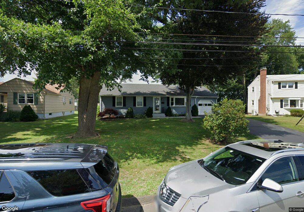
217 Brookside Rd Newington, CT 06111
Estimated Value: $371,162 - $415,000
3
Beds
3
Baths
1,356
Sq Ft
$290/Sq Ft
Est. Value
About This Home
This home is located at 217 Brookside Rd, Newington, CT 06111 and is currently estimated at $393,541, approximately $290 per square foot. 217 Brookside Rd is a home located in Hartford County with nearby schools including Elizabeth Green School, Martin Kellogg Middle School, and Newington High School.
Ownership History
Date
Name
Owned For
Owner Type
Purchase Details
Closed on
Mar 24, 2004
Sold by
Rudolph Nancy K
Bought by
Longo Robert J and Longo Romana Z
Current Estimated Value
Home Financials for this Owner
Home Financials are based on the most recent Mortgage that was taken out on this home.
Original Mortgage
$189,000
Outstanding Balance
$87,531
Interest Rate
5.65%
Estimated Equity
$306,010
Create a Home Valuation Report for This Property
The Home Valuation Report is an in-depth analysis detailing your home's value as well as a comparison with similar homes in the area
Home Values in the Area
Average Home Value in this Area
Purchase History
We collect this data history from publicly available records. To have your information removed, we recommend requesting removal directly through your county’s website.
| Date | Buyer | Sale Price | Title Company |
|---|---|---|---|
| Longo Robert J | $210,000 | -- |
Source: Public Records
Mortgage History
We collect this data history from publicly available records. To have your information removed, we recommend requesting removal directly through your county’s website.
| Date | Status | Borrower | Loan Amount |
|---|---|---|---|
| Open | Longo Robert J | $189,000 | |
| Previous Owner | Longo Robert J | $110,000 | |
| Previous Owner | Longo Robert J | $108,000 | |
| Previous Owner | Longo Robert J | $106,800 |
Source: Public Records
Tax History
| Year | Tax Paid | Tax Assessment Tax Assessment Total Assessment is a certain percentage of the fair market value that is determined by local assessors to be the total taxable value of land and additions on the property. | Land | Improvement |
|---|---|---|---|---|
| 2025 | $5,989 | $149,790 | $55,440 | $94,350 |
| 2024 | $5,942 | $149,790 | $55,440 | $94,350 |
| 2023 | $5,746 | $149,790 | $55,440 | $94,350 |
| 2022 | $5,765 | $149,790 | $55,440 | $94,350 |
| 2021 | $5,813 | $149,790 | $55,440 | $94,350 |
| 2020 | $5,326 | $135,600 | $51,970 | $83,630 |
| 2019 | $5,349 | $135,600 | $51,970 | $83,630 |
| 2018 | $5,221 | $135,600 | $51,970 | $83,630 |
| 2017 | $4,962 | $135,600 | $51,970 | $83,630 |
| 2016 | $4,848 | $135,600 | $51,970 | $83,630 |
| 2014 | $4,741 | $136,340 | $52,140 | $84,200 |
Source: Public Records
Map
Nearby Homes
- 22 Main St
- 76 Main St
- 193 Abbotsford Ave
- 161 Abbotsford Ave
- 255 Williamstown Ct
- 138 Williamstown Ct Unit 138
- 50 Hillcrest Ave
- 67 Bristol St
- 49 Abbotsford Ave
- 72 Hartford Ave
- 11 Thomas St
- 179 Moylan Ct
- 22 Stafford St
- 20 Brook St
- 152 Somerset St
- 402 Connecticut Ave
- 24 Millbrook Ct Unit 24 Millbrook Ct Newi
- 27 Burgoyne St Unit E
- 29 Millbrook Ct
- 37 Lewis Ln
- 88 Woodmere Rd
- 213 Brookside Rd
- 209 Brookside Rd
- 82 Woodmere Rd
- 41 Southwood Dr
- 43 Southwood Dr
- 47 Southwood Dr
- 210 Brookside Rd
- 39 Southwood Dr
- 85 Woodmere Rd
- 49 Southwood Dr
- 205 Brookside Rd
- 35 Southwood Dr
- 198 Brookside Rd
- 101 Brace Rd
- 33 Southwood Dr
- 53 Southwood Dr
- 72 Woodmere Rd
- 38 Southwood Dr
- 46 Southwood Dr
Your Personal Tour Guide
Ask me questions while you tour the home.