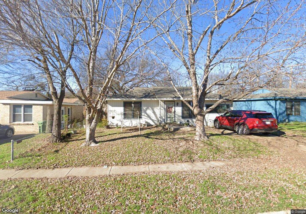
217 Michael Blvd Hurst, TX 76053
Hurst AreaEstimated Value: $218,000 - $260,000
About This Home
This home is located at 217 Michael Blvd, Hurst, TX 76053 and is currently estimated at $241,482, approximately $185 per square foot. 217 Michael Blvd is a home located in Tarrant County with nearby schools including Bellaire Elementary School, Hurst J High School, and L.D. Bell High School.
Ownership History
We collect this data history from publicly available records. To have your information removed, we recommend requesting removal directly through your county’s website.
Purchase Details
Home Values in the Area
Average Home Value in this Area
Purchase History
We collect this data history from publicly available records. To have your information removed, we recommend requesting removal directly through your county’s website.
| Date | Buyer | Sale Price | Title Company |
|---|---|---|---|
| -- | Safeco Land Title |
Tax History
We collect this data history from publicly available records. To have your information removed, we recommend requesting removal directly through your county’s website.
| Year | Tax Paid | Tax Assessment Tax Assessment Total Assessment is a certain percentage of the fair market value that is determined by local assessors to be the total taxable value of land and additions on the property. | Land | Improvement |
|---|---|---|---|---|
| 2025 | $233 | $134,617 | ||
| 2024 | $225 | $218,503 | $50,000 | $168,503 |
| 2023 | $2,229 | $196,563 | $35,000 | $161,563 |
| 2022 | $477 | $194,017 | $35,000 | $159,017 |
| 2021 | $2,217 | $186,247 | $35,000 | $151,247 |
| 2020 | $2,011 | $146,950 | $35,000 | $111,950 |
| 2019 | $1,860 | $137,445 | $35,000 | $102,445 |
| 2018 | $405 | $69,079 | $15,000 | $54,079 |
| 2017 | $1,589 | $94,404 | $15,000 | $79,404 |
| 2016 | $1,445 | $87,779 | $15,000 | $72,779 |
| 2015 | $1,023 | $51,900 | $15,000 | $36,900 |
| 2014 | $1,023 | $51,900 | $15,000 | $36,900 |
Map
- 307 Terry Rd
- 624 E Ellen Ave
- 237 Corinna Ct
- 321 Holder Dr
- 307 Norwood Dr
- 108 Reaves Ln
- 517 Norwood Dr
- 904 Ascension Dr
- 841 Forest Hollow Dr
- 931 Park Forest Dr
- 625 Caduceus Ln
- 429 Harmon Rd
- 905 Forest Hollow Dr
- 10128 Longranger Dr
- 4104 Linkwood Dr
- 3216 Jetranger Rd
- 1200 Tanglewood Trail
- 721 Norwood Dr
- 727 Norwood Dr
- 743 Norwood Dr
- 213 Michael Blvd
- 221 Michael Blvd
- 34 Dorothy Ln
- 209 Michael Blvd
- 38 Dorothy Ln
- 416 Wanda Way
- 30 Dorothy Ln
- 412 Wanda Way
- 205 Michael Blvd
- 420 Wanda Way
- 218 Michael Blvd
- 408 Wanda Way
- 222 Michael Blvd
- 214 Michael Blvd
- 226 Michael Blvd
- 210 Michael Blvd
- 404 Wanda Way
- 26 Dorothy Ln
- 206 Michael Blvd
- 230 Michael Blvd
Ask me questions while you tour the home.