Estimated Value: $147,769 - $198,000
4
Beds
2
Baths
1,464
Sq Ft
$122/Sq Ft
Est. Value
About This Home
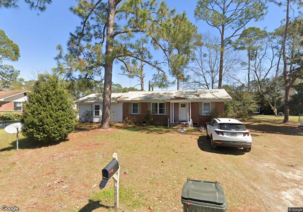
This home is located at 217 Redbud Dr, Adel, GA 31620 and is currently estimated at $179,192, approximately $122 per square foot. 217 Redbud Dr is a home located in Cook County with nearby schools including Cook Primary School, Cook Elementary School, and Cook County Middle School.
Ownership History
Date
Name
Owned For
Owner Type
Purchase Details
Closed on
Mar 24, 2022
Sold by
Dash Co Llc
Bought by
Smith Harvey
Current Estimated Value
Home Financials for this Owner
Home Financials are based on the most recent Mortgage that was taken out on this home.
Original Mortgage
$143,220
Outstanding Balance
$132,214
Interest Rate
3.69%
Mortgage Type
VA
Estimated Equity
$46,978
Purchase Details
Closed on
Jun 9, 2021
Sold by
D E Holt Properties Llc
Bought by
Dash Co Llc
Home Financials for this Owner
Home Financials are based on the most recent Mortgage that was taken out on this home.
Original Mortgage
$96,504
Interest Rate
2.9%
Mortgage Type
New Conventional
Create a Home Valuation Report for This Property
The Home Valuation Report is an in-depth analysis detailing your home's value as well as a comparison with similar homes in the area
Home Values in the Area
Average Home Value in this Area
Purchase History
| Date | Buyer | Sale Price | Title Company |
|---|---|---|---|
| Smith Harvey | $140,000 | -- | |
| Dash Co Llc | $70,000 | -- |
Source: Public Records
Mortgage History
| Date | Status | Borrower | Loan Amount |
|---|---|---|---|
| Open | Smith Harvey | $143,220 | |
| Previous Owner | Dash Co Llc | $96,504 |
Source: Public Records
Tax History
| Year | Tax Paid | Tax Assessment Tax Assessment Total Assessment is a certain percentage of the fair market value that is determined by local assessors to be the total taxable value of land and additions on the property. | Land | Improvement |
|---|---|---|---|---|
| 2025 | $1,695 | $54,921 | $6,801 | $48,120 |
| 2024 | $1,466 | $44,496 | $5,376 | $39,120 |
| 2023 | $1,299 | $39,440 | $4,800 | $34,640 |
| 2022 | $1,084 | $32,916 | $4,800 | $28,116 |
| 2021 | $974 | $27,624 | $4,800 | $22,824 |
| 2020 | $974 | $27,624 | $4,800 | $22,824 |
| 2019 | $975 | $27,624 | $4,800 | $22,824 |
| 2018 | $976 | $27,624 | $4,800 | $22,824 |
| 2017 | $976 | $27,624 | $4,800 | $22,824 |
| 2016 | $977 | $27,624 | $4,800 | $22,824 |
| 2015 | $978 | $27,624 | $4,800 | $22,824 |
| 2014 | $980 | $27,624 | $4,800 | $22,824 |
| 2013 | -- | $27,624 | $4,800 | $22,824 |
Source: Public Records
Map
Nearby Homes
- 322 Magnolia Dr
- 708 Town And Country Dr
- 609 E 4th St
- 111 Brookside Dr
- 313 S Forrest Ave
- 315 Newton Dr
- 403 E 2nd St
- 700 S Gordon Ave
- 411 S Hutchinson Ave
- 806 S Forrest Ave
- 625 Coxstill Rd
- 412 Honeysuckle Way
- 413 Honeysuckle Way
- 301 Honeysuckle Way
- 1002 Bear Creek Rd
- 526 E Mitchell St
- 509 E Mitchell St
- 507 S Poplar St
- 814 N Cleveland Ave
- 309 Wayne St
Your Personal Tour Guide
Ask me questions while you tour the home.